Otto, New York | |
---|---|
Coordinates: 42°22′57″N78°48′53″W / 42.38250°N 78.81472°W | |
Country | United States |
State | New York |
County | Cattaraugus |
Government | |
• Type | Town Council |
• Town Supervisor | Ronald W. Wasmund (D) |
• Town Council | Members' List |
Area | |
• Total | 32.28 sq mi (83.61 km2) |
• Land | 32.16 sq mi (83.30 km2) |
• Water | 0.12 sq mi (0.30 km2) |
Elevation | 1,755 ft (535 m) |
Population | |
• Total | 775 |
• Estimate (2021) [2] | 768 |
• Density | 24.22/sq mi (9.35/km2) |
Time zone | UTC-5 (Eastern (EST)) |
• Summer (DST) | UTC-4 (EDT) |
ZIP code | 14766 |
Area code(s) | 716 |
FIPS code | 36-009-55783 |
GNIS feature ID | 0979331 |
Website | ottony |
Otto is a town in Cattaraugus County, New York, United States. The population was 775 at the 2020 census [2] . The name comes from Jacob S. Otto, an agent of the Holland Land Company. The town lies on the northern border of Cattaraugus County.
The area of the town was first settled around 1816. The town of Otto was formed in 1823 from part of the town of Perrysburg. Otto returned territory to Perrysburg in 1823 and ceded land to Ashford in 1835. In 1854, the eastern half of the town was spun off and renamed East Otto.
The Medora Ball Historical Museum is listed on the National Register of Historic Places. [3]
According to the United States Census Bureau, Otto has a total area of 32.9 square miles (85.1 km2), of which 32.7 square miles (84.8 km2) is land and 0.12 square miles (0.3 km2), or 0.36%, is water. [4]
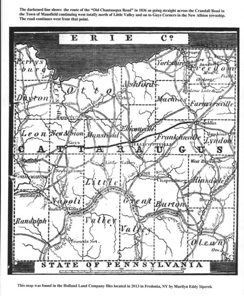
The north town line is formed by Cattaraugus Creek and is the border of Erie County, and the west town line is formed by the South Branch of Cattaraugus Creek.
The main highways through Otto are county roads. Cattaraugus County Route 12 is the main road through town, which extends southwestward toward Cattaraugus and northeastward toward East Otto, while Cattaraugus County Route 11 (North Otto Road) spurs northward from the hamlet of Otto through North Otto (then becomes Route 56 as it turns west on Forty Road), and Cattaraugus County Route 13 (Maples Road) splits off east of the hamlet toward Ellicottville. County Route 68 (Swamp Road) connects North Otto with East Otto.
Part of the Zoar Valley is located by the north town line.
Historical population | |||
---|---|---|---|
Census | Pop. | %± | |
1830 | 1,224 | — | |
1840 | 2,133 | 74.3% | |
1850 | 2,267 | 6.3% | |
1860 | 1,075 | −52.6% | |
1870 | 1,028 | −4.4% | |
1880 | 1,111 | 8.1% | |
1890 | 1,042 | −6.2% | |
1900 | 1,105 | 6.0% | |
1910 | 922 | −16.6% | |
1920 | 773 | −16.2% | |
1930 | 704 | −8.9% | |
1940 | 642 | −8.8% | |
1950 | 685 | 6.7% | |
1960 | 715 | 4.4% | |
1970 | 731 | 2.2% | |
1980 | 828 | 13.3% | |
1990 | 777 | −6.2% | |
2000 | 831 | 6.9% | |
2010 | 808 | −2.8% | |
2020 | 775 | −4.1% | |
2021 (est.) | 768 | [2] | −0.9% |
U.S. Decennial Census [5] |
As of the census [6] of 2000, there were 831 people, 310 households, and 243 families residing in the town. The population density was 25.8 people per square mile (10.0/km2). There were 412 housing units at an average density of 12.8 per square mile (4.9/km2). The racial makeup of the town was 98.92% White, 0.72% Native American, and 0.36% from two or more races. Hispanic or Latino of any race were 0.36% of the population.
There were 310 households, out of which 32.9% had children under the age of 18 living with them, 64.8% were married couples living together, 8.4% had a female householder with no husband present, and 21.6% were non-families. 16.5% of all households were made up of individuals, and 4.8% had someone living alone who was 65 years of age or older. The average household size was 2.68 and the average family size was 2.98.
In the town, the population was spread out, with 25.0% under the age of 18, 6.5% from 18 to 24, 28.2% from 25 to 44, 27.9% from 45 to 64, and 12.4% who were 65 years of age or older. The median age was 40 years. For every 100 females, there were 99.3 males. For every 100 females age 18 and over, there were 103.6 males.
The median income for a household in the town was $37,625, and the median income for a family was $43,942. Males had a median income of $31,063 versus $24,375 for females. The per capita income for the town was $16,748. About 6.3% of families and 9.4% of the population were below the poverty line, including 11.7% of those under age 18 and 4.7% of those age 65 or over.
Ashford is a town in Cattaraugus County, New York, United States. The population was 1,974 at the 2020 census. The town is on the county's northern border.
Carrollton is a town in Cattaraugus County, New York, United States. The population was 1,214 at the 2020 census. The town was named after Guy Carrollton Irvine, an early settler of the region.
Conewango is a town in Cattaraugus County, New York, United States. The population was 1,794 at the 2020 census. The town is named after a creek which flows through the town.
Dayton is a town in Cattaraugus County, New York, United States. The population was 1,689 at the 2020 census. The town is on the western border of Cattaraugus County.
East Otto is a town in Cattaraugus County, New York, United States. The population was 977 at the 2020 census. The town, along with neighboring Otto, is named after an agent of the Holland Land Company, Jacob Otto. The town of East Otto is on the northern border of the county.
IschuaISH-way is a town in Cattaraugus County, New York, United States. The population was 734 at the 2020 census. Ischua is also the name of a hamlet in the town. The town is on the eastern border of the county, north of Olean.
Leon is a town in Cattaraugus County, New York, United States. The population was 1,253 at the 2020 census. The name is derived from the former Kingdom of León in Spain, though it is pronounced like the American first name, "LEE-un". The town is on the western border of the county, northwest of the city of Salamanca.
Mansfield is a town in Cattaraugus County, New York, United States. The population was 843 at the 2020 census. The name was thought to be that of a noble family in England.
New Albion is a town in Cattaraugus County, New York, United States. The population was 1,990 at the 2020 census. The town is named after Albion in Orleans County, the source of some early settlers. New Albion is in the northwest quadrant of the county, northwest of the city of Salamanca.
Persia is a town in Cattaraugus County, New York, United States. The population was 2,203 at the 2020 census. It is in the northwest part of the county. The village of Gowanda is partially in the town.
Ellington is a town in Chautauqua County, New York, United States. The population was 1,493 at the 2020 census.
Hanover is a town in Chautauqua County, New York, United States. The population was 6,893 at the 2020 census. The town lies in the northeast corner of Chautauqua County.
Collins is a town in Erie County, New York, United States. The town is on the south border of the county and is considered to be one of the "Southtowns" of Erie County. The population at the 2010 census was 6,601.
Allegany is a town in Cattaraugus County, New York, United States. The population was 7,493 at the 2020 census.
Ellicottville is a town in Cattaraugus County, New York, United States. The population was 1,317 at the 2020 census. The town is named after Joseph Ellicott, principal land agent of the Holland Land Company.
Little Valley is a town in Cattaraugus County, New York, United States. The population was 1,672 at the 2020 census. The town is named after its local geographical setting, a relative comparison of two tributaries of the Allegheny River.
Olean is a town in Cattaraugus County, New York, United States. The population was 1,890 at the 2020 census. The name is derived from the Latin word "oleum" due to the discovery of crude oil in nearby Ischua.
Perrysburg is a hamlet, census-designated place, and former village in Cattaraugus County, New York, United States. The population was 401 at the 2010 census. It is named after Commodore Oliver Hazard Perry. The community is in the south-central part of the town of Perrysburg. The hamlet is west of Gowanda.
Perrysburg is a town in Cattaraugus County, New York, United States. The population was 1,515 at the 2020 census. The town is named after Commodore Oliver Hazard Perry and is located in the northwest corner of the county. The town contains the census-designated place also named Perrysburg, formerly an incorporated village.
Yorkshire is a town in Cattaraugus County, New York, United States. The population was 3,840 at the 2020 census. The town is located on the northern edge and in the northeast quadrant of the county.