
County Tyrone is one of the six counties of Northern Ireland, one of the nine counties of Ulster and one of the thirty-two traditional counties of Ireland. Its county town is Omagh.
Inishowen is a peninsula in the north of County Donegal in Ireland. Inishowen is the largest peninsula on the island of Ireland.

Eógan mac Néill was a son of Niall Noígiallach and the eponymous ancestor of the Cenél nEógain branch of the Northern Uí Néill. The Cenél Eoghan would found the over-kingdom of Ailech and later Tír Eoghain, which would span the greater part of Ulster. His burial place is said to be in the Inishowen Peninsula in County Donegal, Ireland which was named after him. The historical accuracy or existence of Eógan and his father however are unknown.
Carbery East is a barony in County Cork in Ireland. It has been split since the nineteenth century into East and West Divisions.
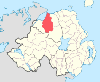
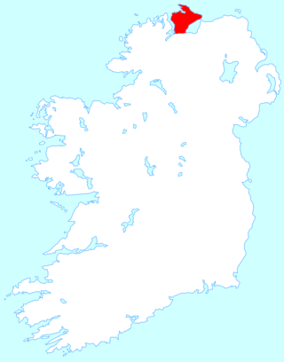
Keenaght is a barony in the mid-northerly third of County Londonderry, Northern Ireland. It connects to the north-Londonderry coastline, and is bordered by four other baronies: Coleraine to the east; Loughinsholin to the south-east; Tirkeeran to the west; and Strabane Upper to the south-west. It was the territory of the Cianachta Glengiven from the 5th century until its takeover in the 12th century by the Ó Cathaín's. The largest settlement in the barony is the town of Limavady.

The Northern Uí Néill was any of several dynasties in north-western medieval Ireland that claimed descent from a common ancestor, Niall of the Nine Hostages. Other dynasties in central and eastern Ireland who also claimed descent from Niall are termed the Southern Uí Néill. The dynasties of the Northern Uí Néill were the Cenél Conaill and Cenél nEógain, named after the two most powerful sons of Niall: Conall and Eógain.
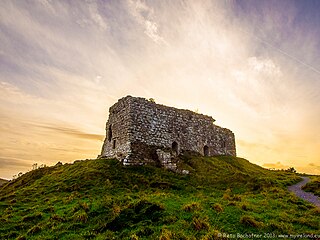
The Cenél nEógain or Kinel-Owen are a branch of the Northern Uí Néill, who claim descent from Eógan mac Néill, son of Niall of the Nine Hostages. Originally their power-base was in Inishowen, with their capital at Ailech, in modern-day County Donegal in what is now the west of Ulster. Under pressure from the Cenél Conaill, they gradually spread their influence eastwards into modern counties Tyrone and Londonderry, pushing aside the Cruithin east of the River Bann, and encroaching on the Airgiallan tribes west of Lough Neagh. By the 11th century their power-base had moved from Ailech to Tullyhogue outside Cookstown, County Tyrone. By the 12th century the Cenél Conaill conquered Inishowen; however, it mattered little to the Cenél nEóghain as they had established a powerful over-kingdom in the east that had become known as Tír Eoghain, or the "Land of Owen", preserved in the modern-day name of County Tyrone.
Maryborough East or East Maryborough is a barony in County Laois, Ireland.
Knockgorm, an Anglicisation of the Gaelic 'Cnoc Gorm', meaning The Blue Hill, is a townland in the civil parish of Templeport, County Cavan, Ireland. It lies in the Roman Catholic parish of Glangevlin and barony of Tullyhaw.
Moneenabrone, an Anglicisation of the Gaelic, ‘Moínín na Brón’, meaning The Little Bog of the Quern-stone, is a townland in the civil parish of Templeport, County Cavan, Ireland. It lies in the Roman Catholic parish of Glangevlin and barony of Tullyhaw.

Kildallan is a townland in the civil parish of Templeoran, barony of Moygoish, County Westmeath, Ireland.

Athlone North, also called North Athlone, is a barony in County Roscommon, Ireland. Baronies were mainly cadastral rather than administrative units. They acquired modest local taxation and spending functions in the 19th century before being superseded by the Local Government (Ireland) Act 1898.

Athlone South, also called South Athlone, is a barony in County Roscommon, Ireland. Baronies were mainly cadastral rather than administrative units. They acquired modest local taxation and spending functions in the 19th century before being superseded by the Local Government (Ireland) Act 1898.
Castlerahan is a barony in County Cavan, Ireland. Baronies were mainly cadastral rather than administrative units. They acquired modest local taxation and spending functions in the 19th century before being superseded by the Local Government (Ireland) Act 1898.

Loughtee Lower, or Lower Loughtee, is a barony in County Cavan, Ireland. Baronies were mainly cadastral rather than administrative units. They acquired modest local taxation and spending functions in the 19th century before being superseded by the Local Government (Ireland) Act 1898.
Loughtee Upper, or Upper Loughtee, is a barony in County Cavan, Ireland. Baronies were mainly cadastral rather than administrative units. They acquired modest local taxation and spending functions in the 19th century before being superseded by the Local Government (Ireland) Act 1898.

Inishowen West, also called West Inishowen or Innishowen West, is a barony in County Donegal, Ireland. Baronies were mainly cadastral rather than administrative units. They acquired modest local taxation and spending functions in the 19th century before being superseded by the Local Government (Ireland) Act 1898.
Kilmacrenan, sometimes spelled Kilmacrennan, is a barony in County Donegal, Ireland. Baronies were mainly cadastral rather than administrative units, which acquired modest local taxation and spending functions in the 19th century before being superseded by higher units under the Local Government (Ireland) Act 1898. Kilmacrenan is the largest barony in Ireland by land area.
Raphoe North, or North Raphoe, is a barony in County Donegal, Ireland. Baronies were mainly cadastral rather than administrative units. They acquired modest local taxation and spending functions in the 19th century before being superseded by the Local Government (Ireland) Act 1898.


