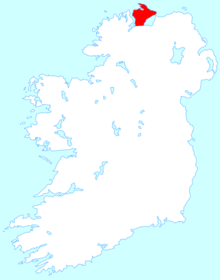
County Donegal is a county of Ireland in the province of Ulster and in the Northern and Western Region. It is named after the town of Donegal in the south of the county. It has also been known as County Tyrconnell or Tirconaill, after the historic territory. Donegal County Council is the local council and Lifford is the county town.

Inishowen is a peninsula in the north of County Donegal in Ireland. Inishowen is the largest peninsula on the island of Ireland.

Buncrana is a town in Inishowen in the north of County Donegal in Ulster, the northern province in Ireland. The town sits on the eastern shores of Lough Swilly, being 23 kilometres (14 mi) northwest of Derry and 43 kilometres (27 mi) north of Letterkenny. In the 2022 census, the population was 6,971, making it the second most populous town in County Donegal, after Letterkenny, and the largest in Inishowen.

Eógan mac Néill was a son of Niall Noígiallach and the eponymous ancestor of the Cenél nEógain branch of the Northern Uí Néill. The Cenél Eoghan would found the over-kingdom of Ailech and later Tír Eoghain, which would span the greater part of Ulster. His burial place is said to be in the Inishowen Peninsula in County Donegal, Ireland which was named after him. The historical accuracy or existence of Eógan and his father however are unknown.

The O'Doherty family of Inishowen in County Donegal is an Irish clan who were a prominent sept of the Northern Uí Néill's Cenél Conaill, and one of the most powerful clans of Tír Connaill.

Belfast Castle is a mansion located in Cave Hill Country Park in Belfast, Northern Ireland, in a prominent position 400 feet (120 m) above sea level. Its location provides unobstructed views over the City of Belfast and Belfast Lough. There have been several structures called "Belfast Castle" over the centuries, located on different sites. The current "castle" is a Victorian structure, built between 1867 and 1870 on the slopes of Cave Hill, and is Grade A listed. The main entrance into the Belfast Castle Demesne is now where Innisfayle Park meets Downview Park West, just off the Antrim Road. The original main entrance into the current demesne was formerly on the Antrim Road itself, where Strathmore Park now meets the Antrim Road.

The Grianan of Aileach, sometimes anglicised as Greenan Ely or Greenan Fort, is a hillfort atop the 244 metres (801 ft) high Greenan Mountain at Inishowen in County Donegal, Ireland. The main structure is a 19th-century reconstruction of a stone ringfort, thought to have been built by the Northern Uí Néill, in the sixth or seventh century CE; although there is evidence that the site had been in use before the fort was built. It has been identified as the seat of the Kingdom of Ailech and one of the royal sites of Gaelic Ireland. The wall is about 4.5 metres (15 ft) thick and 5 metres (16 ft) high. Inside it has three terraces, which are linked by steps, and two long passages within it. Originally, there would have been buildings inside the ringfort. Just outside it are the remains of a well and a tumulus.

Sir Cahir O'Doherty was the last Gaelic Chief of the Name of Clan O'Doherty and Lord of Inishowen, in what is now County Donegal. O'Doherty was a noted loyalist during Tyrone's Rebellion and became known as the Queen's O'Doherty for his service on the Crown's side during the fighting.

Carrickabraghy Castle on a rocky outcrop at the north-western extremity of the Isle of Doagh, at the head of Pollan Bay, in the north of Inishowen, a peninsula on the north coast of County Donegal, Ireland. The townland and its castle are located in the Parish of Clonmany in the Barony of Inishowen East. Known as 'The Castles', the site is of local historical importance.

The Northern Uí Néill was any of several dynasties in north-western medieval Ireland that claimed descent from a common ancestor, Niall of the Nine Hostages. Other dynasties in central and eastern Ireland who also claimed descent from Niall are termed the Southern Uí Néill. The dynasties of the Northern Uí Néill were the Cenél Conaill and Cenél nEógain, named after the two most powerful sons of Niall: Conall and Eógain.
The Cenél nEógain or Kinel-Owen are a branch of the Northern Uí Néill, who claim descent from Eógan mac Néill, son of Niall of the Nine Hostages. Originally their power-base was in Inishowen, with their capital at Ailech, in modern-day County Donegal in what is now the west of Ulster. Under pressure from the Cenél Conaill, they gradually spread their influence eastwards into modern counties Tyrone and Londonderry, pushing aside the Cruithin east of the River Bann, and encroaching on the Airgiallan tribes west of Lough Neagh. By the 11th century their power-base had moved from Ailech to Tullyhogue outside Cookstown, County Tyrone. By the 12th century the Cenél Conaill conquered Inishowen; however, it mattered little to the Cenél nEóghain as they had established a powerful over-kingdom in the east that had become known as Tír Eoghain, or the "Land of Owen", preserved in the modern-day name of County Tyrone.

Ballywiheen is a medieval Christian site and National Monument located on the Dingle Peninsula, Ireland.

Clankee is a barony in County Cavan, Ireland. Baronies were mainly cadastral rather than administrative units. They acquired modest local taxation and spending functions in the 19th century before being superseded by the Local Government (Ireland) Act 1898.

Inishowen East, also called East Inishowen or Innishowen East, is a barony in County Donegal, Ireland. Baronies were mainly cadastral rather than administrative units. They acquired modest local taxation and spending functions in the 19th century before being superseded by the Local Government (Ireland) Act 1898.

Kilmacrenan, sometimes spelled Kilmacrennan, is a barony in County Donegal, Ireland. Baronies were mainly cadastral rather than administrative units, which acquired modest local taxation and spending functions in the 19th century before being superseded by higher units under the Local Government (Ireland) Act 1898. Kilmacrenan is the largest barony in Ireland by land area.

Raphoe North, or North Raphoe, is a barony in County Donegal, Ireland. Baronies were mainly cadastral rather than administrative units. They acquired modest local taxation and spending functions in the 19th century before being superseded by the Local Government (Ireland) Act 1898.

Raphoe South, or South Raphoe, is a barony in County Donegal, Ireland. Baronies were mainly cadastral rather than administrative units. They acquired modest local taxation and spending functions in the 19th century before being superseded by the Local Government (Ireland) Act 1898.

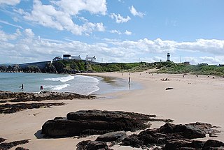
Shrove is a coastal hamlet and townland in Inishowen in the north of County Donegal in Ulster, the northern province in Ireland. The hamlet is located a short distance to the north of Greencastle in the north-east of Inishowen, a peninsula on the north coast of Ireland. The name of both the hamlet and the townland is also sometimes written as Shroove, and is sometimes written as Stroove by some government bodies.

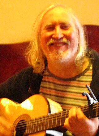
Seoirse Ó Dochartaigh is an Irish singer, guitarist, composer, record producer, painter, writer, and publisher.


