Jefferson, South Dakota

Last updated

Jefferson, South Dakota
Union County South Dakota Incorporated and Unincorporated areas Jefferson Highlighted.svg
Location in Union County and the state of South Dakota
Coordinates: 42°36′15″N96°33′58″W / 42.60417°N 96.56611°W / 42.60417; -96.56611
Country United States
State South Dakota
County Union
Incorporated1895 [1]
Area
[2]
  Total0.51 sq mi (1.32 km2)
  Land0.51 sq mi (1.32 km2)
  Water0.00 sq mi (0.00 km2)
Elevation
[3]
1,116 ft (340 m)
Population
 (2020) [4]
  Total475
  Density931.37/sq mi (359.27/km2)
Time zone UTC-6 (Central (CST))
  Summer (DST) UTC-5 (CDT)
ZIP code
57038
Area code 605
FIPS code 46-32700
GNIS feature ID1267441 [3]

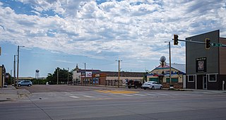
Jefferson is a city in Union County, South Dakota, United States. The population was 475 at the 2020 census. [5] It is part of the Sioux City, IA-NE-SD Metropolitan Statistical Area. Jefferson was founded in 1859. Every year the citizens of Jefferson and surrounding area celebrate the founding of Jefferson during the "Days of '59", a festival that includes softball, basketball, horseshoes, car show, fireworks and parade. [6]

Contents

The city has the name of President Thomas Jefferson. [7]

History

Jefferson was primarily settled by French-Canadians. By 1867 the town consisted of 25 or so French-Canadian families. [8] During the winter of 1880–1, the town was ravaged by a smallpox epidemic, reported to have arrived in the area via Russian Mennonite emigrants en route to Yankton, in the Dakota Territory. The town was quarantined for several weeks, without railroad service or mail delivery. At least 150 cases of "black small pox" were reported by February 1881, resulting in more than 82 deaths. [9]

Geography

According to the United States Census Bureau, the city has a total area of 0.50 square miles (1.29 km2), all land. [10]

The closest bodies of water are Horseshoe Lake, a small oxbow lake formed from the nearby river; McCook Lake, the Big Sioux River and the Missouri River.

Demographics

Historical population
CensusPop.Note
1880 90
1890 229154.4%
1900 36459.0%
1910 40711.8%
1920 55035.1%
1930 426−22.5%
1940 46910.1%
1950 466−0.6%
1960 443−4.9%
1970 4747.0%
1980 59224.9%
1990 527−11.0%
2000 58611.2%
2010 547−6.7%
2020 475−13.2%
U.S. Decennial Census [11] [4]

2010 census

As of the census [12] of 2010, there were 547 people, 233 households, and 146 families residing in the city. The population density was 1,094.0 inhabitants per square mile (422.4/km2). There were 248 housing units at an average density of 496.0 per square mile (191.5/km2). The racial makeup of the city was 97.4% White, 0.5% African American, 0.2% Native American, 0.2% from other races, and 1.6% from two or more races. Hispanic or Latino of any race were 1.5% of the population.

There were 233 households, of which 28.8% had children under the age of 18 living with them, 50.2% were married couples living together, 9.0% had a female householder with no husband present, 3.4% had a male householder with no wife present, and 37.3% were non-families. 29.6% of all households were made up of individuals, and 12.9% had someone living alone who was 65 years of age or older. The average household size was 2.35 and the average family size was 2.94.

The median age in the city was 39.2 years. 23% of residents were under the age of 18; 8.3% were between the ages of 18 and 24; 27.3% were from 25 to 44; 28.4% were from 45 to 64; and 13% were 65 years of age or older. The gender makeup of the city was 49.9% male and 50.1% female.

2000 census

As of the census of 2000, there were 586 people, 228 households, and 160 families residing in the city. The population density was 2,028.2 inhabitants per square mile (783.1/km2). There were 240 housing units at an average density of 830.7 per square mile (320.7/km2). The racial makeup of the city was 96.59% White, 0.85% African American, 1.02% Native American, 0.17% Asian, and 1.37% from two or more races. Hispanic or Latino of any race were 1.88% of the population.

There were 228 households, out of which 38.6% had children under the age of 18 living with them, 61.4% were married couples living together, 6.6% had a female householder with no husband present, and 29.8% were non-families. 25.9% of all households were made up of individuals, and 10.1% had someone living alone who was 65 years of age or older. The average household size was 2.57 and the average family size was 3.13.

In the city, the population was spread out, with 29.7% under the age of 18, 6.8% from 18 to 24, 30.2% from 25 to 44, 22.0% from 45 to 64, and 11.3% who were 65 years of age or older. The median age was 33 years. For every 100 females, there were 103.5 males. For every 100 females age 18 and over, there were 99.0 males.

The median income for a household in the city was $47,625, and the median income for a family was $52,813. Males had a median income of $34,750 versus $23,750 for females. The per capita income for the city was $18,467. About 1.3% of families and 3.7% of the population were below the poverty line, including 4.0% of those under age 18 and 3.9% of those age 65 or over.

Related Research Articles

<span class="mw-page-title-main">Valley City, North Dakota</span> City in North Dakota, United States

Valley City is a city in Barnes County, North Dakota, United States. It is the county seat of Barnes County. The population was 6,575 during the 2020 census, making it the 12th largest city in North Dakota. Valley City was founded in 1874.
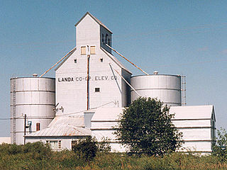
<span class="mw-page-title-main">Landa, North Dakota</span> City in North Dakota, United States

Landa is a city in Bottineau County, North Dakota, United States. The population was 41 at the 2020 census. Landa was founded in 1904.
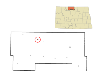
<span class="mw-page-title-main">Westhope, North Dakota</span> City in North Dakota, United States

Westhope is a city in Bottineau County, North Dakota, United States. The population was 374 at the 2020 census. Westhope was founded in 1903 along a Great Northern Railway branch line that began in Rugby. The name was based on the slogan "Hope of the West," created by Great Northern officials to promote prosperity for the new town.

<span class="mw-page-title-main">Lincoln, North Dakota</span> City in North Dakota, United States

Lincoln is a city in Burleigh County, North Dakota, United States. It is a suburb of adjacent Bismarck, and also a core city of the Bismarck-Mandan Metropolitan Statistical Area. The population was 4,257 at the 2020 census, making it the fourteenth largest city in North Dakota. Lincoln was founded in 1977.

<span class="mw-page-title-main">Park River, North Dakota</span> City in North Dakota, United States

Park River is a city in Walsh County, North Dakota, United States. The population was 1,424 at the 2020 census. Park River was founded in 1884.

<span class="mw-page-title-main">Tyndall, South Dakota</span> City in South Dakota, United States

Tyndall is a city in and the county seat of Bon Homme County, South Dakota, United States. The population was 1,057 at the 2020 census.

<span class="mw-page-title-main">Wagner, South Dakota</span> City in South Dakota, United States

Wagner is a city in Charles Mix County, South Dakota, United States. The population was 1,490 at the 2020 census. The city is served by Wagner Municipal Airport as well as YST Transit buses.

<span class="mw-page-title-main">Clear Lake, South Dakota</span> City in South Dakota, United States

Clear Lake is a city in and the county seat of Deuel County, South Dakota, United States. The population was 1,218 at the 2020 census.

<span class="mw-page-title-main">Gregory, South Dakota</span> City in South Dakota, United States

Gregory is a city in western Gregory County, South Dakota, United States. The population was 1,221 at the 2020 census.

<span class="mw-page-title-main">Miller, South Dakota</span> City in South Dakota, United States

Miller is a city in and county seat of Hand County, South Dakota, United States. The population was 1,349 at the 2020 census.

<span class="mw-page-title-main">Parkston, South Dakota</span> City in South Dakota, United States

Parkston is a city in Hutchinson County, South Dakota, United States. The population was 1,567 at the 2020 census.

<span class="mw-page-title-main">Whitewood, South Dakota</span> City in South Dakota, United States

Whitewood is a city in Lawrence County, South Dakota, United States. The population was 879 at the 2020 census.

<span class="mw-page-title-main">Tea, South Dakota</span> City in South Dakota, United States

Tea is a city in Lincoln County, South Dakota, United States and is a suburb of Sioux Falls. The population was 5,598 at the 2020 census.

<span class="mw-page-title-main">Crooks, South Dakota</span> City in South Dakota, United States

Crooks is a city in Minnehaha County, South Dakota, United States and is a suburb of Sioux Falls. The population was 1,362 at the 2020 census. Crooks was named New Hope until 1904. The town's present name honors W. A. Crooks, a local politician.
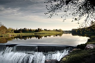
<span class="mw-page-title-main">Garretson, South Dakota</span> City in South Dakota, United States

Garretson is a city in Minnehaha County, South Dakota, United States. The city had a population of 1,228 at the 2020 census.

<span class="mw-page-title-main">Hartford, South Dakota</span> City in South Dakota, United States

Hartford is a suburban American city in Minnehaha County, South Dakota, a few miles northwest of Sioux Falls. Its population was 3,354 at the 2020 census.

<span class="mw-page-title-main">New Underwood, South Dakota</span> City in South Dakota, United States

New Underwood is a city in Pennington County, South Dakota, United States. The population was 590 at the 2020 Census.
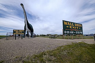
<span class="mw-page-title-main">Wall, South Dakota</span> Town in South Dakota, United States

Wall is a town in Pennington County, South Dakota, United States. The population was 699 at the 2020 census.
<span class="mw-page-title-main">Mission, South Dakota</span> City in South Dakota, United States

Mission is a city on the Rosebud Indian Reservation in northern Todd County, South Dakota, United States. The population was 1,156 at the 2020 census.

<span class="mw-page-title-main">Elk Point, South Dakota</span> City in South Dakota, United States

Elk Point is a city in and county seat of Union County, South Dakota, United States. The population was 2,149 as of the 2020 census.

References

  1. "SD Towns" (PDF). South Dakota State Historical Society. Archived from the original (PDF) on February 10, 2010. Retrieved February 13, 2010.
  2. "ArcGIS REST Services Directory". United States Census Bureau. Retrieved October 15, 2022.
  3. 1 2 U.S. Geological Survey Geographic Names Information System: Jefferson, South Dakota
  4. 1 2 "Census Population API". United States Census Bureau. Retrieved October 15, 2022.
  5. "U.S. Census Bureau: Jefferson city, South Dakota". www.census.gov. United States Census Bureau. Retrieved May 6, 2022.
  6. "Archived copy" (PDF). Archived from the original (PDF) on March 16, 2012. Retrieved January 9, 2011.{{cite web}}: CS1 maint: archived copy as title (link)
  7. Federal Writers' Project (1940). South Dakota place-names, v.1-3. American guide series. University of South Dakota. p. 43.
  8. http://www.waymarking.com/waymarks/WMAQ56_St_Peters_Church_Jefferson_SD [ bare URL ]
  9. "Stricken with Small Pox" New York Times, Feb. 3, 1881 https://timesmachine.nytimes.com/timesmachine/1881/02/03/103396017.pdf
  10. "US Gazetteer files 2010". United States Census Bureau. Archived from the original on July 2, 2012. Retrieved June 21, 2012.
  11. United States Census Bureau. "Census of Population and Housing" . Retrieved September 23, 2013.
  12. "U.S. Census website". United States Census Bureau . Retrieved June 21, 2012.