Keno Air Force Station

Last updated
Keno Air Force Station
Air Defense Command.png
Part of Air Defense Command (ADC)

Keno Air Force Station.jpg

Circa 1975 historical photograph
USA Oregon location map.svg
Red pog.svg
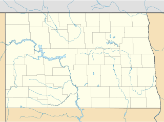
Keno AFS
Location of Keno AFS, Oregon
Coordinates 42°04′08″N121°58′20″W / 42.06889°N 121.97222°W / 42.06889; -121.97222 (Keno AFS TM-180) Coordinates: 42°04′08″N121°58′20″W / 42.06889°N 121.97222°W / 42.06889; -121.97222 (Keno AFS TM-180)
Type Air Force Station
Site information
Controlled byFlag of the United States Air Force.svg  United States Air Force
Site history
Built 1957
In use 1958-1979
Garrison information
Garrison 827th Aircraft Control and Warning Squadron
Map all coordinates using: OpenStreetMap  ·  Google Maps
Download coordinates as: KML  ·  GPX
FPS-6 and FPS-67 radars Keno-2.jpg
FPS-6 and FPS-67 radars
827th Radar Squadronemblem 827th Air Defense Group - Emblem.png
827th Radar Squadronemblem

Keno Air Force Station (ADC ID: TM-180, NORAD ID: Z-180) is a closed United States Air Force General Surveillance Radar station. It is located 4.6 miles (7.4 km) south-southwest of Keno, Oregon. It was closed in 1979 by the Air Force, and turned over to the Federal Aviation Administration (FAA).

United States Air Force Air and space warfare branch of the United States Armed Forces

The United States Air Force (USAF) is the aerial and space warfare service branch of the United States Armed Forces. It is one of the five branches of the United States Armed Forces, and one of the seven American uniformed services. Initially formed as a part of the United States Army on 1 August 1907, the USAF was established as a separate branch of the U.S. Armed Forces on 18 September 1947 with the passing of the National Security Act of 1947. It is the youngest branch of the U.S. Armed Forces, and the fourth in order of precedence. The USAF is the largest and most technologically advanced air force in the world. The Air Force articulates its core missions as air and space superiority, global integrated intelligence, surveillance, and reconnaissance, rapid global mobility, global strike, and command and control.

Keno, Oregon Unincorporated community in Oregon, United States

Keno is an unincorporated community in Klamath County, Oregon, United States, southwest of Klamath Falls on the Klamath River near Oregon Route 66. As of 2000, the population was 1,059. Keno's elevation is 4,108 feet (1,252 m) above sea level.

Federal Aviation Administration United States Government agency dedicated to civil aviation matters

The Federal Aviation Administration (FAA) is a governmental body of the United States with powers to regulate all aspects of civil aviation in that nation as well as over its surrounding international waters. Its powers include the construction and operation of airports, air traffic management, the certification of personnel and aircraft, and the protection of U.S. assets during the launch or re-entry of commercial space vehicles. Powers over neighboring international waters were delegated to the FAA by authority of the International Civil Aviation Organization.

Contents

Today the site is part of the Joint Surveillance System (JSS), designated by NORAD as Western Air Defense Sector (WADS) Ground Equipment Facility J-82.

Joint Surveillance System

The Joint Surveillance System (JSS) is a joint United States Air Force and Federal Aviation Administration system for the atmospheric air defense of North America. It replaced the Semi Automatic Ground Environment (SAGE) system in 1983.

Western Air Defense Sector

The Western Air Defense Sector (WADS) is a unit of the Washington Air National Guard located at Joint Base Lewis-McChord, Tacoma, Washington.

History

Keno Air Force Station came into existence as part of Phase III of the Air Defense Command Mobile Radar program. On October 20, 1953 ADC requested a third phase of twenty-five radar sites be constructed. The site was located east of the Cascade mountains to provide coverage of the air refueling tracks in Northern California. In 1957, 306 acres of land were acquired for DoD use at the new site.

The 827th Aircraft Warning and Control Squadron was assigned to the new station on 1 February 1958. [2] Logistical support and housing for personnel was provided by Kingsley Field in Klamath Falls, thirteen miles to the east. The squadron initially began operations with an AN/FPS-20A search radar and a pair of AN/FPS-6A height-finder radars (one east hemisphere coverage, and one west). A Ground-Air Transmit/Receive site (GATR) was co-located on the site, with antennas favoring the south toward the air refueling tracks in California.

Initially the station functioned as a Ground Control Intercept (GCI) and warning station. As a GCI station, the squadron's role was to guide interceptor aircraft toward unidentified intruders picked up on the unit's radar scopes. In 1960 Keno became a joint-use facility with the Federal Aviation Administration (FAA), performing air-traffic-control duties. In 1961 the search radar was upgraded and redesignated as an AN/FPS-67.

Squadron (aviation) military aviation unit size

A squadron in air force, army aviation, or naval aviation is a unit comprising a number of military aircraft and their aircrews, usually of the same type, typically with 12 to 24 aircraft, sometimes divided into three or four flights, depending on aircraft type and air force. Land based squadrons equipped with heavier type aircraft such as long-range bombers, cargo aircraft, or air refueling tankers have around 12 aircraft as a typical authorization, while most land-based fighter equipped units have an authorized number of 18 to 24 aircraft.

Interceptor aircraft Fighter aircraft classification; tasked with defensive interception of enemy aircraft

An interceptor aircraft, or simply interceptor, is a type of fighter aircraft designed specifically to attack enemy aircraft, particularly bombers and reconnaissance aircraft, as they approach. There are two general classes of interceptor: relatively lightweight aircraft built for high performance, and heavier aircraft designed to fly at night or in adverse weather and operate over longer ranges.

In military aviation, an intruder is a fighter aircraft or light bomber, often a night fighter, the crew of which are tasked with penetrating deep into enemy airspace to disrupt enemy air operations. To achieve this they attack fighters, airfields, radar and other infrastructure; stage diversionary attacks; and escort bombers. Intruders often loiter in the vicinity of enemy airbases to attack aircraft as they take off or land.

During 1962 Keno AFS joined the Semi Automatic Ground Environment (SAGE) system, feeding data to DC-13 at Adair AFS, Oregon. After joining, the squadron was redesignated as the 827th Radar Squadron (SAGE) on 1 December 1962. [2] The radar squadron provided information 24/7 the SAGE Direction Center where it was analyzed to determine range, direction altitude speed and whether or not aircraft were friendly or hostile. In 1963 an AN/FPS-90 replaced the east hemisphere coverage AN/FPS-6 height-finder radar, and the search radar was further upgraded to the AN/FPS-67B version. On 31 July 1963, the site was redesignated as NORAD ID Z-180.

In addition to the main facility, Keno operated several AN/FPS-14 Gap Filler sites:

Routine operations continued until 1 March 1970 when the 827th Radar Squadron was inactivated and replaced by the 827th Air Defense Group, operating the BUIC installation. [2] [3] The upgrade to group status was done because of Kingsley Field's status as a Backup Interceptor Control (BUIC) site. BUIC sites were alternate control sites in the event that SAGE Direction Centers became disabled and unable to control interceptor aircraft. The group was inactivated and replaced by the 827th Radar Squadron. [3] as defenses against manned bombers were reduced. The group was disbanded in 1984. [4] Over the years, the equipment at the station was upgraded or modified to improve the efficiency and accuracy of the information gathered by the radars. The Radar Squadron was inactivated 1 October 1979 [2] when operations reverted to an Operating Location of the 25th Air Division at McChord AFB. At the time of its BUIC III inactivation in 1976, the 827th manned the last operating BUIC III in the western United States.

In 1976 the AN/FPS-90 was removed and sent to the new Joint Surveillance System (JSS) site at Salem (Laurel Mtn./Dallas Oregon) (J-82), where it became operational in 1980. The remaining height-finder radar, an AN/FPS-116, was retired c. 1988 and the station closed, and property transferred to the FAA.

In the early 1990s, the abandoned station buildings at the former Keno AFS were removed (including the sewage lagoon) and most of the site has been returned to its natural state. Today, only the FAA unattended search radar is functional.

Air Force units and assignments

Units

Activated at Kingsley Field, Oregon on 1 September 1957
Radar site renamed Keno Air Force Station Oregon on 1 February 1958
Site merged back into Kingsley Field on 1 January 1959
Redesignated 827th Radar Squadron (SAGE) on 1 December 1962
Inactivated on 1 March 1970
Redesignated 827th Radar Squadron on 1 January 1974
Activated on 17 January 1974
Inactivated on 1 October 1979 [2]
Activated on 1 March 1970
Inactivated on 17 January 1974 [3]
Disbanded on 21 September 1984 [4]

Assignments

28th Air Division, 1 September 1957
25th Air Division, 1 March 1959
Portland Air Defense Sector, 1 March 1960
26th Air Division, 1 April 1966
27th Air Division, 15 September 1969
26th Air Division, 19 November 1969
25th Air Division, 17 January 1974 - 1 October 1979 [2]
25th Air Division, 1 March 1970 - 17 January 1974 [3]

Commanders

Lt Col. Richard A. Wood, 1 Mar 1970 - unknown [5]

See also

Notes

  1. Used unofficially by the 827th Air Defense Group
  2. 1 2 3 4 5 6 Cornett & Johnson, p. 171
  3. 1 2 3 4 Cornett, & Johnson, p.86
  4. 1 2 Department of the Air Force/MPM Letter 575q, 27 Sep 1984, Subject: Disbandment of Units
  5. Abstract, History of 827th Air Defense Group, Jul 1970-Dec 1970 (accessed 14 Jan 2012)

Related Research Articles

Empire Air Force Station 1951-1978 radar site of the United States Air Force

Empire Air Force Station is a former United States Air Force Aerospace Defense Command (ADC) long range radar site located 0.7 miles (1.1 km) south-southeast of Empire, Michigan, in Empire Township. It was closed in 1978 by the Air Force, and turned over to the Federal Aviation Administration (FAA).

Fortuna Air Force Station North Dakota, an abandoned Air Force Long Range radar site

Fortuna Air Force Station is a closed United States Air Force General Surveillance Radar station. It is located 4.2 miles (6.8 km) west of Fortuna, North Dakota. It was closed in 1979 as a radar station, remaining as a Long-Range Radar (LRR) facility until 1984.

Dickinson Air Force Station

Dickinson Air Force Station is a closed United States Air Force General Surveillance Radar station. It is located 3.8 miles (6.1 km) northeast of Dickinson, North Dakota. It was closed in 1965.

Lewistown Air Force Station

Lewistown Air Force Station is a closed United States Air Force General Surveillance Radar station. It is located 7.0 miles (11.3 km) east-southeast of Hilger, Montana. It was closed in 1971.

Winston-Salem Air Force Station

Winston-Salem Air Force Station is a closed United States Air Force General Surveillance Radar station. It is located 1 mile (1.6 km) southeast of Winston-Salem, North Carolina. It was closed in 1970.

Kirksville Air Force Station

Kirksville Air Force Station is a closed United States Air Force General Surveillance Radar station. It is located 7.1 miles (11.4 km) north of Kirksville, Missouri. It was closed by the Air Force in 1968. Today the radar site is used by the Federal Aviation Administration (FAA) as a Joint Surveillance System (JSS) site.

Port Austin Air Force Station

Port Austin Air Force Station is a closed United States Air Force General Surveillance Radar station. It is located 1.2 miles (1.9 km) south-southwest Port Austin, Michigan. It was closed in 1988 by the Air Force.

Hanna City Air Force Station

Hanna City Air Force Station is a closed United States Air Force General Surveillance Radar station. It is located 1.6 miles (2.6 km) west-northwest of Hanna City, Illinois. It was closed in 1968. It is still in use by the Federal Aviation Administration as a Joint Surveillance System radar station.

Wadena Air Force Station

Wadena Air Force Station is a closed United States Air Force General Surveillance Radar station. It is located 0.2 miles (0.32 km) north-northeast of Wadena, Minnesota. It was closed in 1970.

Chandler Air Force Station closed radar station in Minnesota

Chandler Air Force Station is a closed United States Air Force General Surveillance Radar station. It is 2.2 miles (3.5 km) south of Chandler, Minnesota, on the Buffalo Ridge in section 13 of Moulton Township, Murray County. It was closed in 1969.

Gettysburg Air Force Station

Gettysburg Air Force Station is a closed United States Air Force General Surveillance Radar station. It is located 2.6 miles (4.2 km) north of Gettysburg, South Dakota. It was closed in 1968.

Opheim Air Force Station

Opheim Air Force Station is a closed United States Air Force General Surveillance Radar station. It is located 3.3 miles (5.3 km) west of Opheim, Montana. It was closed in 1979.

Havre Air Force Station

Havre Air Force Station is a Formerly Used Defense Site that was used as a Cold War general surveillance radar station. In addition to radar facilities and a NORAD Control Center the site had support services: NCO club, bowling alley, hobby shops, library, movie theater, barber shop, exchange, commissary, grade school, and housing for officers and senior NCOs.

Condon Air Force Station

Condon Air Force Station is a closed United States Air Force General Surveillance Radar station. It is located 5.7 miles (9.2 km) west of Condon, Oregon. It was closed in 1970.

Red Bluff Air Force Station

Red Bluff Air Force Station is a closed United States Air Force General Surveillance Radar station. It is located 4.3 miles (6.9 km) west-southwest of Red Bluff, California. It was closed in 1970.

Othello Air Force Station

Othello Air Force Station is a closed United States Air Force General Surveillance Radar station. It is located 7.2 miles (11.6 km) south of Othello, Washington. It was the home station of the 637th Aircraft Control and Warning Squadron and the 637th Air Defense Group, closing in 1975.

Mica Peak Air Force Station

Mica Peak Air Force Station is a closed United States Air Force General Surveillance Radar station. It is located 6.3 miles (10.1 km) east-northeast of Mica, Washington. It was closed in 1975 by the Air Force, and turned over to the Federal Aviation Administration (FAA).

Kalispell Air Force Station

Kalispell Air Force Station is a closed United States Air Force General Surveillance Radar station. It is located 13.3 miles (21.4 km) south of Kalispell, Montana near the community of Lakeside.

Makah Air Force Station

Makah Air Force Station is a closed United States Air Force General Surveillance Radar station. It is located 2.4 miles (3.9 km) south of Neah Bay, Washington. It was closed in 1988 by the Air Force, and turned over to the Federal Aviation Administration (FAA).

Houma Air Force Station

Houma Air Force Station is a closed United States Air Force General Surveillance Radar station. It is located 3.5 miles (5.6 km) southeast Houma, Louisiana. It was closed in 1970.

References

PD-icon.svg This article incorporates  public domain material from the Air Force Historical Research Agency website http://www.afhra.af.mil/ .