Kentwood, Louisiana

Last updated

Kentwood, Louisiana
Town of Kentwood
2015-05-07 Kentwood Day of Prayer landscape DSC 0216.jpg
Kentwood residents observe a noontide Day of Prayer in front of the Town Hall in 2015
Motto: 
"The Foyer of Louisiana"
Tangipahoa Parish Louisiana Incorporated and Unincorporated areas Kentwood Highlighted.svg
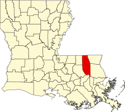
Location of Kentwood in Tangipahoa Parish, Louisiana.
Louisiana in United States (US48).svg
Location of Louisiana in the United States
Coordinates: 30°55′50″N90°30′25″W / 30.93056°N 90.50694°W / 30.93056; -90.50694 [1]
CountryUnited States
StateLouisiana
Parish Tangipahoa
Founded1893
Area
[2]
  Total
7.11 sq mi (18.42 km2)
  Land7.11 sq mi (18.42 km2)
  Water0.00 sq mi (0.01 km2)
Elevation
[1]
223 ft (68 m)
Population
 (2020)
  Total
2,145
  Density301.69/sq mi (116.48/km2)
Time zone UTC−06:00 (CST)
  Summer (DST) UTC−05:00 (CDT)
ZIP code
70444 [3]
Area code 985
FIPS code 22-39545
GNIS feature ID2405939 [1]

Kentwood is a rural town in Tangipahoa Parish, Louisiana, United States, near the Mississippi state line. The population was 2,198 at the 2010 census. It is part of the Hammond MSA. Kentwood is best known as the hometown of singer Britney Spears.

Contents

History

Amos Kent assisted in laying out the town. The Postmaster named the town in honor of Kent on February 29, 1888. [4]

On August 30, 2012, damage was caused by pressure on the 2,300 foot Percy Quin dam, a dam on the Tangipahoa River north of Kentwood, as a result of Hurricane Isaac, led to Louisiana Governor Bobby Jindal calling for a mandatory evacuation of the town due to fears of large-scale flooding from Lake Tangipahoa. The evacuation order, which was amended twice, was later rescinded as the dam held. The lake was drawn down so repairs could be made. [5]

The 490-acre Lake Tangipahoa, which opened in 1939 and is located six miles south of McComb, Mississippi, was reopened in 2016. Repairs had been completed in 2014 and the lake restocked. [6]

Geography

According to the United States Census Bureau, the town has a total area of 6.9 square miles (18 km2), of which 6.9 square miles (18 km2) is land and 0.14% is water.

Demographics

Historical population
CensusPop.Note
1900 1,313
1910 3,609174.9%
1920 3,059−15.2%
1930 1,726−43.6%
1940 1,8547.4%
1950 2,41730.4%
1960 2,6077.9%
1970 2,7364.9%
1980 2,667−2.5%
1990 2,468−7.5%
2000 2,205−10.7%
2010 2,198−0.3%
2020 2,145−2.4%
U.S. Decennial Census [7]
Kentwood racial composition as of 2020 [8]
RaceNumberPercentage
White (non-Hispanic)41419.3%
Black or African American (non-Hispanic)1,64276.55%
Native American 10.05%
Asian 40.19%
Other/Mixed 602.8%
Hispanic or Latino 241.12%

As of the 2020 United States census, there were 2,145 people, 771 households, and 421 families residing in the town.

Education

Tangipahoa Parish School Board operates public schools:

Notable people

See also

References

  1. 1 2 3 U.S. Geological Survey Geographic Names Information System: Kentwood, Louisiana
  2. "2020 U.S. Gazetteer Files". United States Census Bureau. Retrieved March 20, 2022.
  3. "Kentwood LA ZIP Code". zipdatamaps.com. 2023. Retrieved June 16, 2023.
  4. "Kentwood History" . Retrieved July 7, 2024.
  5. "Percy Quin's Lake Tangipahoa drained after Tropical Storm Isaac". August 31, 2012. Retrieved July 7, 2024.
  6. "Lake Tangipahoa (Percy Quin State Park)" . Retrieved July 7, 2024.
  7. "Census of Population and Housing". Census.gov. Retrieved June 4, 2015.
  8. "Explore Census Data". data.census.gov. Retrieved December 28, 2021.