The Kuthiathode or river stream, was once the major waterway for transporting goods to the local market from Kochi via the Vembanad lake.[according to whom?]
History
The name Kuthiathode comes from Kuthia (dug)+ thode (canal) means a dug-canal.
The Panchayat has a Gandhi memorial inside its office dedicated to Mahathma Gandhi who visited this place during the Pre-Independence period.
Demographics
As of 2011[update] India census, Kuthiathode had a population of 23,669 with 11,483 males and 12,186 females.[2][1]
Kuthiathode is under the Pattanakkad development block.[3]
Kuthiathode, Vallethode, Parayakad, Nallukulanagara, Pallithode, Chapakadavu, Tirumalabhagom, Thazhuppu, Thuravoor North, and Valamangalam North are the local areas under the panchayat.[citation needed]
The panchayat office has a library and a community hall. The Kuthiathode village office, Krishi Bhavan office, government veterinary clinic, excise range office, BSNL telephone exchange and sub-treasury are also located in Kuthiathode.
Kuthiathode is within the Aroor state assembly constituency.
Schools
Govt.West UP School,Thuravoor
Government Primary School, Tirumalabhagam
Government Upper Primary School, Parayakadu
St. Sebastian High School, Pallithode
St. Thomas Lower Primary School, Pallithode
Spring of Arts Academy,Kuthiathode.(Study center of Music & Arts)
The local market on both sides of the river was a major commercial hub around the locality. [fact or opinion?]Even now, the market exists with a few wholesale traders selling vegetables and other provisions. The vast agricultural lands on the western side, or the Thuravoor Kari, where large-scale paddy cultivation and shrimp farming are done annually and serve as the seasonal livelihood for many of them. A large number of shrimp peeling sheds operating in this panchayat provide large-scale employment.[citation needed]
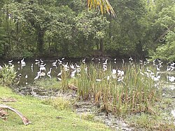
The Crystal Museum at Pallithode Beach is the one and only Crystal Museum in South India. The landscape of paddy fields on both sides of the Pallithode-Chavady road is really splendid. One can enjoy the evening panoramic view of Chinese fishing nets across the Pallithodebackwaters from the Pallithode bridge. A small backwater lake at Tazzupu connects Kuthiathode with Valiathode.During Onam boat racing is held in Tazzupu backwaters and attracts many seasonal tourists.
Religious buildings
Pallithode bund road running across the Thuravoor kari
This page is based on this Wikipedia article Text is available under the CC BY-SA 4.0 license; additional terms may apply. Images, videos and audio are available under their respective licenses.