Landing, New Jersey

Last updated

Landing, New Jersey
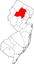
Location map of Morris County, New Jersey.svg
Red pog.svg
Landing
Location in Morris County
USA New Jersey relief location map.svg
Red pog.svg
Landing
Location in New Jersey
Usa edcp relief location map.png
Red pog.svg
Landing
Location in the United States
Coordinates: 40°54′18″N74°39′55″W / 40.90500°N 74.66528°W / 40.90500; -74.66528
Country Flag of the United States.svg  United States
State Flag of New Jersey.svg  New Jersey
County Morris
Township Roxbury
Area
[1]
  Total2.480 sq mi (6.42 km2)
  Land2.134 sq mi (5.53 km2)
  Water0.346 sq mi (0.90 km2)
Elevation
922 ft (281 m)
Population
 (2020) [2]
  Total4,296
  Density2,013.12/sq mi (777.27/km2)
ZIP Code
07850
Area code 973
FIPS code 34-38700 [3]
GNIS feature ID0877660 [4]

Landing is an unincorporated community and census-designated place (CDP) [5] in Roxbury Township, Morris County, New Jersey, United States. [6] The community is located at the south end of Lake Hopatcong near Hopatcong State Park. The area is served as United States Postal Service ZIP Code 07850.

Contents

As of the 2020 census, the population of the CDP was 4,296. [2]

History

Landing was established as a resort community. From the 1880s through the 1940s, each summer it attracted thousands of people to the shores of Lake Hopatcong. After World War II, it began to decline and transform itself into a large suburban neighborhood. In 2017, measures were passed to give the neighborhood a facelift, the plans including several new, modern buildings, parks and signs. The improvements are expected to be complete in late 2022.

Geography

Landing is on the western edge of Morris County, in the northwestern part of Roxbury Township. It is bordered to the northwest, across Lake Hopatcong and its outlet, the Musconetcong River, by the borough of Hopatcong in Sussex County. Within Morris County, it is bordered to the east by the borough of Mount Arlington, to the south by unincorporated Ledgewood, and to the west by unincorporated Port Morris.

Interstate 80 forms the southern boundary of the Landing CDP, separating it from Ledgewood. Exit 28 (Landing Road) provides access to the community. I-80 leads east 29 miles (47 km) to Paterson and west 28 miles (45 km) to the Delaware Water Gap.

According to the U.S. Census Bureau, the Landing CDP has a total area of 2.480 square miles (6.423 km2), of which 2.134 square miles (5.527 km2) are land and 0.346 square miles (0.896 km2), or 13.95%, are water. [1] The outlet of Lake Hopatcong is along the northern boundary of the community; the Musconetcong River flows out of the lake, leading southwest to the Delaware River. Hopatcong State Park is within the CDP at the lake outlet.

Notable people

People who were born in, residents of, or otherwise closely associated with Landing include:

See also

Related Research Articles

<span class="mw-page-title-main">Mount Arlington, New Jersey</span> Borough in Morris County, New Jersey, US

Mount Arlington is a borough in western Morris County, in the U.S. state of New Jersey. As of the 2020 United States census, the borough's population was 5,909, an increase of 859 (+17.0%) from the 2010 census count of 5,050, which in turn reflected an increase of 387 (+8.3%) from the 4,663 counted in the 2000 census.

<span class="mw-page-title-main">Mount Olive Township, New Jersey</span> Township in Morris County, New Jersey, US

Mount Olive Township is a township in western Morris County, in the U.S. state of New Jersey. As of the 2020 United States census, the township's population was 28,886, its highest decennial census count ever and an increase of 769 (+2.7%) from the 2010 census count of 28,117, which in turn reflected an increase of 3,924 (+16.2%) from the 24,193 counted in the 2000 census.

<span class="mw-page-title-main">Roxbury, New Jersey</span> Township in Morris County, New Jersey, US

Roxbury is a township in southwestern Morris County, in the U.S. state of New Jersey. As of the 2020 United States census, the township's population was 22,950, a decrease of 374 (−1.6%) from the 2010 census count of 23,324, which in turn reflected a decline of 559 (−2.3%) from the 23,883 counted in the 2000 census. The township is located approximately 36 miles (58 km) west-northwest of New York City, 27 miles (43 km) west-northwest of Newark, New Jersey and 26 miles (42 km) east of the Delaware Water Gap on the border of New Jersey and Pennsylvania.

<span class="mw-page-title-main">Hopatcong, New Jersey</span> Borough in Sussex County, New Jersey, US

Hopatcong is a borough in Sussex County, in the U.S. state of New Jersey. As of the 2020 United States census, the borough's population was 14,362, a decrease of 785 (−5.2%) from the 2010 census count of 15,147, which in turn reflected a decline of 741 (−4.7%) from the 15,888 counted in the 2000 census.

<span class="mw-page-title-main">Jefferson Township, New Jersey</span> Township in Morris County, New Jersey, US

Jefferson Township is the northernmost township in Morris County, in the U.S. state of New Jersey. As of the 2020 United States census, the township's population was 20,538, a decrease of 776 (−3.6%) from the 2010 census count of 21,314, which in turn reflected an increase of 1,597 (+8.1%) from the 19,717 counted in the 2000 census.

<span class="mw-page-title-main">Flanders, New Jersey</span> Populated place in Morris County, New Jersey, US

Flanders is an unincorporated community and census-designated place (CDP) in Mount Olive Township, in southwestern Morris County, New Jersey, United States. As of the 2020 census, the population was 9,832. Flanders is served by the U.S. Postal Service as ZIP Code 07836.

<span class="mw-page-title-main">Musconetcong River</span> River in New Jersey, United States

The Musconetcong River is a 45.7-mile-long (73.5 km) tributary of the Delaware River in northwestern New Jersey in the United States. It flows through the rural mountainous country of northwestern New Jersey. The name derives from the Lenape words moschakgeu meaning "clear" and hannek meaning "stream". Part of it is a National Wild and Scenic River.

<span class="mw-page-title-main">Lake Hopatcong</span> Natural lake, reservoir in New Jersey, United States

Lake Hopatcong is the largest freshwater body in New Jersey, United States, about 4 square miles (10 km2) in area. Located 30 miles (48 km) from the Delaware River and 40 miles (64 km) from Manhattan, New York City, the lake forms part of the border between Sussex and Morris counties in the state's northern highlands region.

<span class="mw-page-title-main">Succasunna, New Jersey</span> Place in Morris County, New Jersey, United States

Succasunna is an unincorporated community and census-designated place (CDP) located within Roxbury Township, in Morris County, in the U.S. state of New Jersey, serving as its downtown and population center, having a population of 9,152 people as of the 2010 United States Census.

<span class="mw-page-title-main">Newfoundland, New Jersey</span> Populated place in Morris and Passaic counties, New Jersey, US

Newfoundland is an unincorporated community and census-designated place (CDP) covering portions of both West Milford in Passaic County, and Jefferson Township in Morris County, in the U.S. state of New Jersey. It is located along Route 23 and is the mailing address of Green Pond, a private lake in Rockaway Township. As of the 2020 United States census, the CDP's population was 1,145.

<span class="mw-page-title-main">Kenvil, New Jersey</span> Populated place in Morris County, New Jersey, US

Kenvil is an unincorporated community and census-designated place (CDP) located within Roxbury Township, in Morris County, in the U.S. state of New Jersey. As of the 2020 census, it had a population of 1,806.

<span class="mw-page-title-main">Ledgewood, New Jersey</span> Populated place in Morris County, New Jersey, US

Ledgewood is an unincorporated community and census-designated place (CDP) located within Roxbury Township in Morris County, in the U.S. state of New Jersey. It was historically known as Drakesville after Abraham Drake, originally from Piscataway, New Jersey, who operated a mill and tavern here in the mid 1700s. The community was located on the Morris Canal.

<span class="mw-page-title-main">Hibernia, New Jersey</span> Populated place in Morris County, New Jersey, US

Hibernia is an unincorporated community and census-designated place (CDP) located along County Route 513 in Rockaway Township of Morris County, in the U.S. state of New Jersey. The area is served as United States Postal Service ZIP Code 07842. The community takes its name from Hibernia, the classical name for Ireland.

<span class="mw-page-title-main">Lake Hopatcong, New Jersey</span> Populated place in Morris County, New Jersey, US

Lake Hopatcong is a census-designated place (CDP) in Jefferson Township, Morris County, New Jersey, United States. It includes communities on the northeast side of Lake Hopatcong, the largest freshwater body in the state. As of the 2020 United States census, the population was 10,232.

<span class="mw-page-title-main">Hopatcong State Park</span> State park in New Jersey, United States

Hopatcong State Park is a state park in the Landing section of Roxbury Township, New Jersey, United States. Operated and maintained by the New Jersey Division of Parks and Forestry, the park consists of two parcels of land: one that encompasses Lake Hopatcong and some of its southwestern shore, and another that encompasses Lake Musconetcong about one mile to the west-southwest.

<span class="mw-page-title-main">Lake Hopatcong station</span> NJ Transit railway station

Lake Hopatcong is a commuter railroad station for New Jersey Transit. The station, located in the community of Landing in Roxbury Township, Morris County, New Jersey, United States, serves trains for the Montclair-Boonton Line and Morristown Line at peak hours and on holiday weekends. Service from Lake Hopatcong is provided to/from Hackettstown to New York Penn Station and Hoboken Terminal. The stop is located on the tracks below Landing Road next to the eponymous Lake Hopatcong. The station consists of one active platform with shelter, and an abandoned side platform. There is no accessibility for handicapped people.

Port Morris is a historic unincorporated community and census-designated place (CDP) located within Roxbury Township, in Morris County, in the U.S. state of New Jersey. Despite its name, Port Morris is in the hills of the Skylands Region, on the shores of Lake Musconetcong.

<span class="mw-page-title-main">Asbury, New Jersey</span> Populated place in Warren County, New Jersey, US

Asbury is an unincorporated community and census-designated place (CDP) located within Franklin Township in Warren County, in the U.S. state of New Jersey, that was created as part of the 2010 United States Census. As of the 2010 Census, the CDP's population was 273.

<span class="mw-page-title-main">Finesville, New Jersey</span> Populated place in Warren County, New Jersey, US

Finesville is an unincorporated community and census-designated place (CDP) located within Pohatcong Township in Warren County, in the U.S. state of New Jersey. The CDP was defined as part of the 2010 United States Census. As of the 2010 Census, the CDP's population was 175.

<span class="mw-page-title-main">Lower Berkshire Valley, New Jersey</span> Populated place in Morris County, New Jersey, US

Lower Berkshire Valley is a census-designated place (CDP) located in Roxbury and Jefferson townships, Morris County, in the U.S. state of New Jersey. It is primarily in the northeast part of Roxbury, along Berkshire Valley Road. Interstate 80 passes through the southern part of the CDP, but with no direct access. The community is 2 miles (3 km) northwest of Wharton and 4 miles (6 km) northwest of Dover.

References

  1. 1 2 "2024 U.S. Gazetteer Files: New Jersey". United States Census Bureau. Retrieved October 21, 2024.
  2. 1 2 Census Data Explorer: Landing CDP, New Jersey, United States Census Bureau. Accessed June 15, 2023.
  3. Geographic Codes Lookup for New Jersey, Missouri Census Data Center. Accessed June 9, 2023.
  4. "Landing". Geographic Names Information System . United States Geological Survey, United States Department of the Interior . Retrieved September 24, 2012.
  5. State of New Jersey Census Designated Places - BVP20 - Data as of January 1, 2020, United States Census Bureau. Accessed December 1, 2022.
  6. Locality Search, State of New Jersey. Accessed June 9, 2016.
  7. Havsy, Jane, for the Daily Record . "Roxbury alum Dylan Castanheira now Atlanta United II goalkeeper", Milwaukee Journal Sentinel , June 6, 2019. Accessed June 12, 2020. "Columbia senior goalkeeper Dylan Castanheira of Landing signed with Atlanta United 2 on Friday.... After missing his freshman season at Roxbury High School due to a twice-broken leg, Castanheira was able to train with Stoke City in England for a week in the summer and was invited to return for a more formal tryout a couple of months later."
  8. McFadden, Robert D. "Karen Ann Quinlan, 31, Dies; Focus Of '76 Right To Die Case", The New York Times , June 12, 1985. Accessed August 22, 2017. "Four weeks after her birth, the Quinlans took out adoption papers and took her home to their two-story gray-and-white colonial-style house at 510 Ryerson Road in the Landing section of Roxbury Township, just above Lake Hopatcong in Morris County."