Mørsvikvatnet (Norwegian) or Murgosjávrre (Lule Sami) is a lake located in Sørfold Municipality in Nordland county, Norway. The 1.1-square-kilometre (0.42 sq mi) lake lies on the northeastern side of the village of Mørsvikbotn. The European route E6 highway runs along the western edge of the lake.

Altevatnet (Norwegian) or Álddesjávri (Northern Sami) is Norway’s 11th largest lake. The 79.65-square-kilometre (30.75 sq mi) lake lies in Bardu Municipality in Troms county, Norway.

Blåmannsisen (Norwegian) or Ålmåjalosjiegŋa (Lule Sami) is the fifth-largest glacier in mainland Norway. It is located on the border of Fauske Municipality and Sørfold Municipality in Nordland county, Norway—just 2 kilometres (1.2 mi) west of the border with Sweden.
Baugevatnet is a lake that lies in Narvik Municipality in Nordland county, Norway. The 4.99-square-kilometre (1.93 sq mi) lake is located about 25 kilometres (16 mi) east of the village of Kjøpsvik and just 1.5 kilometres (0.93 mi) northwest of the border with Sweden. The lake Båvrojávrre lies about 3 kilometres (1.9 mi) to the southwest and the lake Langvatnet lies about the same distance to the north.
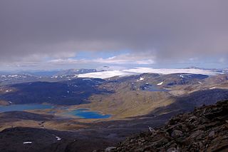
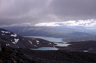
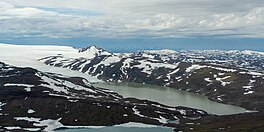
Blåmannsisvatnet (Norwegian) or Ålmåjalosjiegŋajávrre (Lule Sami) is a lake in Fauske Municipality in Nordland county, Norway. The 3.76-square-kilometre (1.45 sq mi) lake lies on the southeast edge of the large Blåmannsisen glacier, about 35 kilometres (22 mi) east of the town of Fauske. The border with Sweden is located about 6 kilometres (3.7 mi) east of the lake.
Båvrojávrre is a lake that lies on the border between Norway and Sweden. Most of the 6.08-square-kilometre (2.35 sq mi) lake lies in Norway in Narvik Municipality in Nordland county. Only 0.61 square kilometres (0.24 sq mi) of the lake lies in Sweden in Gällivare Municipality in Norrbotten County. The lake Baugevatnet lies just to the north. The ending -jávrre is the Lule Sami word for lake.
Tjårdavatnet (Norwegian) or Čoađgejávri (Northern Sami) is a lake that is located on the border of Norway and Sweden, about 15 kilometres (9.3 mi) south of the village of Elvegård in Norway. The Norwegian side lies in Narvik Municipality in Nordland county and the Swedish side lies in Gällivare Municipality in Norrbotten County. The lake has an area of about 3.63 square kilometres (1.40 sq mi), with 3.5 square kilometres (1.4 sq mi) being in Norway, the tiny remainder is in Sweden.
Kvitvatnet is a lake that lies in Sørfold Municipality in Nordland county, Norway. It is located in the southeastern part of the municipality, about 21 kilometres (13 mi) east of the village of Straumen. The lake lies on the north side of the Blåmannsisen glacier, just south of the Rago National Park, and just west of the border with Sweden.
Langvatnet (Norwegian) or Guhkesjávrre (Lule Sami) is a lake that lies in Sørfold Municipality in Nordland county, Norway. The 13.97-square-kilometre (5.39 sq mi) lake is located about 30 kilometres (19 mi) northeast of the village of Straumen, just north of Rago National Park and the border with Sweden.
Langvatnet (Norwegian) or Tjoaddnejávrre (Lule Sami) is a lake that lies on the border between Norway and Sweden. Almost all of the lake is located in Hamarøy Municipality in Nordland county, Norway with a very small part of the lake in Jokkmokk Municipality in Norrbotten County, Sweden. The 5.46-square-kilometre (2.11 sq mi) lake is located about 20 kilometres (12 mi) southeast of the village of Kjøpsvik in Tysfjord.

Lomivatnet (Norwegian) or Loamejávrre (Lule Sami) is a lake in Fauske Municipality in Nordland county, Norway. The 11.43-square-kilometre (4.41 sq mi) lake lies about 5 kilometres (3.1 mi) east of the village of Sulitjelma, just south of the Sulitjelma Glacier and north of Junkerdal National Park. The border with Sweden is 3 kilometres (1.9 mi) east of the lake. The Lomi Hydroelectric Power Station uses the lake as a reservoir.
Muorkkejávrre (Lule Sami) or Eidevatnet (Norwegian) is a lake that lies in Fauske Municipality in Nordland county, Norway. The 5.94-square-kilometre (2.29 sq mi) lake lies about 75 metres (246 ft) west of the border with Sweden and about 10 kilometres (6.2 mi) east of the village of Sulitjelma. The water from the lake flows west into the neighboring lake Låmivatnet. The ending -jávrre is the Lule Sami word for "lake".

Storskogvatnet is a lake that lies in Sørfold Municipality in Nordland county, Norway. The 2.39-square-kilometre (0.92 sq mi) lake is located about 20 kilometres (12 mi) northeast of the village of Straumen, inside of Rago National Park.
Trollvatnet is a lake that lies in Sørfold Municipality in Nordland county, Norway. The 3.88-square-kilometre (1.50 sq mi) lake is located northeast of the Sagfjorden, about 20 kilometres (12 mi) west of the village of Mørsvikbotn.
Vuolep Sårjåsjávrre is a lake which lies on the border between Norway and Sweden. The western part lies in Fauske Municipality in Nordland county, Norway, and the eastern part lies in Jokkmokk Municipality in Norrbotten County, Sweden. The 7.17-square-kilometre (2.77 sq mi) lake lies just to the east of the large Blåmannsisen glacier and smaller neighboring lake Bajep Sårjåsjávrre.
Rengen is a lake on the border between Sweden and Norway. The 21.49-square-kilometre (8.30 sq mi) lake covers 15.72 square kilometres (6.07 sq mi) in Norway and 5.77 square kilometres (2.23 sq mi) in Sweden. The Norwegian part is located in the municipality of Lierne in Trøndelag county, and the Swedish part is located in the municipality of Krokom in Jämtland County. Water flows into Rengen from the lake Ulen to the north.
Holderen is a lake on the border between Sweden and Norway. The 1.83-square-kilometre (0.71 sq mi) Norwegian part is located inside Blåfjella–Skjækerfjella National Park in the municipality of Snåsa in Trøndelag county. The 6.44-square-kilometre (2.49 sq mi) Swedish part is located in the municipality of Åre in Jämtland County. The lake lies about 3 kilometres (2 mi) south of the lake Grøningen.
Kingen is a lake on the border between Sweden and Norway. The Norwegian part is located in the municipality of Lierne in Trøndelag county, and the Swedish part is located in the municipality of Krokom in Jämtland County. It lies south of the larger lake Rengen.

Rostojávri (Northern Sami), Råstojaure (Swedish), or Storrostavatnet (Norwegian) is a lake on the border between Norway and Sweden. The Norwegian part of the lake (smaller) is located in Målselv Municipality in Troms county and the Swedish part of the lake (larger) is located in Kiruna Municipality in Norrbotten County. The Norwegian part of the lake lies inside Øvre Dividal National Park. The lake lies at an elevation of 680 metres (2,230 ft) and covers a total area of 34.24 square kilometres (13.22 sq mi); with 3.67 square kilometres (1.42 sq mi) located in Norway and the remaining 30.57 square kilometres (11.80 sq mi) are located in Sweden.
Leinavatnet (Norwegian) or Davit Lenesjávri (Northern Sami) is a lake on the border between Norway and Sweden. It is almost entirely located in Bardu Municipality in Troms county in Norway, but a very small area crosses over into Kiruna Municipality in Norrbotten County in Sweden. The lake's area is 28.32 square kilometres (10.93 sq mi) and it sits at an elevation of 491 metres (1,611 ft) above sea level. Its shoreline measures 62.83 kilometres (39.04 mi).


