Related Research Articles

The Raritan River is a major river of New Jersey. Its watershed drains much of the mountainous area of the central part of the state, emptying into the Raritan Bay on the Atlantic Ocean.

Lenapehoking is widely translated as 'homelands of the Lenape', which in the 16th and 17th centuries, ranged along the Eastern seaboard from western Connecticut to Delaware, and encompassed the territory adjacent to the Delaware and lower Hudson river valleys, and the territory between them.

The Ramapo River is a tributary of the Pompton River, approximately 30 mi (48 km) long, in southern New York and northern New Jersey in the United States.
The following is an alphabetical list of articles related to the U.S. state of New Jersey.
A township, in the context of New Jersey local government, refers to one of five types and one of eleven forms of municipal government. As a political entity, a township in New Jersey is a full-fledged municipality, on par with any town, city, borough, or village. They collect property taxes and provide services such as maintaining roads, garbage collection, water, sewer, schools, police and fire protection. The Township form of local government is used by 27% of New Jersey municipalities; however, slightly over 50% of the state's population resides within them.

The South Branch Raritan River is a 50-mile-long (80 km) tributary of the Raritan River in New Jersey.
Matchaponix Brook is a tributary of the South River in Monmouth and Middlesex counties, New Jersey in the United States.
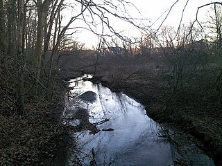
Manalapan Brook is a tributary of the South River in Monmouth and Middlesex counties, New Jersey in the United States.

New Jersey is a state within the United States of America that lies on the north eastern edge of the North American continent. It shares a land border with the state of New York along the north, ratified by both states after the New York – New Jersey Line War, which is its only straight line border.

Holland Brook is a tributary of the South Branch Raritan River in Hunterdon and Somerset Counties, New Jersey in the United States.

U.S. Route 202 (US 202) is a U.S. Highway running from New Castle, Delaware northeast to Bangor, Maine. In the U.S. state of New Jersey, the route runs 80.31 mi (129.25 km) from the New Hope–Lambertville Toll Bridge over the Delaware River at the Pennsylvania border in Delaware Township, Hunterdon County near Lambertville northeast to the New York border in Mahwah, Bergen County. Along the route's journey, it passes through a variety of suburban and rural environments, including the communities of Flemington, Somerville, Morristown, Parsippany-Troy Hills, Wayne, and Oakland as well as five counties: Hunterdon, Somerset, Morris, Passaic, and Bergen. US 202 encounters many major roads in New Jersey, including Route 31, US 206, US 22, Interstate 80 (I-80), US 46, Route 23, and Route 17. From Somerville to the New York border, US 202 generally runs within a close distance of I-287 and interchanges with that route several times. The road ranges from a four-lane freeway between Lambertville and Ringoes in Hunterdon County to a two-lane surface road through much of the northern portion of the route. North of the Route 53 intersection in Morris Plains, US 202 is maintained by individual counties rather than the New Jersey Department of Transportation with a few exceptions.

The members of the New Jersey Legislature are chosen from 40 electoral districts. Each district elects one senator and two assemblymen.

Hunterdon Plateau is a plateau in western Hunterdon County, New Jersey. It borders the higher Musconetcong Mountain to the northwest, the Delaware River to the west, Amwell Valley to the south and the lower lying areas of the Newark Basin to the east.
The Pompton or Pamapon people were a sub-tribe of Algonquian-speaking Native Americans, who once lived northern New Jersey. The Pompton historically lived along Pompton and Pequannock Rivers, near what is now Paterson, New Jersey, but they were forced out of New Jersey after their lands had been taken without compensation by European colonists.
The members of the New Jersey Legislature are chosen from 40 electoral districts. Each district elects one senator and two assemblymen.
References
Citations
Sources
- Beauchamp, William Martin (1906). Aboriginal place names of New York. New York State Education Department, New York State Museum.
- Bright, William (2004). Native American Place Names of the United States. Norman: University of Oklahoma Press.
- Campbell, Lyle (1997). American Indian Languages: The Historical Linguistics of Native America. Oxford: Oxford University Press.
- Ruttenber, Edward Manning. History of the Indian tribes of Hudson's River: their origin, manners and customs, tribal and sub-tribal organizations, wars, treaties, etc., etc. J. Munsell, (1872)
- Hutchinson, Viola L. (May 1945). The Origin of New Jersey Place Names (PDF). New Jersey Public Library Commission.