
This is part of the list of United Kingdom locations: a gazetteer of place names in the United Kingdom showing each place's locality and geographical coordinates.
This is part of the list of United Kingdom locations: a gazetteer of place names in the United Kingdom showing each place's locality and geographical coordinates.
| Location | Locality | Coordinates (links to map & photo sources) | OS grid reference |
| Itchen | City of Southampton | 50°53′N1°22′W / 50.89°N 01.37°W | SU4411 |
| Itchen Abbas | Hampshire | 51°05′N1°14′W / 51.08°N 01.24°W | SU5332 |
| Itchen Stoke | Hampshire | 51°05′N1°13′W / 51.08°N 01.21°W | SU5532 |
| Itchingfield | West Sussex | 51°02′N0°23′W / 51.04°N 00.38°W | TQ1328 |
| Itchington | South Gloucestershire | 51°34′N2°30′W / 51.57°N 02.50°W | ST6586 |
| Itteringham | Norfolk | 52°49′N1°10′E / 52.82°N 01.17°E | TG1430 |
| Itteringham Common | Norfolk | 52°49′N1°11′E / 52.81°N 01.18°E | TG1529 |
| Itton | Monmouthshire | 51°39′N2°44′W / 51.65°N 02.73°W | ST4995 |
| Itton Common | Monmouthshire | 51°40′N2°45′W / 51.66°N 02.75°W | ST4896 |
| Location | Locality | Coordinates (links to map & photo sources) | OS grid reference |
| Ivegill | Cumbria | 54°46′N2°55′W / 54.77°N 02.91°W | NY4143 |
| Ivelet | North Yorkshire | 54°22′N2°06′W / 54.36°N 02.10°W | SD9397 |
| Iver | Buckinghamshire | 51°31′N0°31′W / 51.51°N 00.51°W | TQ0381 |
| Iver Heath | Buckinghamshire | 51°32′N0°32′W / 51.53°N 00.53°W | TQ0283 |
| Iverley | Staffordshire | 52°25′N2°11′W / 52.42°N 02.19°W | SO8781 |
| Iveston | Durham | 54°50′N1°47′W / 54.84°N 01.79°W | NZ1350 |
| Ivinghoe | Buckinghamshire | 51°50′N0°38′W / 51.83°N 00.63°W | SP9416 |
| Ivinghoe Aston | Buckinghamshire | 51°51′N0°37′W / 51.85°N 00.62°W | SP9518 |
| Ivington | Herefordshire | 52°11′N2°46′W / 52.19°N 02.77°W | SO4756 |
| Ivybridge | Devon | 50°23′N3°55′W / 50.38°N 03.92°W | SX6356 |
| Ivy Chimneys | Essex | 51°41′N0°05′E / 51.68°N 00.09°E | TL4500 |
| Ivychurch | Kent | 51°00′N0°52′E / 51.00°N 00.87°E | TR0227 |
| Ivy Cross | Dorset | 51°00′N2°12′W / 51.00°N 02.20°W | ST8623 |
| Ivy Hatch | Kent | 51°16′N0°16′E / 51.26°N 00.26°E | TQ5854 |
| Ivy Todd | Norfolk | 52°38′N0°47′E / 52.64°N 00.79°E | TF8909 |
| Location | Locality | Coordinates (links to map & photo sources) | OS grid reference |
| Iwade | Kent | 51°22′N0°43′E / 51.37°N 00.71°E | TQ8967 |
| Iwerne Courtney or Shroton | Dorset | 50°54′N2°13′W / 50.90°N 02.21°W | ST8512 |
| Iwerne Minster | Dorset | 50°55′N2°12′W / 50.92°N 02.20°W | ST8614 |
| Iwood | North Somerset | 51°22′N2°47′W / 51.36°N 02.79°W | ST4563 |
| Location | Locality | Coordinates (links to map & photo sources) | OS grid reference |
| Ixworth | Suffolk | 52°17′N0°49′E / 52.29°N 00.81°E | TL9270 |
| Ixworth Thorpe | Suffolk | 52°19′N0°48′E / 52.31°N 00.80°E | TL9172 |
Britain most often refers to:

The Parliament of the United Kingdom of Great Britain and Northern Ireland is the supreme legislative body of the United Kingdom, and may also legislate for the Crown Dependencies and the British Overseas Territories. It meets at the Palace of Westminster in London. Parliament possesses legislative supremacy and thereby holds ultimate power over all other political bodies in the United Kingdom and the Overseas Territories. While Parliament is bicameral, it has three parts: the sovereign, the House of Lords, and the House of Commons. The three parts acting together to legislate may be described as the King-in-Parliament. The Crown normally acts on the advice of the prime minister, and the powers of the House of Lords are limited to only delaying legislation; thus power is de facto vested in the House of Commons.

The prime minister of the United Kingdom is the head of government of the United Kingdom. The prime minister advises the sovereign on the exercise of much of the royal prerogative, chairs the Cabinet and selects its ministers. As modern prime ministers hold office by virtue of their ability to command the confidence of the House of Commons, they sit as members of Parliament.

A primary school, elementary school, or grade school is a school for primary education of children who are 4 to 10 years of age. Primary schooling follows preschool and precedes secondary schooling.
The United Kingdom of Great Britain and Northern Ireland, commonly known as the United Kingdom (UK) or Britain, is a country in Northwestern Europe, off the coast of the continental mainland. It comprises England, Scotland, Wales, and Northern Ireland. The UK includes the island of Great Britain, the north-eastern part of the island of Ireland, and most of the smaller islands within the British Isles. Northern Ireland shares a land border with the Republic of Ireland; otherwise, the United Kingdom is surrounded by the Atlantic Ocean, the North Sea, the English Channel, the Celtic Sea, and the Irish Sea. The total area of the United Kingdom is 94,354 square miles (244,376 km2), with an estimated population of nearly 67.6 million people in 2022.
The Peerage of Ireland consists of those titles of nobility created by the English monarchs in their capacity as Lord or King of Ireland, or later by monarchs of the United Kingdom of Great Britain and Ireland. It is one of the five divisions of Peerages in the United Kingdom. The creation of such titles came to an end in the 19th century. The ranks of the Irish peerage are duke, marquess, earl, viscount and baron. As of 2016, there were 135 titles in the Peerage of Ireland extant: two dukedoms, ten marquessates, 43 earldoms, 28 viscountcies, and 52 baronies. However, these titles have no official recognition in the Republic of Ireland, with Article 40.2 of the Constitution of Ireland forbidding the state conferring titles of nobility and stating that an Irish citizen may not accept titles of nobility or honour except with the prior approval of the Irish government.
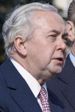
The October 1974 United Kingdom general election took place on Thursday 10 October 1974 to elect 635 members of the House of Commons. It was the second general election held that year; the first year that two general elections were held in the same year since 1910; and the first time that two general elections were held less than a year apart from each other since the 1923 and 1924 elections, which took place 10 months apart. The election resulted in the Labour Party, led by Prime Minister Harold Wilson, winning a bare majority of three seats. That enabled the remainder of the Labour government to take place, but it saw a gradual loss of its majority.
The December 1910 United Kingdom general election was held from 3 to 19 December. It was the last general election to be held over several days and the last to be held before the First World War.
The 1832 United Kingdom general election was the first United Kingdom general election held in the Reformed House of Commons following the Reform Act. The election saw the Whigs win an overall majority of 224 seats, with the Tories winning less than 30% of the vote.
The 2004 European Parliament election was the United Kingdom's part of the wider 2004 European Parliament election which was held between 10 and 13 June 2004 in the 25 member states of the European Union. The United Kingdom's part of this election was held on Thursday 10 June 2004. The election also coincided with the 2004 local elections and the London Assembly and mayoral elections. In total, 78 Members of the European Parliament were elected from the United Kingdom using proportional representation.

The Yugoslavia national football team represented Yugoslavia in international association football.

These are lists of places in Wales.

The Parliament of the United Kingdom currently has 650 parliamentary constituencies across the constituent countries, each electing a single member of parliament (MP) to the House of Commons by the plurality voting system, ordinarily every five years. Voting last took place in all 650 of those constituencies at the United Kingdom general election on 12 December 2019.

In the United Kingdom, a member of Parliament (MP) is an individual elected to serve in the House of Commons, the lower house of the Parliament of the United Kingdom.

The unitary authorities of England are a type of local authority responsible for all local government services in an area. They combine the functions of a non-metropolitan county council and a non-metropolitan district council, which elsewhere in England provide two tiers of local government.

The Kingdom of Portugal was a monarchy in the western Iberian Peninsula and the predecessor of the modern Portuguese Republic. Existing to various extents between 1139 and 1910, it was also known as the Kingdom of Portugal and the Algarves after 1415, and as the United Kingdom of Portugal, Brazil and the Algarves between 1815 and 1822. The name is also often applied to the Portuguese Empire, the realm's overseas colonies.

Since 1922, the United Kingdom has been made up of four countries: England, Scotland, Wales and Northern Ireland. The UK Prime Minister's website has used the phrase "countries within a country" to describe the United Kingdom.