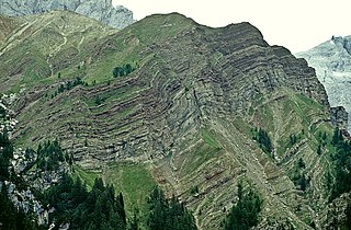
Metamorphic rocks arise from the transformation of existing rock to new types of rock in a process called metamorphism. The original rock (protolith) is subjected to temperatures greater than 150 to 200 °C and, often, elevated pressure of 100 megapascals (1,000 bar) or more, causing profound physical or chemical changes. During this process, the rock remains mostly in the solid state, but gradually recrystallizes to a new texture or mineral composition. The protolith may be an igneous, sedimentary, or existing metamorphic rock.
Obduction is a geological process whereby denser oceanic crust is scraped off a descending ocean plate at a convergent plate boundary and thrust on top of an adjacent plate. When oceanic and continental plates converge, normally the denser oceanic crust sinks under the continental crust in the process of subduction. Obduction, which is less common, normally occurs in plate collisions at orogenic belts or back-arc basins.

An ophiolite is a section of Earth's oceanic crust and the underlying upper mantle that has been uplifted and exposed, and often emplaced onto continental crustal rocks.

Peridotite ( PERR-ih-doh-tyte, pə-RID-ə-) is a dense, coarse-grained igneous rock consisting mostly of the silicate minerals olivine and pyroxene. Peridotite is ultramafic, as the rock contains less than 45% silica. It is high in magnesium (Mg2+), reflecting the high proportions of magnesium-rich olivine, with appreciable iron. Peridotite is derived from Earth's mantle, either as solid blocks and fragments, or as crystals accumulated from magmas that formed in the mantle. The compositions of peridotites from these layered igneous complexes vary widely, reflecting the relative proportions of pyroxenes, chromite, plagioclase, and amphibole.
The Nevadan orogeny occurred along the western margin of North America during the Late Jurassic to Early Cretaceous approximately 155 Ma to 145 Ma. Throughout the duration of this orogeny there were at least two different kinds of orogenic processes occurring. During the early stages of orogenesis an "Andean type" continental magmatic arc developed due to subduction of the Farallon oceanic plate beneath the North American Plate. The latter stages of orogenesis, in contrast, saw multiple oceanic arc terranes accreted onto the western margin of North America in a "Cordilleran type" accretionary orogen. Deformation related to the accretion of these volcanic arc terranes is mostly limited to the western regions of the resulting mountain ranges and is absent from the eastern regions. In addition, the deformation experienced in these mountain ranges is mostly due to the Nevadan orogeny and not other external events such as the more recent Sevier and Laramide Orogenies. It is noted that the Klamath Mountains and the Sierra Nevada share similar stratigraphy indicating that they were both formed by the Nevadan orogeny. In comparison with other orogenic events, it appears that the Nevadan Orogeny occurred rather quickly taking only about 10 million years as compared to hundreds of millions of years for other orogenies around the world.

The rock cycle is a basic concept in geology that describes transitions through geologic time among the three main rock types: sedimentary, metamorphic, and igneous. Each rock type is altered when it is forced out of its equilibrium conditions. For example, an igneous rock such as basalt may break down and dissolve when exposed to the atmosphere, or melt as it is subducted under a continent. Due to the driving forces of the rock cycle, plate tectonics and the water cycle, rocks do not remain in equilibrium and change as they encounter new environments. The rock cycle explains how the three rock types are related to each other, and how processes change from one type to another over time. This cyclical aspect makes rock change a geologic cycle and, on planets containing life, a biogeochemical cycle.

The Narryer Gneiss Terrane is a geological complex in Western Australia that is composed of a tectonically interleaved and polydeformed mixture of granite, mafic intrusions and metasedimentary rocks in excess of 3.3 billion years old, with the majority of the Narryer Gneiss Terrane in excess of 3.6 billion years old. The rocks have experienced multiple metamorphic events at amphibolite or granulite conditions, resulting in often complete destruction of original igneous or sedimentary (protolith) textures. Importantly, it contains the oldest known samples of the Earth's crust: samples of zircon from the Jack Hills portion of the Narryer Gneiss have been radiometrically dated at 4.4 billion years old, although the majority of zircon crystals are about 3.6-3.8 billion years old.

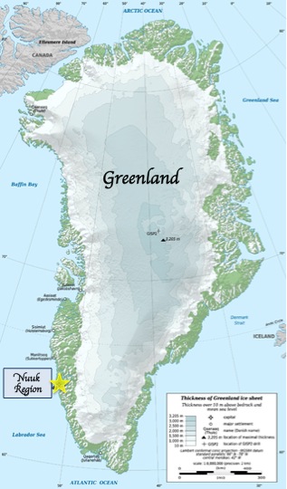
The Isua Greenstone Belt is an Archean greenstone belt in southwestern Greenland, aged between 3.7 and 3.8 billion years. The belt contains variably metamorphosed mafic volcanic and sedimentary rocks, and is the largest exposure of Eoarchaean supracrustal rocks on Earth. Due to its age and low metamorphic grade relative to many Eoarchaean rocks, the Isua Greenstone Belt has become a focus for investigations on the emergence of life and the style of tectonics that operated on the early Earth.

Guernsey has a geological history stretching further back into the past than most of Europe. The majority of rock exposures on the Island may be found along the coastlines, with inland exposures scarce and usually highly weathered. There is a broad geological division between the north and south of the Island. The Southern Metamorphic Complex is elevated above the geologically younger, lower lying Northern Igneous Complex. Guernsey has experienced a complex geological evolution with multiple phases of intrusion and deformation recognisable.
The Merlis Serpentinites are an aligned group of small serpentinite outcrops in the northwestern French Massif Central. Their parent rocks were peridotites from the upper mantle.

High pressure terranes along the ~1200 km long east-west trending Bangong-Nujiang suture zone (BNS) on the Tibetan Plateau have been extensively mapped and studied. Understanding the geodynamic processes in which these terranes are created is key to understanding the development and subsequent deformation of the BNS and Eurasian deformation as a whole.

The Samail Ophiolite, also known as the Semail Ophiolite, is a large, ancient geological formation in Oman and the United Arab Emirates in the Arabian Peninsula. It is one of the world's largest and best-exposed segments of oceanic crust, made of volcanic rocks and ultramafic rocks from the Earth's upper mantle that was overthrust onto the continental crust. This ophiolite provides insight into the dynamics of oceanic crust formation and the tectonic processes involved in the creation of ocean basins.
The Coal Creek Serpentinite(Coal Creek Serpentine) is a name for a Precambrian rock formation that outcrops on the southeastern side of the Llano Uplift in Gillespie and Blanco counties, Texas. The Coal Creek Serpentinite is tabular south-dipping body of serpentinite. Its outcrop is about 3.7 mi (6.0 km) long along an east–west axis and varies in width from 0.3 to 1.4 mi (0.48 to 2.25 km). Along the central part of the body, the southern contact of the serpentinite slopes about 60° to the south and gradually decreases in dip to about 40° further west. The southern and northern contacts are shear zones. The serpentinite underlies a very sparsely vegetated east–west trending ridge.

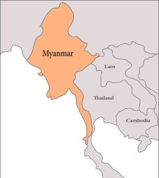
The geology of Myanmar is shaped by dramatic, ongoing tectonic processes controlled by shifting tectonic components as the Indian Plate slides northwards and towards Southeast Asia. Myanmar spans across parts of three tectonic plates separated by north-trending faults. To the west, a highly oblique subduction zone separates the offshore Indian Plate from the Burma microplate, which underlies most of the country. In the center-east of Myanmar, a right lateral strike slip fault extends from south to north across more than 1,000 km (620 mi). These tectonic zones are responsible for large earthquakes in the region. The India-Eurasia plate collision which initiated in the Eocene provides the last geological pieces of Myanmar, and thus Myanmar preserves a more extensive Cenozoic geological record as compared to records of the Mesozoic and Paleozoic eras. Myanmar is physiographically divided into three regions: the Indo-Burman Range, Myanmar Central Belt and the Shan Plateau; these all display an arcuate shape bulging westwards. The varying regional tectonic settings of Myanmar not only give rise to disparate regional features, but also foster the formation of petroleum basins and a diverse mix of mineral resources.

The geology of Italy includes mountain ranges such as the Alps and the Apennines formed from the uplift of igneous and primarily marine sedimentary rocks all formed since the Paleozoic. Some active volcanoes are located in Insular Italy.

The Eastern Block of the North China Craton is one of the Earth's oldest pieces of continent. It is separated from the Western Block by the Trans-North China Orogen. It is situated in northeastern China and North Korea. The Block contains rock exposures older than 2.5 billion years. It serves as an ideal place to study how the crust was formed in the past and the related tectonic settings.

The geology of New Caledonia includes all major rock types, which here range in age from ~290 million years old (Ma) to recent. Their formation is driven by alternate plate collisions and rifting. The mantle-derived Eocene Peridotite Nappe is the most significant and widespread unit. The igneous unit consists of ore-rich ultramafic rocks thrust onto the main island. Mining of valuable metals from this unit has been an economical pillar of New Caledonia for more than a century.
The Horokanai ophiolite is a geological complex located in the Kamuikotan tectonic belt about 30 km northwest of Asahikawa city, Hokkaido, Japan. The ophiolite complex is exposed along either side of a north-dipping anticline in several blocks.
The Ballantrae Complex is an assemblage of rocks in southwest Scotland considered to be an ophiolite, that is a section of the earth's oceanic crust and upper mantle obducted onto continental crust. The complex is bounded by the coast of the Firth of Clyde to the west and the Stinchar Valley Fault, a constituent element of the Southern Uplands Fault to the south. The emplacement of this highly faulted assemblage of both intrusive and extrusive igneous rocks and metamorphic rocks took place within the Grampian phase of the Caledonian orogeny.
The Highland Border Ophiolite (HBO) is a set of rocks that are ophiolitic in character found within the Highland Border Complex. They are exposed in a series of fault-bounded outcrops along the line of the Highland Boundary Fault that forms the southeastern boundary to the Grampian Highlands in Scotland. They represent fragments of a piece of oceanic crust or exhumed mantle that has been obducted onto continental crust. These rocks provide an important constraint on models of how the current geometry arose during the Caledonian Orogeny.


