Loudoun Valley Estates, Virginia

Last updated

Loudoun Valley Estates, Virginia
Loudoun Valley Estates, Virginia (cropped).jpg
Aerial view of the Loudoun Valley Estates
USA Virginia Northern location map.svg
Red pog.svg
Loudoun Valley Estates
USA Virginia location map.svg
Red pog.svg
Loudoun Valley Estates
Usa edcp location map.svg
Red pog.svg
Loudoun Valley Estates
Coordinates: 38°58′51″N77°30′28″W / 38.98083°N 77.50778°W / 38.98083; -77.50778
CountryFlag of the United States.svg  United States
State Flag of Virginia.svg  Virginia
County Flag of Loudoun County, Virginia.svg Loudoun
Area
[1]
  Total2.83 sq mi (7.32 km2)
  Land2.81 sq mi (7.27 km2)
  Water0.02 sq mi (0.06 km2)
Elevation
295 ft (90 m)
Population
 (2010) [2]
  Total3,656
  Density1,303/sq mi (503.2/km2)
Time zone UTC−5 (Eastern (EST))
  Summer (DST) UTC−4 (EDT)
ZIP codes
20148 (Ashburn)
20166 (Sterling)
FIPS code 51-47136
GNIS feature ID2584868

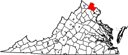
Loudoun Valley Estates is a census-designated place (CDP) in Loudoun County, Virginia, United States. The population as of the 2010 United States Census was 3,656. [2] It is a Toll Brothers community located near the planned Ashburn Metro station complex and Moorefield Station town center in the southern part of Ashburn, Virginia. Loudoun Valley Estates is governed by a homeowners' association. [3]

Contents

It was formerly part of the county planning commission's Urban Policy Area but has been removed. [4] The community is served by the Loudoun County Parkway. [5]

Geography

Loudoun Valley Estates is in southeastern Loudoun County and is bordered by Brambleton to the south and west, Broadlands and Moorefield to the north, and the runways of Dulles International Airport to the east. It is 2 miles (3 km) southwest of the Dulles Greenway (Virginia Route 267), 11 miles (18 km) south of Leesburg, the county seat, and 32 miles (51 km) west-northwest of Washington, D.C.

According to the U.S. Census Bureau, the Loudoun Valley Estates CDP has a total area of 2.8 square miles (7.3 km2), of which 0.02 square miles (0.06 km2), or 0.76%, are water. [1] The community is drained by Broad Run, a northeast-flowing tributary of the Potomac River.

The land around Loudoun Valley Estates is gently rolling. The average elevation is 289 feet (88 m). [6] The population density is about 500 people per square kilometer. [7]

The climate is humid subtropical. [8] The average temperature is 57 °F (14 °C). The warmest month is August, at 77 °F (25 °C), and the coldest is January, at 32 °F (0 °C). [9] The average rainfall 46.8 inches (1,188 mm) per year. The wettest month was October, at 5.0 inches (128 mm) of rain, and the least wet was November, at 2.1 inches (54 mm). [10]

Demographics

According to the 2010 census, Loudoun Valley Estates had a population of 3,656. Of this, 29.3% were white; 4.2% African American; 0.3% were American Indians and Alaska Natives; 61% were Asian; 0.0% Hawaiians and other Pacific Islanders; 1.1% from another race, and 4.1% from two or more races. 3.3% of the total population were Hispanic or Latino of any race. [11]

Notable residents

Survivor contestant Reem Daly lives in Loudoun Valley Estates. [12]

Related Research Articles

<span class="mw-page-title-main">Loudoun County, Virginia</span> County in Virginia, United States

Loudoun County is in the northern part of the Commonwealth of Virginia in the United States. In 2020, the census returned a population of 420,959, making it Virginia's third-most populous county. The county seat is Leesburg. Loudoun County is part of the Washington–Arlington–Alexandria, DC–VA–MD–WV Metropolitan Statistical Area.

<span class="mw-page-title-main">Sterling, Virginia</span> Census-designated place in Virginia

Sterling, Virginia, refers most specifically to a census-designated place (CDP) in Loudoun County, Virginia, United States. The population of the CDP as of the 2020 United States Census was 30,337 The CDP boundaries are confined to a relatively small area between Virginia State Route 28 on the west and Virginia State Route 7 on the northeast, excluding areas near SR 606 and the Dulles Town Center.

<span class="mw-page-title-main">Ashburn, Virginia</span> Census-designated place in Virginia, United States

Ashburn is a rapidly growing census-designated place (CDP) in Loudoun County, Virginia, United States. At the 2010 United States census, its population was 43,511, up from 3,393 in 1990. It is 30 miles (48 km) northwest of Washington, D.C., and part of the Washington metropolitan area.

<span class="mw-page-title-main">South Riding, Virginia</span> Census-designated place in Virginia

South Riding is a census-designated place and planned community in Loudoun County, Virginia, United States. The South Riding homeowner association was founded in January 1995 to provide services to the community. Neighboring U.S. Route 50 and State Route 28 provide access to the Dulles/Reston/Tysons Corner technology corridor and other major employment centers in Northern Virginia and Washington, D.C.

<span class="mw-page-title-main">Brambleton, Virginia</span> Census-designated place in Virginia

Brambleton is a census-designated place (CDP) in Loudoun County, Virginia, United States, south of the Dulles Greenway. The population as of the 2010 United States Census was 9,845. In 2017, Brambleton had an estimated population of 19,900, with a median age of 34.3 and a median household income of $173,690. Between 2016 and 2017 the population of Brambleton, VA grew from 17,063 to 19,876, a 16.5% increase and its median household income grew from $164,321 to $173,690, a 5.7% increase. Construction started on the Brambleton community in 2001.

Stone Ridge is a census-designated place in Loudoun County, Virginia, United States. Residences use Aldie mailing addresses, and it is near Washington Dulles International Airport. The population as of the 2020 census was 15,039. Stone Ridge is a Van Metre Homes planned, mixed-use community.

Lansdowne is a census-designated place and planned community located near Leesburg, Virginia in Loudoun County, Virginia. The population as of the 2010 United States Census was 11,253. It is north of State Route 7 and south of the Potomac River. Before the Revolutionary War, the Lee family established Coton Manor here. A section of the Potomac Heritage Trail runs through Lansdowne. It is the home of Inova Loudoun Hospital, the Jack Kent Cooke Foundation, Lansdowne Resort, Prison Fellowship, and Lansdowne Woods of Virginia, a gated, age-restricted community.

Belmont is a census-designated place (CDP) in Loudoun County, Virginia, United States. The population as of the 2010 United States Census was 5,966. It is 5 miles (8 km) southeast of Leesburg, the Loudoun county seat, and 31 miles (50 km) northwest of Washington, D.C. The Belmont Manor House, built between 1799 and 1802 by a son of Richard Henry Lee, is in the northeast part of the CDP and is now the clubhouse for a gated golf community.

<span class="mw-page-title-main">Broadlands, Virginia</span> Census-designated place in Virginia

Broadlands is a census-designated place (CDP) in Loudoun County, Virginia, United States. It is a 1,500-acre (610 ha) master-planned community started and developed by Van Metre Homes in the 1990s. It is built on wetlands and is certified as a Community Wildlife Habitat by the National Wildlife Federation.

<span class="mw-page-title-main">Dranesville, Virginia</span> Census-designated place in Virginia, United States

Dranesville is a census-designated place (CDP) in Fairfax County, Virginia, United States. Dranesville is located on the Leesburg Pike at its intersection with Georgetown Pike. The U.S. Census Bureau defines Dranesville as a census-designated place (CDP) with a population of 11,921 as of 2010. At the 2020 Census the population was 11,785.

<span class="mw-page-title-main">Dulles Technology Corridor</span> US business cluster of defense and technology companies

The Dulles Technology Corridor is a business cluster containing many defense and technology companies, located in Northern Virginia near Washington Dulles International Airport. The area was called "The Silicon Valley of the East" by Atlantic magazine. It was dubbed the "Netplex" in a 1993 article by Fortune magazine. Another article in 2000 claimed that the area contained "vital electronic pathways that carry more than half of all traffic on the Internet. The region is home to more telecom and satellite companies than any other place on earth."

<span class="mw-page-title-main">Dulles Town Center, Virginia</span> Census-designated place in Virginia

Dulles Town Center is a census-designated place (CDP) in Loudoun County, Virginia, United States. It is located about 7 miles (11 km) north of Washington Dulles International Airport. The CDP is the location of the Dulles Town Center shopping mall, for which it is named. The United States Postal Service considers Dulles Town Center to be a subsection of Dulles, which is itself a subsection of Sterling; none of these locations is an incorporated municipality.

<span class="mw-page-title-main">Cascades, Virginia</span> Census-designated place in Virginia

Cascades is a census-designated place (CDP) in Loudoun County, Virginia, United States. The population as of the 2010 United States Census was 11,912. Along with nearby Countryside and Lowes Island, it is considered one of the three main components of the Potomac Falls community within Sterling, Virginia.

<span class="mw-page-title-main">Moorefield, Virginia</span> Census-designated place in Virginia

Moorefield is a census-designated place (CDP) in Loudoun County, Virginia, United States. As of the 2010 census, the CDP was named Moorefield Station, and the population was 77. As of 2019, the estimated population was 1,976. Moorefield is a mixed-use development currently in progress, located at the Ashburn station at the western terminus of the Metrorail Silver Line.

Sugarland Run is a planned community and census-designated place in Loudoun County, Virginia, United States. The population at the 2010 census was 11,799. In 2020, it was estimated to be 12,956. Sugarland Run is part of the Washington metropolitan area and is 26 miles (42 km) by road northwest of Washington, D.C.

University Center is a census-designated place (CDP) in Loudoun County, Virginia, United States. The population as of the 2010 United States Census was 3,586. Mailing addresses in the community are for Ashburn.

<span class="mw-page-title-main">McNair, Virginia</span> Census-designated place in Virginia, United States

McNair is a census-designated place located in the Oak Hill section of Fairfax County, Virginia, United States. It is directly to the east of Washington Dulles International Airport. The population as of the 2020 census was 21,598. Much of the population resides in the McNair Farms planned community. The community has a school called McNair Elementary.

One Loudoun is a census-designated place (CDP) in Loudoun County, Virginia, United States. It is a mixed-use development just south of Virginia State Route 7, 29 miles (47 km) northwest of Washington, D.C., and 7 miles (11 km) southeast of Leesburg. One Loudoun was developed since the 2010 census, so it was not recognized as a census-designated place until the 2020 census. The community has an Ashburn mailing address.

Goose Creek Village is a census-designated place (CDP) in Loudoun County, Virginia, United States. It was first drawn as a CDP prior to the 2020 census.

Kincora is a census-designated place in Loudoun County, Virginia, United States. The CDP was first drawn prior to the 2020 census.

References

  1. 1 2 "2020 U.S. Gazetteer Files –Virginia". United States Census Bureau. Retrieved February 26, 2021.
  2. 1 2 "Total Population: 2010 Census DEC Summary File 1 (P1), Loudoun Valley Estates CDP, Virginia". data.census.gov. U.S. Census Bureau. Retrieved February 26, 2021.
  3. HOA Information
  4. Supervisors Dive into Urban Planning
  5. Loudoun County Parkway Extension Set for Opening
  6. Loudon Valley Estates Geonames.org
  7. "NASA Earth Observations: Population Density". NASA/SEDAC. Retrieved January 30, 2016.
  8. Peel, M C; Finlayson, B L (2007). "Updated world map of the Köppen-Geiger climate classification". Hydrology and Earth System Sciences. 11 (5): 1633–1644. Bibcode:2007HESS...11.1633P. doi: 10.5194/hess-11-1633-2007 . Retrieved January 30, 2016.
  9. "NASA Earth Observations Data Set Index". NASA. Retrieved January 30, 2016.
  10. "NASA Earth Observations: Rainfall (1 month - TRMM)". NASA/Tropical Rainfall Monitoring Mission. Retrieved January 30, 2016.
  11. Virginia Trend Report 2: State and Complete Places (Sub-state 2010 Census Data). Missouri Census Data Center. Accessed 2011-02-25.
  12. ‘Survivor’ journey officially ends for Ashburn resident Reem Daly