Maiden Rock, Wisconsin

Last updated
Maiden Rock, Wisconsin
Maiden Rock Wisconsin downtown 1 WIS35.jpg
Downtown Maiden Rock
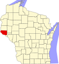
Pierce County Wisconsin Incorporated and Unincorporated areas Maiden Rock Highlighted.svg
Location of Maiden Rock in Pierce County, Wisconsin.
Coordinates: 44°34′16″N92°14′37″W / 44.57111°N 92.24361°W / 44.57111; -92.24361
Country Flag of the United States.svg  United States
State Flag of Wisconsin.svg  Wisconsin
County Pierce
Area
[1]
  Total1.21 sq mi (3.13 km2)
  Land1.21 sq mi (3.12 km2)
  Water0.00 sq mi (0.01 km2)
Elevation
[2]
1,135 ft (346 m)
Population
 (2010) [3]
  Total119
  Estimate 
(2019) [4]
117
  Density97.10/sq mi (37.49/km2)
Time zone UTC-6 (Central (CST))
  Summer (DST) UTC-5 (CDT)
Area code(s) 715 & 534
FIPS code 55-48200 [5]
GNIS feature ID1568900 [2]
Website www.co.pierce.wi.us/government/municipal_government/village/maiden_rock.php/
Maiden Rock Maiden Rock.jpg
Maiden Rock

Maiden Rock is a village in Pierce County, Wisconsin, United States. The population was 119 at the 2010 census. The village is located within the Town of Maiden Rock.

Contents

History

The town is named for a cliff (also called "Maiden Rock") just south of the village. In the Winona legend, the daughter of Dakota Sioux chief Red Wing (for whom the nearby town of Red Wing, Minnesota is named) jumped from this cliff after her lover, a member of the rival Chippewa tribe, was killed by Dakota warriors under orders from Red Wing. A plaque still stands near the base of the cliff, memorializing the village's namesake. [6]

Geography

Maiden Rock is located at 44°33′40″N92°18′34″W / 44.56111°N 92.30944°W / 44.56111; -92.30944 (44.561295, -92.309563). [7]

According to the United States Census Bureau, the village has a total area of 1.18 square miles (3.06 km2), of which, 1.17 square miles (3.03 km2) of it is land and 0.01 square miles (0.03 km2) is water. [8]

Demographics

Historical population
CensusPop.Note
1880 319
1890 3437.5%
1900 304−11.4%
1910 33710.9%
1920 293−13.1%
1930 3116.1%
1940 291−6.4%
1950 269−7.6%
1960 189−29.7%
1970 172−9.0%
1980 1720.0%
1990 146−15.1%
2000 121−17.1%
2010 119−1.7%
2019 (est.)117 [4] −1.7%
U.S. Decennial Census [9]

2010 census

As of the census [3] of 2010, there were 119 people, 50 households, and 31 families residing in the village. The population density was 101.7 inhabitants per square mile (39.3/km2). There were 81 housing units at an average density of 69.2 per square mile (26.7/km2). The racial makeup of the village was 96.6% White, 0.8% Asian, and 2.5% from two or more races. Hispanic or Latino of any race were 0.8% of the population.

There were 50 households, of which 34.0% had children under the age of 18 living with them, 46.0% were married couples living together, 8.0% had a female householder with no husband present, 8.0% had a male householder with no wife present, and 38.0% were non-families. 28.0% of all households were made up of individuals, and 12% had someone living alone who was 65 years of age or older. The average household size was 2.38 and the average family size was 2.81.

The median age in the village was 40.4 years. 24.4% of residents were under the age of 18; 7.6% were between the ages of 18 and 24; 25.1% were from 25 to 44; 36.2% were from 45 to 64; and 6.7% were 65 years of age or older. The gender makeup of the village was 49.6% male and 50.4% female.

2000 census

As of the census [5] of 2000, there were 121 people, 54 households, and 30 families residing in the village. The population density was 107.4 inhabitants per square mile (41.5/km2). There were 79 housing units at an average density of 70.1 per square mile (27.1/km2). The racial makeup of the village was 99.17% White and 0.83% Native American. 0.83% of the population were Hispanic or Latino of any race.

There were 54 households, out of which 24.1% had children under the age of 18 living with them, 31.5% were married couples living together, 16.7% had a female householder with no husband present, and 44.4% were non-families. 29.6% of all households were made up of individuals, and 5.6% had someone living alone who was 65 years of age or older. The average household size was 2.24 and the average family size was 2.77.

In the village, the population was spread out, with 24.8% under the age of 18, 9.1% from 18 to 24, 28.9% from 25 to 44, 25.6% from 45 to 64, and 11.6% who were 65 years of age or older. The median age was 38 years. For every 100 females, there were 105.1 males. For every 100 females age 18 and over, there were 85.7 males.

The median income for a household in the village was $40,625, and the median income for a family was $55,000. Males had a median income of $31,250 versus $28,750 for females. The per capita income for the village was $22,781. 2.3% of the population lived below the poverty line, including no families, no one under eighteen or over 64.

Images

Related Research Articles

<span class="mw-page-title-main">Woodland, Georgia</span> City in Georgia, United States

Woodland is a city in Talbot County, Georgia, United States. The population was 408 at the 2010 census.

<span class="mw-page-title-main">Gardner, Illinois</span> Village in Illinois, United States

Gardner is a village in Grundy County, Illinois, United States. The population was 1,463 at the 2010 census.

<span class="mw-page-title-main">Time, Illinois</span> Village in Illinois, United States

Time is a village in Pike County, Illinois, United States. The population was 29 at the 2000 census.

<span class="mw-page-title-main">Oak Grove, Illinois</span> Village in Illinois, United States

Oak Grove is a village in Rock Island County, Illinois, United States. The population was 396 at the 2010 census.

<span class="mw-page-title-main">Port Austin, Michigan</span> Village in Michigan, United States

Port Austin is a village in Huron County in the U.S. state of Michigan. The population was 664 at the 2010 census. The village is within Port Austin Township.

<span class="mw-page-title-main">Spring Grove, Minnesota</span> City in Minnesota, United States

Spring Grove is a city in Houston County, Minnesota, United States. The population was 1,330 at the 2010 census. It is part of the La Crosse-Onalaska, WI-MN Metropolitan Statistical Area.

<span class="mw-page-title-main">Lake Tapawingo, Missouri</span> City in Missouri, United States

Lake Tapawingo is a city in Jackson County, Missouri, United States. The population was 730 at the 2010 census.

Northwest is a city in Brunswick County, North Carolina, United States. The population was 735 at the 2010 census. It is part of the Myrtle Beach metropolitan area.

Walnut Creek is a village in Wayne County, North Carolina, United States. The population was 835 in 2010. It is included in the Goldsboro, North Carolina Metropolitan Statistical Area.

<span class="mw-page-title-main">Rock Creek, Ohio</span> Village in Ohio, United States

Rock Creek is a village in Ashtabula County, Ohio, United States. The population was 667 at the 2020 census. It is part of the Ashtabula micropolitan area, 45 miles (72 km) northeast of Cleveland.

<span class="mw-page-title-main">Hanging Rock, Ohio</span> Village in Ohio, United States

Hanging Rock is a village in Lawrence County, Ohio, United States, along the Ohio River. The population was 221 at the 2010 census. It is regularly labeled a speed trap; the village earned revenues of $109,186 in mayor's court receipts in 2000, compared with $3,106 in property taxes.

<span class="mw-page-title-main">Weber City, Virginia</span> Town in Virginia, United States

Weber City is an incorporated town in Scott County, Virginia, United States. The population was 1,327 at the 2010 census. It is part of the Kingsport–Bristol (TN)–Bristol (VA) Metropolitan Statistical Area, which is a component of the Johnson City–Kingsport–Bristol, TN-VA Combined Statistical Area – commonly known as the "Tri-Cities" region.

<span class="mw-page-title-main">Ahtanum, Washington</span> CDP in Washington, United States

Ahtanum is a census-designated place (CDP) in Yakima County, Washington. The population was 3,601 at the time of the 2010 census.

<span class="mw-page-title-main">Smithfield, West Virginia</span> Town in West Virginia, United States

Smithfield is a town in Wetzel County, West Virginia, United States. The population was 103 at the 2020 census.

<span class="mw-page-title-main">Kekoskee, Wisconsin</span> Village in Wisconsin, United States

Kekoskee is a village in Dodge County, Wisconsin, United States. The population was 161 at the 2010 census.

<span class="mw-page-title-main">Cecil, Wisconsin</span> Village in Wisconsin, United States

Cecil is a village in Shawano County, Wisconsin, United States. The population was 570 at the 2010 census.

<span class="mw-page-title-main">Schoharie (village), New York</span> Village in New York, United States

Schoharie is a village in Schoharie County, New York, United States. The population was 922 at the 2010 census. It is the county seat of Schoharie County. The name is a native word for driftwood.

<span class="mw-page-title-main">Melrose, Wisconsin</span> Village in Wisconsin, United States

Melrose is a village in Jackson County, Wisconsin, United States. The population was 503 at the 2010 census. The village is located within the Town of Melrose.

<span class="mw-page-title-main">Necedah, Wisconsin</span> Village in Wisconsin, United States

Necedah is a village in Juneau County, Wisconsin, United States. The population was 916 at the 2010 census. The village is located within the Town of Necedah.

Maiden Rock is a town in Pierce County, Wisconsin, United States. The population was 589 at the 2000 census. The Village of Maiden Rock is located within the town. The unincorporated communities of Nerike and Warrentown are located in the town. The unincorporated community of Lund is also partially located within the town.

References

  1. "2019 U.S. Gazetteer Files". United States Census Bureau. Retrieved August 7, 2020.
  2. 1 2 "US Board on Geographic Names". United States Geological Survey. 2007-10-25. Retrieved 2008-01-31.
  3. 1 2 "U.S. Census website". United States Census Bureau . Retrieved 2012-11-18.
  4. 1 2 "Population and Housing Unit Estimates". United States Census Bureau. May 24, 2020. Retrieved May 27, 2020.
  5. 1 2 "U.S. Census website". United States Census Bureau . Retrieved 2008-01-31.
  6. Porter, Cynthya (Feb 1, 2009). "Homecoming To Explore Roles Of American Indian Women". Winona Daily News reprinted at Diversity Foundation. Retrieved 21 Oct 2015.
  7. "US Gazetteer files: 2010, 2000, and 1990". United States Census Bureau. 2011-02-12. Retrieved 2011-04-23.
  8. "US Gazetteer files 2010". United States Census Bureau. Archived from the original on 2012-01-25. Retrieved 2012-11-18.
  9. "Census of Population and Housing". Census.gov. Retrieved June 4, 2015.

Maiden Rock Area Community Association websitenot affiliated with the Village of Maiden Ro

ck