Meadow Valley, California

Last updated
Meadow Valley
Plumas County California Incorporated and Unincorporated areas Meadow Valley Highlighted.svg
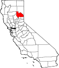
Location in Plumas County and the state of California
Usa edcp location map.svg
Red pog.svg
Meadow Valley
Location in the United States
Coordinates: 39°56′13″N121°3′43″W / 39.93694°N 121.06194°W / 39.93694; -121.06194 Coordinates: 39°56′13″N121°3′43″W / 39.93694°N 121.06194°W / 39.93694; -121.06194
Country Flag of the United States.svg  United States
State Flag of California.svg  California
County Plumas
Area
[1]
  Total8.520 sq mi (22.066 km2)
  Land8.520 sq mi (22.066 km2)
  Water0 sq mi (0 km2)  0%
Elevation
3,776 ft (1,151 m)
Population
 (2010)
  Total464
  Density54/sq mi (21/km2)
Time zone UTC-8 (Pacific (PST))
  Summer (DST) UTC-7 (PDT)
ZIP code
95956
Area code(s) 530
FIPS code 06-46618
GNIS feature ID1659096

Meadow Valley is a census-designated place (CDP) in Plumas County, California, United States. The population was 464 at the 2010 census, down from 575 at the 2000 census.

Contents

Geography

Meadow Valley is located at 39°56′13″N121°3′43″W / 39.93694°N 121.06194°W / 39.93694; -121.06194 (39.936921, -121.062051). [2]

According to the United States Census Bureau, the CDP has a total area of 8.5 square miles (22 km2), all of it land.

Climate

This region experiences warm (but not hot) and dry summers, with no average monthly temperatures above 71.6 °F. According to the Köppen Climate Classification system, Meadow Valley has a warm-summer Mediterranean climate, abbreviated "Csb" on climate maps. [3]

Demographics

2010

The 2010 United States Census [4] reported that Meadow Valley had a population of 464. The population density was 54.5 inhabitants per square mile (21.0/km2). The racial makeup of Meadow Valley was 435 (93.8%) White, 0 (0.0%) African American, 13 (2.8%) Native American, 0 (0.0%) Asian, 0 (0.0%) Pacific Islander, 4 (0.9%) from other races, and 12 (2.6%) from two or more races. Hispanic or Latino of any race were 21 persons (4.5%).

The Census reported that 464 people (100% of the population) lived in households, 0 (0%) lived in non-institutionalized group quarters, and 0 (0%) were institutionalized.

There were 231 households, out of which 41 (17.7%) had children under the age of 18 living in them, 115 (49.8%) were opposite-sex married couples living together, 7 (3.0%) had a female householder with no husband present, 5 (2.2%) had a male householder with no wife present. There were 15 (6.5%) unmarried opposite-sex partnerships, and 0 (0%) same-sex married couples or partnerships. 82 households (35.5%) were made up of individuals, and 39 (16.9%) had someone living alone who was 65 years of age or older. The average household size was 2.01. There were 127 families (55.0% of all households); the average family size was 2.62.

The population was spread out, with 62 people (13.4%) under the age of 18, 25 people (5.4%) aged 18 to 24, 84 people (18.1%) aged 25 to 44, 201 people (43.3%) aged 45 to 64, and 92 people (19.8%) who were 65 years of age or older. The median age was 52.4 years. For every 100 females, there were 106.2 males. For every 100 females age 18 and over, there were 104.1 males.

There were 304 housing units at an average density of 35.7 per square mile (13.8/km2), of which 171 (74.0%) were owner-occupied, and 60 (26.0%) were occupied by renters. The homeowner vacancy rate was 3.4%; the rental vacancy rate was 3.2%. 351 people (75.6% of the population) lived in owner-occupied housing units and 113 people (24.4%) lived in rental housing units.

2000

As of the census [5] of 2000, there were 575 people, 263 households, and 173 families residing in the CDP. The population density was 67.8 inhabitants per square mile (26.2/km2). There were 311 housing units at an average density of 36.6 per square mile (14.1/km2). The racial makeup of the CDP was 94.26% White, 0.17% African American, 3.13% Native American, 0.17% Asian, 0.70% from other races, and 1.57% from two or more races. Hispanic or Latino of any race were 4.17% of the population.

There were 263 households, out of which 25.9% had children under the age of 18 living with them, 55.5% were married couples living together, 6.8% had a female householder with no husband present, and 34.2% were non-families. 28.1% of all households were made up of individuals, and 10.3% had someone living alone who was 65 years of age or older. The average household size was 2.19 and the average family size was 2.66.

In the CDP, the population was spread out, with 21.2% under the age of 18, 5.0% from 18 to 24, 25.4% from 25 to 44, 33.4% from 45 to 64, and 15.0% who were 65 years of age or older. The median age was 44 years. For every 100 females, there were 113.0 males. For every 100 females age 18 and over, there were 106.8 males.

The median income for a household in the CDP was $33,571, and the median income for a family was $45,469. Males had a median income of $40,000 versus $30,667 for females. The per capita income for the CDP was $19,726. About 10.6% of families and 11.5% of the population were below the poverty line, including 9.8% of those under age 18 and 9.0% of those age 65 or over.

Politics

In the state legislature, Meadow Valley is in the 1st Senate District , represented by Republican Brian Dahle, [6] and the 1st Assembly District , represented by Republican Megan Dahle. [7]

Federally, Meadow Valley is in California's 1st congressional district , represented by Republican Doug LaMalfa. [8]

Related Research Articles

McDonald Chapel, Alabama CDP in Alabama, United States

McDonald Chapel is a census-designated place in Jefferson County, Alabama, United States. It is northeast of the Birmingham suburb of Pleasant Grove. At the 2020 census, the population was 739. Large portions of this area were damaged by violent tornadoes in 1956, 1998, and 2011. The 1998 tornado was rated F5 on the Fujita scale.

Willow Valley, Arizona Census-designated place in Arizona, United States

Willow Valley is an unincorporated community and census-designated place (CDP) in Mohave County, Arizona, United States. The population was 1,059 as of the 2020 census.

Bear Valley, Alpine County, California Census-designated place in California, United States

Bear Valley is a census-designated place in Alpine County, California, best known as the location of the Bear Valley ski area. The population was 121 at the 2010 census, down from 133 at the 2000 census.

Dixon Lane-Meadow Creek, California Census-designated place in California, United States

Dixon Lane-Meadow Creek is a census-designated place (CDP) in Inyo County, California, United States. The population was 2,645 at the 2010 census, down from 2,702 at the 2000 census.

Onyx, California Census-designated place in California, United States

Onyx is a census-designated place (CDP) in Kern County, California, United States. Onyx is located 3.5 miles (6 km) east-northeast of Weldon in the South Fork Valley at an elevation of 2,795 feet (852 m). The population was 475 at the 2010 census, down from 476 at the 2000 census.

Valley Acres, California Census-designated place in California, United States

Valley Acres is a census-designated place (CDP) in Kern County, California, United States. Valley Acres is located 5.2 miles (8.4 km) north-northeast of Taft, at an elevation of 420 feet (128.02 m). The population was 527 at the 2010 census, up from 512 at the 2000 census.

Tamalpais-Homestead Valley, California Census-designated place in California, United States

Tamalpais-Homestead Valley is a census-designated place (CDP) in Marin County, California, United States. The population was 11,492 at the 2020 census.

Boronda, California Census-designated place in California, United States

Boronda is a census-designated place (CDP) in Monterey County, California, United States. The population was 1,710 at the 2010 census, up from 1,325 at the 2000 census. Boronda is located directly west of Salinas. Boronda is named after José Eusebio Boronda, a Californio ranchero, and located on the lands of his Rancho Rincón del Sanjón.

Penn Valley, California Census-designated place in California, United States

Penn Valley is a census-designated place (CDP) in Nevada County, California. The population was 1,621 at the 2010 census, up from 1,387 at the 2000 census.

Meadow Vista, California Census-designated place in California, United States

Meadow Vista is a census-designated place (CDP) in Placer County, California, United States. It is part of the Sacramento–Arden-Arcade–Roseville Metropolitan Statistical Area. The population was 3,217 at the 2010 census, up from 3,096 at the 2000 census.

Lake Almanor Peninsula, California Census-designated place in California, United States

Lake Almanor Peninsula is a census-designated place (CDP) in Plumas County, California, United States. The population was 356 at the 2010 census, up from 336 at the 2000 census.

Valle Vista, California Census-designated place in California, United States

Valle Vista is a census-designated place (CDP) in Riverside County, California, United States and is located in the San Jacinto Valley. Some areas of Valle Vista are considered to be part of both unincorporated San Jacinto and Hemet but have yet to be incorporated. The population was 11,036 at the 2010 census, up from 8,356 at the 2000 census.

Rosemont, California Census-designated place in California, United States

Rosemont is a census-designated place (CDP) in Sacramento County, California, United States. It is part of the Sacramento–Arden-Arcade–Roseville metropolitan area. The population was 22,681 at the 2010 census, down from 22,904 at the 2000 census.

Hidden Meadows, California Census designated place in California, United States

Hidden Meadows is a census-designated place (CDP) near Escondido in San Diego County, California. The population was 3,485 at the 2010 census, up from 3,463 at the 2000 census.

Morada, California Census-designated place in California, United States

Morada is a census-designated place (CDP) in San Joaquin County, California, United States. The population was 3,166 at the 2020 census, down from 3,828 at the 2010 census.

Fruitdale, San Jose Place in California, United States

Fruitdale is a district of San Jose, California, located in West San Jose, though some portions are still unincorporated as a census-designated place. The population of the CDP was 935 at the 2010 census.

Aptos Hills-Larkin Valley, California Census-designated place in California, United States

Aptos Hills-Larkin Valley is an unincorporated community in Santa Cruz County, California, United States. It is identified as one of several small communities with a combined population of 24,402 forming the unincorporated town of Aptos by the local Chamber of Commerce along with:

Day Valley, California Census-designated place in California, United States

Day Valley is a census-designated place (CDP) in Santa Cruz County, California, United States. The population was 3,409 at the 2010 census.

Green Valley, Solano County, California Census-designated place in California, United States

Green Valley is a census-designated place (CDP) located in Solano County, California, United States. It sits in the northeast corner of the San Francisco Bay Area and is located approximately 45 miles (72 km) from Sacramento, approximately 38 miles (61 km) from San Francisco, approximately 32 miles (51 km) from Oakland, less than 15 miles (24 km) from Napa Valley, and less than 15 miles (24 km) from both the Carquinez Bridge and the Benicia Bridge.

Fussels Corner, Florida Census-designated place in Florida, United States

Fussels Corner is a census-designated place (CDP) in Polk County, Florida, United States. The population was 5,313 at time of the 2000 census. It is part of the Lakeland–Winter Haven Metropolitan Statistical Area.

References

  1. U.S. Census Archived 2012-01-25 at the Wayback Machine
  2. "US Gazetteer files: 2010, 2000, and 1990". United States Census Bureau. 2011-02-12. Retrieved 2011-04-23.
  3. Climate Summary for Meadow Valley, California
  4. "2010 Census Interactive Population Search: CA - Meadow Valley CDP". U.S. Census Bureau. Archived from the original on July 15, 2014. Retrieved July 12, 2014.
  5. "U.S. Census website". United States Census Bureau . Retrieved 2008-01-31.
  6. "Senators". State of California. Retrieved March 10, 2013.
  7. "Members Assembly". State of California. Retrieved March 2, 2013.
  8. "California's 1st Congressional District - Representatives & District Map". Civic Impulse, LLC. Retrieved March 3, 2013.