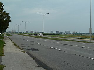
Merivale Road near Kirkwood Avenue looking south. The steep drop of the eastern end of the southern Ottawa escarpment can be seen here as the road approaches the Ottawa River.
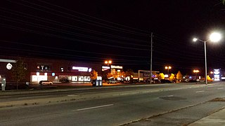
South of Baseline Road, Merivale Road turns (it is actually the continuation of Clyde Avenue and Maitland Avenue) and becomes a major arterial route through a commercial district that contains several major malls, dozens of restaurants and radio and former CTV broadcast facilities (CJOH-TV, building structure was badly damaged by fire in 2010 and the building was demolished in 2011). During the 1950s through the 1990s prior to the City of Nepean's amalgamation with the city of Ottawa, this area of Merivale Road formed the largest commercial shopping district within the city of Nepean and a major shopping area for the National Capital region. During the 1950s and 1960s several major department stores, such as Towers, Miracle Mart, Pascals, and Kmart, were located along Merivale Road along with major Canadian grocery chains such as Steinberg's and Dominion. The late 1970s saw the building of Merivale Mall at the intersection of Merivale and Viewmount Drive on the site of a former farm house and farm lands. It was home to a Woolco at the south end of the mall, one of its anchor stores. The building of the Meadowlands Mall at the intersection of Merivale Road and Meadowlands Road took place around this time, before it contained large box stores.
This area of Merivale Road also leads to the City of Nepean's first experiment in promoting industrial development through the creation of industrial parks. The Colonnade Road Industrial Park at the intersection of Merivale and Colonnade lies just to the south of Viewmount Road and is/was the location for branches, production facilities and headquarters of many large high tech companies such as Gandalf Technologies, and Mitel as well as OC Transpo's south west garage facilities. Through the 1980s it was also home to Ottawa's largest Flea Market at the time, the Colonnade Flea Market (the Flea Market has since been renamed to the Bentley Flea Market and relocated further south on Merivale to 7 Cleopatra Drive).
During the 1990s another major commercial area was developed further south on Merivale road located at the intersection of Hunt Club Road. This was precipitated by the extension of the Hunt Club Road west across the Rideau River creating a new intersection with Merivale Road in what used to be a rural farming field. This area includes various national retailers such as Canadian Tire, Petsmart, Rona, Costco and the Brick as well as various restaurant chains such as Boston Pizza and Eastside Mario's, fast food places such as Burger King and A&W, car dealerships, workout gyms and smaller specialty stores.
South of Hunt Club Road, Merivale runs through an industrial district with many small businesses which during the 1970s and 1980s was the second location for intense industrial development led by the City of Nepean. This area also contains extensive petroleum storage facilities, and brownfield sites where such facilities once stood.
South of the intersection of Merivale and Slack Road, Merivale passes the neighbourhoods of Pineglen and Country Place and then crosses the greenbelt; an area protected from further urban development. South of this Merivale, passes through Rideau Glen, part of the growing subdivision of Barrhaven.
Speed limits
Speed limits vary throughout this long stretch:
Between Island Park Drive and the Central Experimental Farm, the speed limit is 50km/h.
A small section afterwards has a speed limit of 50km/h while the rest of the road from north of Fallowfield Road to Prince of Wales Drive the speed limit is 80km/h.
Bus routes
Merivale Road is well served by OC Transpo bus service as follows:
Route 53 travels between Summerville Avenue and Kirkwood Avenue during Westbound trips, and between Caldwell Avenue and Summerville Avenue during Eastbound trips.
Route 80 travels between Carling Avenue and Leiken Drive, though some Monday-Friday trips do not travel between MacFarlane Road and Leiken Drive.
Route 81 travels between Caldwell Avenue and Central Park Drive, and again between Central Park Drive and Clyde Avenue.
Route 83 travels between Viewmount Drive and Woodfield Drive.
Route 89 travels between Viewmount Drive and Colonnade Road.
Route 96 travels between Viewmount Drive and MacFarlane Road, though some Saturday/Sunday trips do not travel between Hunt Club Road and MacFarlane Road.
Route 186 travels between Meadowlands Drive and Slack Road during peak hours Monday-Friday only.
Route 187 travels between Slack Road and Amberwood Crescent during peak hours Monday-Friday only.
Route 199 travels between Hunt Club Road and Leiken Drive during peak hours Monday-Friday only.
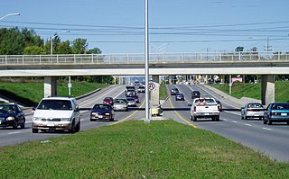
Hunt Club Road, also known as Ottawa Road 32, is a major east–west route in Ottawa, Ontario, Canada. It originally ran from a dead end east of Bank Street to the Hunt Club Golf Course; later, there were many extensions due to the 1970s housing boom, first westward to Riverside Drive, then eastward to Hawthorne Road in the late 1980s. The section between Bank Street and Riverside Drive, originally only one lane in each direction, was expanded to two lanes in each direction in 1993–1994. It was further extended across the Rideau River and the southern edge of the suburbs to Richmond Road by the late 1990s; this extension is signed as West Hunt Club Road by the City of Ottawa. Construction to extend Hunt Club eastward to Highway 417 near Ramsayville was completed on August 21, 2014.
Nepean is a part of Ottawa, Ontario, located west of Ottawa's inner core. It was an independent city until amalgamated with the Regional Municipality of Ottawa–Carleton in 2001 to become the new city of Ottawa. However, the name "Nepean" continues in common usage in reference to the area. The population of Nepean is about 170,544 people.
Baseline Road is a road in Ottawa, Ontario, Canada.
Barrhaven is a rapidly growing suburban neighbourhood in the southwest of the urban area of the city of Ottawa, Ontario, Canada, about 17 km (11 mi) southwest of downtown Ottawa. Prior to amalgamation with Ottawa in 2001, Barrhaven was part of the City of Nepean. Its population as of the Canada 2016 Census was 87,234.
Nepean—Carleton was a federal electoral district in Ontario, Canada that was represented in the House of Commons from 1979 to 1988, and again from 1997 to 2015.
Woodroffe Avenue is a major north-south arterial road in Ottawa, Ontario, Canada's west end. It runs south from the Sir John A. Macdonald Parkway through Baseline Road and Barrhaven to just short of Prince of Wales Drive near Manotick. The road runs through the heart of Nepean in Ottawa's west end. A satellite Via Rail station is also located at the intersection of Fallowfield Road.
Meadowlands Drive is a suburban road in Ottawa, Ontario, Canada. It begins at Prince of Wales Drive as a continuation of Hog's Back Road in the neighborhood of Rideauview. There are two small shopping plazas and a Shell station at its corner with Prince of Wales. It then continues westward towards Fisher Avenue and consists of low-income housing projects, low-rise apartment buildings, townhouses and semi-detached homes. The speed limit here is 50 km/h (31 mph). most of Meadowlands is one lane, other than between Prince of Wales to Fisher, and from Chesterton to Merivale.
Strandherd Drive is a major road serving the community of Barrhaven in southwest Ottawa.
Prince of Wales Drive is a road serving Ottawa, Ontario, named after the eponymous road in Battersea, London, U.K. The northern section is a low-speed street running along the west bank of the Rideau River, while southern portions of the road were formerly Highway 16.
Borden Farm is a neighbourhood in Knoxdale-Merivale Ward in Ottawa, Ontario, Canada. It is located in the former city of Nepean, which was amalgamated into Ottawa in 2001. It was built on the site of the former Borden Dairy Farm. The land was bought by the Canada Mortgage and Housing Corporation (CMHC) in 1959. The Borden farm community was built in 1967–1976 as a joint development of the CMHC and the Ontario Housing Corporation and features single-family homes with parks and bikeways placed behind the houses, instead of on the streets. There was more development in the 1980s and early 1990s.
Parkwood Hills is a neighbourhood in Knoxdale-Merivale Ward in the west end of Ottawa, Canada. Prior to amalgamation in 2001, it was located in the City of Nepean. It is notable for the thriller Parkwood Hills (2002) which was filmed on location in the area by Kolin Casagrande, and for being a typical and illustrative example of town planning and development by Minto in the context of its position as the property manager for the National Capital Commission.
Skyline is a neighbourhood in Knoxdale-Merivale Ward in Ottawa, Ontario, Canada. Prior to amalgamation in 2001, the neighbourhood was located in the City of Nepean. It is bounded on the south by Meadowlands Drive of Parkwood Hills, on the west by Clyde Avenue and Merivale Road, on the north by Baseline Road and on the east by the neighbourhood of Fisher Heights.
Fisher Heights is a neighbourhood located in the far northeast corner of the former City of Nepean in Ottawa, Ontario, Canada. It is located in Knoxdale-Merivale Ward. The area is located south of the Experimental Farm and approximately 8 km away from downtown Ottawa.
Westgate Shopping Centre is a small scale shopping centre in Ottawa, Ontario, Canada. It is located southwest of downtown, bordering Carling Avenue, Merivale Road, and Highway 417, owned by RioCan Real Estate Investment Trust.
City View is a neighbourhood in College Ward in the west end of the city of Ottawa, Ontario, Canada. It is located within the former city of Nepean.
Crestview is a neighbourhood in College Ward in the west end of Ottawa, Ontario, Canada. It was originally part of the City of Nepean before amalgamation with Ottawa in 2001. Together with the neighbouring community of Meadowlands, the area is served by the Crestview-Meadowlands Community Association. The community association's boundaries are Meadowlands Drive on the north, Merivale Road on the east, the CN Railtracks on the south and Woodroffe Avenue on the west.
Tanglewood, also known as Tanglewood-Hillsdale is a suburban neighbourhood in Knoxdale-Merivale Ward in the city of Ottawa, Ontario, Canada. It is located within the former City of Nepean in the west end of the city. It is located in the federal and provincial ridings of Nepean-Carleton. It is informally bounded by CN Railway to the north, Merivale Road to the east, Hunt Club Road to the south, and Woodroffe Avenue to the west.
Country Place is a residential neighbourhood near the geographical centre of Ottawa, Canada and part of the former city of Nepean. It is a mature residential subdivision with about 400 houses located just inside the Ottawa greenbelt near the Rideau River, and about 11 km from downtown Ottawa. It is bordered by the Black Rapids Creek and the greenbelt to the south, Prince of Wales Drive to the east, Merivale Road to the west, and the Pineglen community to the north. Amberwood Crescent meanders through the community, exiting onto Prince of Wales and Merivale. Tennyson Drive links Country Place to Pineglen.
Merivale Mall is an indoor mall located at 1642 Merivale Road in the Nepean district of Ottawa, Ontario, Canada. The mall opened back in 1976 and is bordered by Viewmount Drive to the south and Merivale Road to the east. It's an approximate 20-minute drive from Downtown Ottawa. Some of the shops and services currently located at the mall include Farm Boy, CIBC, Pizza Pizza, Shoppers Drug Mart, Sport Chek, and Planet Fitness. The mall is currently owned by First Capital Realty.
This page is based on this Wikipedia article Text is available under the CC BY-SA 4.0 license; additional terms may apply. Images, videos and audio are available under their respective licenses.