Meteor City, Arizona

Last updated
Meteor City, Arizona
Meteor City Trading Post, Historic Route 66, Meteor City, AZ.jpg
Meteor City Trading Post, Historic Route 66, Meteor City, AZ
USA Arizona location map.svg
Red pog.svg
Meteor City
Location within the state of Arizona
Usa edcp location map.svg
Red pog.svg
Meteor City
Meteor City (the United States)
Coordinates: 35°05′40″N110°56′08″W / 35.09444°N 110.93556°W / 35.09444; -110.93556 Coordinates: 35°05′40″N110°56′08″W / 35.09444°N 110.93556°W / 35.09444; -110.93556
Country United States
State Arizona
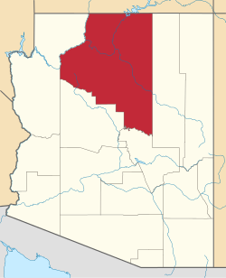
County Coconino
Elevation
[1]
5,033 ft (1,534 m)
Time zone UTC-7 (Mountain (MST))
  Summer (DST) UTC-7 (MST)
Area code(s) 928
FIPS code 04-46105
GNIS feature ID 24515

Meteor City was a historic trading post located on historic Route 66 west of the town of Unincorporated Winslow situated in Coconino County, Arizona. [2] Accessing it from interstate 40 (I-40), you would exit at Mile-marker / Exit 239 (Meteor City Road) coming from the east or west.

Contents

It has an estimated elevation of 5,033 feet (1,534 m) above sea level. [1]

Despite the name, Meteor City was never the name of a town, but rather, it was a trading post. The Meteor City Trading Post, named in honor of the nearby Meteor or Barringer Crater, is the first of three Route 66-inspired roadside attractions located only a few miles apart along a 30-mile stretch west on Interstate 40 from Winslow to Flagstaff: Meteor City; the ghost town of Two Guns and the ruins of the Twin Arrows Trading Post / Diner and Gas Station, which now marks the turnoff for the new Twin Arrows Navajo Casino Resort.

Meteor City was first opened in 1938 and was operated as the Sharber Service Station, under the Texaco brand, by Arizona resident Joe Sharber.

In 1941, an expansion of the property by a new owner, Iowan Jack Newsum, nicknamed “Lonesome Jack,” included the addition of a trading post where visitors could buy gas, groceries and curios. At one time the sign upon entering the area once read, "Population: 1" [2] and later "Population 2" when the service station's proprietor Joseph Sharber married Gloria. [3] A geodesic dome, complete with a bright yellow faux Mohawk, was built in 1979 after the original building burnt down in the 1960s to house the curio shop which was stocked with a variety of items, including moccasins, postcards and Baja shirts.

In March 2017, Mike and Joann Brown purchased Meteor City and are currently working to restore the dome, as well as the surrounding buildings and property .

Two former 'quirky' tourist attractions on the Meteor City property were billed as the “World’s Longest Map of Route 66,” painted by American artist and cartographer Bob Waldmire, and the “World’s Largest Dream-catcher,” located out near the road in front of the dome. There are also five 'tee-pees' on the property.

Dreamcatcher, Meteor City Trading Post, Historic US 66 Meteor City Trading Post, Historic Route 66, Meteor City, AZ (2).jpg
Dreamcatcher, Meteor City Trading Post, Historic US 66

The exterior wood fence the map was on has fallen down and has been placed into storage and the tattered dream-catcher will be repaired.

The Browns also hope to restore the original Justice of the Peace building located just west of the dome. Infamous as “the wicked witch of Route 66,” Newsum's wife, Goldie, serving as justice, issued speeding citations to unwary drivers on Route 66.

They plan to soft open the dome to visitors fall/winter 2020 while focusing on the 'city' aspect of Meteor City.

See also

Related Research Articles

U.S. Route 66 or U.S. Highway 66, also known as the Will Rogers Highway, the Main Street of America or the Mother Road, was one of the original highways in the U.S. Highway System. US 66 was established on November 11, 1926, with road signs erected the following year. The highway, which became one of the most famous roads in the United States, originally ran from Chicago, Illinois, through Missouri, Kansas, Oklahoma, Texas, New Mexico, and Arizona before terminating in Santa Monica in Los Angeles County, California, covering a total of 2,448 miles (3,940 km). It was recognized in popular culture by both the hit song "(Get Your Kicks on) Route 66" and the Route 66 television series, which aired on CBS from 1960 to 1964. In John Steinbeck's classic American novel, The Grapes of Wrath (1939), the road "Highway 66" symbolized escape and loss.

Williams, Arizona City in Arizona, United States

Williams is a city in Coconino County, Arizona, United States, located west of Flagstaff. Its population was 3,023 at the 2010 census. It lies on the routes of Historic Route 66 and Interstate 40. It is also the southern terminus of the Grand Canyon Railway, which takes visitors to Grand Canyon Village. There are numerous inns, motels, restaurants and gas stations catering to the large influx of tourists rather than local residents, especially during the summer and holiday seasons.

Kingman, Arizona City in Arizona, United States

Kingman is a city in, and the county seat of, Mohave County, Arizona, United States. It is named after Lewis Kingman, a civil engineer. According to the 2010 census, the population of the city is 28,068. Kingman is located approximately 105 miles (169 km) southeast of Las Vegas, Nevada and about 165 miles (266 km) northwest of the state capital, Phoenix.

Winslow, Arizona City in Arizona, United States

Winslow is a city in Navajo County, Arizona, United States. According to the 2010 census, the population of the city is 9,655. It is approximately 57 miles (92 km) southeast of Flagstaff, 240 miles (390 km) west of Albuquerque, New Mexico, and 329 miles (529 km) southeast of Las Vegas.

Seligman, Arizona CDP in Yavapai County, Arizona

Seligman is a census-designated place (CDP) on the northern border of Yavapai County, in northwestern Arizona, United States. The population was 456 at the 2000 census.

Erick, Oklahoma City in Oklahoma, United States

Erick is a city in Beckham County, Oklahoma, United States. It is located 15 miles (24 km) west of Sayre, the county seat, and 6 miles (9.7 km) east of the Oklahoma-Texas border. The population was 1,052 at the 2010 census.

U.S. Route 66 in California Highway in California

U.S. Route 66 is a part of a former United States Numbered Highway in the state of California that ran from the west in Santa Monica on the Pacific Ocean through Los Angeles and San Bernardino to Needles at the Arizona state line. It was truncated during the 1964 renumbering and its signage removed in 1974. The highway is now mostly replaced with several streets in Los Angeles, State Route 2 (SR 2), SR 110, SR 66, San Bernardino County Route 66 (CR 66), Interstate 15 (I-15), and I-40.

In the U.S. state of Arizona, Interstate 10 (I‑10), the major east–west Interstate Highway in the United States Sun Belt, runs east from California, enters Arizona near the town of Ehrenberg and continues through Phoenix and Tucson and exits at the border with New Mexico near San Simon. The highway also runs through the cities of Casa Grande, Eloy, and Marana. Segments of the highway are referred to as either the Papago Freeway, Inner Loop, or Maricopa Freeway within the Phoenix area and the Pearl Harbor Memorial Highway outside metro Phoenix.

U.S. Route 66 also known as the Will Rogers Highway, was a major United States Numbered Highway in the state of Arizona from November 11, 1926 to June 26, 1985. US 66 covered a total of 385.20 miles (619.92 km) through Arizona. The highway ran from west to east, starting in Needles, California, through Kingman and Seligman to the New Mexico state line. Nationally, US 66 ran from Santa Monica, California, to Chicago, Illinois. In its height of popularity, US 66 was one of the most popular highways in the state of Arizona, sometimes carrying over one million cars a year.

Jack Rabbit Trading Post Tourist attraction on US Route 66 in Arizona

The Jack Rabbit Trading Post is a convenience store and curio shop located on former U.S. Route 66, five miles west of Joseph City, Arizona city limits off of Exit 269 on Interstate 40.

Winslow station (Arizona)

Winslow is an Amtrak train station at 501 East Second Street in Winslow, Navajo County, Arizona, United States. It is served daily by Amtrak's Southwest Chief between Chicago, Illinois and Los Angeles, California. The Santa Fe Depot and La Posada Hotel Harvey House compound are the centerpiece of the La Posada Historic District.

Teapot Dome Service Station United States historic place

The Teapot Dome Service Station is a former gas station built in the shape of a teapot located in Zillah, Washington, United States, that is listed on the National Register of Historic Places.

Interstate 40 (I-40) is an east–west Interstate Highway that has a 359.11-mile (577.93 km) section in the U.S. state of Arizona, connecting sections in California and New Mexico. The interstate is also referred to as the Purple Heart Trail to honor those wounded in combat who have received the Purple Heart. It enters Arizona from the west at a crossing of the Colorado River southwest of Kingman. It travels eastward across the northern portion of the state connecting the cities of Kingman, Ash Fork, Williams, Flagstaff, Winslow, and Holbrook. I-40 continues into New Mexico, heading to Albuquerque. The highway has major junctions with U.S. Route 93 — the main highway connecting Phoenix and Las Vegas, Nevada — in Kingman and again approximately 22 miles (35 km) to the east and Interstate 17 — the freeway linking Phoenix to northern Arizona — in Flagstaff.

Interstate business routes are roads connecting a central or commercial district of a city or town with an Interstate bypass. These roads typically follow along local streets often along a former U.S. route or state highway that had been replaced by an Interstate. Interstate business route reassurance markers are signed as either loops or spurs using a green shield shaped and numbered like the shield of the parent Interstate highway.

Dennison, Arizona Former railroad stop in Coconino County, Arizona, US

Dennison was a stop on the Atchison, Topeka and Santa Fe Railway between Canyon Diablo, and Winslow, Arizona, United States, in Coconino County. Formerly in Yavapai County, it came to be in Coconino County upon the latter's creation in 1891. Dennison was named for a railroad roadmaster named Denny.

Twin Arrows, Arizona Ghost town in Arizona, US

Twin Arrows is a ghost town located in the central part of Arizona on U.S. Route 66 (US 66) in Coconino County between the city of Flagstaff and the town of Winslow.

References

  1. 1 2 "Feature Detail Report for: Meteor City". Geographic Names Information System . United States Geological Survey.
  2. 1 2 Kaszynski, William (2013). Route 66: Images of America's Main Street. McFarland. p. 119. ISBN   978-0786477180.
  3. Sonderman, Joe (2010). Route 66 in Arizona. Arcadia Publishing. ISBN   978-0-7385-7942-9.