
The Judaean Mountains, or Judaean Hills, is a mountain range in Israel and the West Bank where Jerusalem and several other biblical cities are located. The mountains reach a height of 1,026 metres (3,366 ft). The Judean Mountains can be separated to a number of sub-regions, including the Mount Hebron ridge, the Jerusalem ridge and the Judean slopes. These mountains formed the heartland of the Kingdom of Judah, where the earliest Jewish settlements emerged.

Mount Frissell, 2,454 feet (748 m), located on the border of southwest Massachusetts and northwest Connecticut, is a prominent peak of the Taconic Range.
Mount Cardigan is a prominent bare-rock summit in the towns of Orange and Alexandria in western New Hampshire, USA. While its peak is only 3,155 feet (962 m) above sea level, it has extensive areas of bare granite ledges and alpine scrub, giving it the feel to hikers of a much higher mountain. Most of the summit area was denuded by devastating forest fires in 1855.

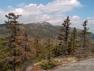
Mount Tripyramid is a mountain located in Grafton County, New Hampshire. The mountain, so-called because of the three distinct peaks along its mile-long summit ridge, is part of the Sandwich Range of the White Mountains. Scaur Peak and The Fool Killer are subsidiary peaks to the northwest and northeast. To the southeast, Tripyramid is flanked by The Sleepers.

Black Cap is a mountain located in the town of Conway, New Hampshire, United States. It is located between Kearsarge North Mountain and Peaked Mountain. The rocky summit provides views of Maine and New Hampshire's White Mountains.

Mount Toby, 1,269 feet (387 m), is the highest summit of a sprawling collection of mostly wooded hills and knolls that rise from a distinct plateau-like upland in the towns of Sunderland and Leverett, Massachusetts, just east of the Connecticut River. This mountain mass, part of the Metacomet Ridge geology, is oval shaped and roughly three miles by two miles wide. Although three of the subordinate peaks have names of their own, none of them are noteworthy on their own, and the designation “Mount Toby” is most often used to describe the entire geologic mass. This article, therefore, describes the entire Mount Toby upland.
Table Top Mountain is a mountain located in Essex County, New York. Table Top Mtn. is flanked to the north by Phelps Mountain, and to the south by Mount Marcy. Table Top has three summits; the southernmost is the highest, followed by the middle peak (1,312 m) and the north peak (1,285 m).

Lyon Mountain is a mountain located in Clinton County, New York, of which its peak is the highest point. The mountain is named for Nathaniel Lyon, an early settler of the area who moved from Vermont in 1803 and died circa 1850.

Vly Mountain is a mountain located in the town of Halcott, New York, United States in Greene County. The mountain is part of the Catskill Mountains. Vly Mountain is flanked to the northwest by Bearpen Mountain, to the east by Vinegar Hill, to the northeast by Kipp Hill, and to the southeast by Beech Ridge.
Pitcher Mountain is a 2,153 feet monadnock located in southwest New Hampshire. The mountain is traversed by the 50 mile (80 km) Monadnock-Sunapee Greenway and offers 360 degree views from its open summit. Lower elevations are wooded with species of the northern hardwood forest type; small stands of coniferous red spruce cling to the upper slopes. A fire tower stands on the summit and a beef livestock farm occupies the east shoulder of the mountain. Pitcher Mountain is part of an extensive area of heath barrens and blueberry fields that continue north over Hubbard Hill and Jackson Hill.

Alander Mountain, 2,239 feet (682 m), is a prominent peak of the south Taconic Mountains; it is located in southwest Massachusetts and adjacent New York. Part of the summit is grassy and open and part is covered with scrub oak and shrubs; the sides of the mountain are wooded with northern hardwood tree species. Views from the top include the southern Taconic Mountains, the Hudson River Valley including the Catskills. Several trails traverse Alander Mountain, most notably the 15.7 mi (25.3 km) South Taconic Trail, which passes just beneath the summit.
Tower Mountain, 2,193 feet (668 m), is a prominent peak in the Taconic Mountains of western Massachusetts. The mountain is located in Pittsfield State Forest and is traversed by the 35 mi (56 km) Taconic Crest hiking trail and the 12.1 mi (19.5 km) multi-use Taconic Skyline Trail. The summit is partially open with views to the west; the slopes are wooded with northern hardwood tree species.
Honwee Mountain, east summit 2,313 feet (705 m) and west summit 2,280 feet (690 m), is a prominent mountain in the Taconic Mountains of western Massachusetts. The mountain is located in Pittsfield State Forest. The east (highest) summit is traversed by the Honwee Circuit multi-use trail. The west summit is crossed by the 35 mi (56 km) Taconic Crest hiking trail and the 12.1 mi (19.5 km) multi-use Taconic Skyline Trail. The mountain is wooded with northern hardwood forest species.
The Watchung Outliers include six areas of isolated low hills and rock outcrops of volcanic and sedimentary origin in the U.S. states of New York, New Jersey, and Pennsylvania. These geologic outliers are primarily diminutive and detached remnants of the Triassic/Jurassic age Watchung Mountain basalt flows with intervening layers of sedimentary rock. All six of the outliers are found along the western edge of the Newark Basin, occupying small synclines adjacent to the Ramapo fault system. The outliers, from north to south, are known as: Ladentown, Union Hill, New Germantown/Oldwick, Prospect Hill, Sand Brook, and Jacksonwald.

Speckled Mountain is a mountain located in western Maine. It can be ascended by the Bickford Brook, Spruce Hill, Cold Brook, Red Rock and Blueberry Ridge trails, and is a popular day hike. It is a part of the Caribou-Speckled Mountain Wilderness within the White Mountain National Forest. It is located near the AMC Cold River Camp.

The Endicott Mountains are a range of mountains, part of the Brooks Range in northern Alaska. They are located in the middle of the Brooks range and run some 151 miles (243 km) east–west. To the east are the Philip Smith Mountains and to the west are the Schwatka Mountains. The Endicott Mountains are separated from the Philip Smith Mountains by the Middle Fork of the Koyukuk River, the Dalton Highway, and Atigun Pass. The Endicott Mountains are separated from the Schwatka Mountains by Walker Lake, the upper reaches of the West Fork of the Kobuk River, Akabluak Pass, and the Noatak River. The Endicott Mountains are separated from the mountains north of the Schwatka by Lucky Six Creek, Gull Pass, Gull Creek, a portion of the Alatna River and the Killik River.

Streeter Hill is a mountain located in the Catskill Mountains of New York north-northeast of North Kortright. Middle Brook Hill is located east, Titus Hill is located north, Quaker Hill is located west-northwest, and Fan Hill is located east-southeast of Streeter Hill.
Titus Hill is a mountain located in the Catskill Mountains of New York north of North Kortright. Titus Lake is located on Titus Hill. Middle Brook Hill is located southeast, Streeter Hill is located south, Quaker Hill is located west-southwest, and Fan Hill is located southeast of Titus Hill.
Fan Hill is a mountain located in the Catskill Mountains of New York northeast of North Kortright. Streeter Hill is located west-northwest, and Middle Brook Hill is located northeast of Fan Hill.


