
Indian Lake is a town in Hamilton County, New York, United States. The population was 1,352 at the 2010 census. The name is from a lake of the same name that is largely inside the town. There are no permanent stop lights in the town. Law enforcement is provided by New York State Troopers and Hamilton County Sheriff's Office.
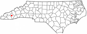
Sylva is an incorporated town located in central Jackson County, in the Plott Balsam Mountains of Western North Carolina, United States of America. As of the 2010 census, the town had a total population of 2,588. It is the county seat, having taken over from nearby Webster in 1913.

Granada Hills is a lightly populated, highly diverse and high-income neighborhood. It is a suburban residential community in the San Fernando Valley portion of the city of Los Angeles, California.
Hamilton East was a federal electoral district in Ontario, Canada. It was represented in the House of Commons of Canada from 1904 to 2004. It consisted of the eastern part of the city of Hamilton, Ontario. It is considered a working class district.

Hamilton Mountain is a federal electoral district in Ontario, Canada, that has been represented in the House of Commons of Canada since 1968. The riding is located in the Hamilton, Ontario region.

Park Foothills is a neighborhood in Northeast El Paso. It is located west of U.S. 54 to the Franklin Mountains, and from Mountain Ridge Drive and Atlas Avenue north to the boundary of Castner Range at Hondo Pass Avenue, mainly on a hill known as Wingate Point down which Hondo Pass and Hercules Avenue run, which forms part of the eastern foothills of the Franklin Mountains. It encompasses the officially recognized neighborhoods of Park Foothills and Sunrise Acres West, which includes the area east of Echo Street to the Patriot Freeway. Park Foothills is mainly residential and developed piecemeal as part of a slow ongoing process, consisting of apartment complexes of varying sizes and houses of varying styles built either individually or as part of small developments constructed beginning in the early 1950s, with a commercial area along Gateway South Boulevard at its eastern edge and smaller business districts around the intersections of Hercules Avenue and Leo Street, Magnetic Street and Hondo Pass Avenue, and Zion Drive with Alabama Street. Many of Park Foothills' streets are named for minerals or gemstones or have names with an astronomical theme. Sunrise Park at the center of Park Foothills is its only park of any size.

Below is the transportation infrastructure found in Hamilton, Ontario:

Ponce de Leon Avenue, often simply called Ponce, provides a link between Atlanta, Decatur, Clarkston, and Stone Mountain, Georgia. It was named for Ponce de Leon Springs, in turn from explorer Juan Ponce de León, but is not pronounced as in Spanish. Several grand and historic buildings are located on the avenue.
Queenston Road is a two-way Lower City arterial road in Hamilton, Ontario, Canada. Also known as Highway 8. It starts off at the Queenston Traffic Circle and travels eastward over the Red Hill Valley Parkway and into Stoney Creek past the Fruitland and Winona communities and into Niagara Region as Niagara Regional Road 81.

Black Cap is a mountain located in the town of Conway, New Hampshire, United States. It is located between Kearsarge North Mountain and Peaked Mountain. The rocky summit provides views of Maine and New Hampshire's White Mountains.
North Hills is a residential neighborhood in the Northeast section of El Paso, Texas.
Saltonstall Mountain, also known as Saltonstall Ridge, with a high point of (est.) 320 feet (98 m) above sea level, is a traprock mountain ridge located 3 miles (5 km) east of New Haven, Connecticut and 1.75 miles (2.8 km) north of Long Island Sound. It is part of the Metacomet Ridge that extends from Long Island Sound near New Haven, Connecticut, north through the Connecticut River Valley of Massachusetts to the Vermont border. Saltonstall Mountain is known for its 100 foot (30 m) scenic cliff faces and sharp ridgeline, unique microclimate ecosystems, rare plant communities, and for Lake Saltonstall, a 3 miles (5 km) long by 0.3 miles (400 m) wide municipal reservoir nearly enclosed by the mountain. Saltonstall Mountain is traversed by a number of hiking trails managed by the South Central Connecticut Regional Water Authority (SCCRWA) and Branford Land Trust.

Mansface Hill is a mountain located in Green River, Wyoming. The mountain is named for its rock outcroppings, which form the shape of a face looking up into the sky.

Brace Mountain is the peak of a ridge in the southern Taconic Mountains, near the tripoint of the U.S. states of New York, Connecticut and Massachusetts. Its 2,311-foot (704 m) main summit is located in New York; it is the highest point in that state's Dutchess County.
Berry Mountain, east peak 2,203 feet (671 m) and west peak 2,188 feet (667 m), is a prominent mountain in the Taconic Mountains of western Massachusetts. The mountain is located in Pittsfield State Forest. The west peak is traversed by the 35 mi (56 km) Taconic Crest hiking trail and the east peak is traversed by the 12.1 mi (19.5 km) multi-use Taconic Skyline Trail. The summits are mostly wooded with northern hardwood forest species, but also support a 65-acre (260,000 m2) field of wild azaleas. A microwave tower stands on the east peak. A park loop automobile road and a campground, maintained for summer use, are located just to the north of the summits. Berry Pond, 2,150 feet (660 m), presumed the highest natural pond in the state of Massachusetts, is located on the ridge between Berry Mountain and Berry Hill to the north.

The New River Mountains are a small 14-mi (23 km) long, mountain range in central Arizona, and on the north border of the Phoenix valley; the range is located on the southwest perimeter of the Arizona transition zone. The range is a sub-part of landforms extending south from the Black Hills of Yavapai County. Rivers and canyons border east and west; the south of the range is located in Maricopa County, the location of much of the Phoenix metropolitan area.
Memorial is a neighborhood in the southeastern area of San Diego, California. It is generally bounded by Imperial Avenue to the north, California State Route 15 to the east, Interstate 5 to the south, and 28th Street to the west. Major thoroughfares in the neighborhood include Commercial Street, Oceanview Boulevard, and National Avenue. The San Diego Trolley runs through the area. Chollas Creek flows through the eastern edge of the neighborhood.

Van Loan Hill is a mountain in Greene County, New York. It is located in the Catskill Mountains southwest of Maplecrest. Round Hill is located west, Elm Ridge is located north-northeast, and East Jewett Range is located south of Van Loan Hill.


