Jo Daviess County is the northwesternmost county in the U.S. state of Illinois. According to the 2020 census, it had a population of 22,035. Its county seat is Galena. Jo Daviess County is part of the Tri-State Area and is located near Dubuque, Iowa and Platteville, Wisconsin. As part of the Driftless Area, Jo Daviess County contains rugged terrain compared to the rest of the state. Within Jo Daviess County lies Charles Mound, the highest natural point in Illinois, as well as eight of the ten highest points in Illinois.

Apple River is a village in Jo Daviess County, Illinois, United States. The population was 366 at the 2010 census, down from 379 in 2000.

Galena is the largest city in and the county seat of Jo Daviess County, Illinois, United States. It had a population of 3,308 at the 2020 census. A 581-acre (235 ha) section of the city is listed on the National Register of Historic Places as the Galena Historic District. The city is named for the mineral galena, which was in the ore that formed the basis for the region's early lead mining economy.

Scales Mound is a village in Jo Daviess County, Illinois, United States. The population was 436 at the 2020 census.

Warren is a village in Jo Daviess County, Illinois, United States. The population was 1,323 at the 2020 census, down from 1,428 at the 2010 census.

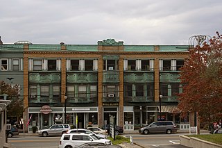
Wakefield is a village in the town of South Kingstown, Rhode Island, United States, and the commercial center of South Kingstown. Together with the village of Peace Dale, it is treated by the U.S. Census as a component of the census-designated place identified as Wakefield-Peacedale, Rhode Island. West Kingston, another South Kingstown village, was the traditional county seat of Washington County. Since 1991, the Washington County Courthouse has been in Wakefield. The Sheriff's Office which handles corrections is also in Wakefield.

The Galena River, also known as the Fevre or Fever River, is a 52.4-mile-long (84.3 km) river which flows through the Midwestern United States.
The Illinois Historic Preservation Division, formerly Illinois Historic Preservation Agency, is a governmental agency of the U.S. state of Illinois, and is a division of the Illinois Department of Natural Resources. It is tasked with the duty of maintaining State-owned historic sites, and maximizing their educational and recreational value to visitors or on-line users. In addition, it manages the process for applications within the state for additions to the National Register of Historic Places.

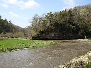
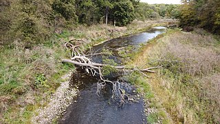
The Apple River is a tributary of the Mississippi River, about 55 miles (89 km) long, in southwestern Wisconsin and northwestern Illinois in the United States. It rises in Lafayette County, Wisconsin, and flows for most of its length in Illinois, through Jo Daviess and Carroll Counties. Along its course it passes through Apple River Canyon State Park and the town of Hanover. It flows into the Mississippi River about 7 mi (11 km) northwest of Savanna.

Kirby's Mill is a historic grist mill in Medford, Burlington County, New Jersey, United States. Originally known as Haines Mill, it was built in 1778 by Isaac Haines and partners along the Southwest Branch of Rancocas Creek. It was the last commercial operating mill in New Jersey.

Rush Township is one of 23 townships in Jo Daviess County, Illinois, United States. As of the 2010 census, its population was 380 and it contained 188 housing units.

Apple River Canyon State Park is an Illinois state park on 297 acres (120 ha) in Jo Daviess County, Illinois, United States. The park was begun with land purchased by the state in 1932, as a result of a prolonged campaign led by botanist Herman Silas Pepoon; with additional acquisitions since, 1,907 acres (772 ha) of land have been preserved to protect much of an 8+1⁄2-mile (13.7 km) long canyon on the Apple River.

Apple River Fort, today known as the Apple River Fort State Historic Site, was one of many frontier forts hastily completed by settlers in northern Illinois and southern Wisconsin following the onset of the 1832 Black Hawk War. Located in present-day Elizabeth, Illinois, United States, the fort at the Apple River settlement was built in less than a week. It was one of the few forts attacked during the war and the only one attacked by a band led by Black Hawk himself. At the Battle of Apple River Fort, a firefight of about an hour ensued, with Black Hawk's forces eventually withdrawing. The fort suffered one militia man killed in action, and another wounded. After the war, the fort stood until 1847, being occupied by squatters before being sold to a private property owner who dismantled the building.

James McGowan Strode (1804–1857/1860) was a militia officer and politician from the U.S. state of Illinois. He served in the Illinois militia during the Winnebago War and the Black Hawk War. Strode, originally from Tennessee, lived much of his life in Galena, Illinois. In Galena, during the Black Hawk War he was given command of the 27th Regiment of the Illinois militia and oversaw the construction of a fort in that city. Strode was involved in combat during the war at the infamous Battle of Stillman's Run. In 1835 Strode was elected to represent much of the region of Illinois north of Peoria in the Illinois State Senate.

Hindostan Falls is an extinct unincorporated community in Center Township, Martin County, in the U.S. state of Indiana.

Stagecoach Trail is a historic route through northern Jo Daviess County and western Stephenson County, in the northwest of Illinois. The trail was a part of the larger Galena–Chicago trail that crossed almost the entire state.

The Townsend Home is a historic house located about 3 miles (4.8 km) from Stockton, Illinois, in Jo Daviess County. It is a fine example of an Upright and Wing style house with Greek Revival detailing and was completed in 1856. The house was listed on the U.S. National Register of Historic Places in 2005.
Millville is a hamlet in the town of Shelby in Orleans County, New York, United States.
The Galena–Chicago trail was a stagecoach route located in northern Illinois that ran from the mid-to-late 1830s until 1854. As indicated by its name, the route linked Chicago, located in the northeast of the state, with Galena which was located in the lead mining district of the northwest. The Chicago-Galena trail includes the "Stagecoach Trail" that runs between Galena and Lena, Illinois. East of Lena the stage route follows U.S. Route 20 and Business U.S. Route 20 through Eleroy, Freeport and Rockford to Belvidere. This road began as the old State Road number 2 established on 15 January 1836 and laid out by June 1837.

The Dowling House is the oldest building in Galena, Illinois, United States, now a historic house museum.


