Scales Mound, Illinois

Last updated
Scales Mound
Gidonb Scales Mound Franklin Street.jpg
Scales Mound - Franklin Street in Winter 2008
Motto: 
At the Top of Illinois
Daviess County Illinois Incorporated and Unincorporated areas Scales Mound Highlighted.svg
Location of Scales Mound in Daviess County, Illinois.
Illinois in United States (US48).svg
Location of Illinois in the United States
Coordinates: 42°28′41″N90°15′02″W / 42.47806°N 90.25056°W / 42.47806; -90.25056 Coordinates: 42°28′41″N90°15′02″W / 42.47806°N 90.25056°W / 42.47806; -90.25056
CountryUnited States
StateIllinois
County Jo Daviess
Township Scales Mound
Area
[1]
  Total0.63 sq mi (1.63 km2)
  Land0.63 sq mi (1.63 km2)
  Water0.00 sq mi (0.00 km2)
Elevation
[2]
955 ft (291 m)
Population
 (2020)
  Total436
  Density694.27/sq mi (267.89/km2)
Time zone UTC-6 (CST)
  Summer (DST) UTC-5 (CDT)
ZIP Code(s)
61075
Area code 815
FIPS code 17-67925
Wikimedia CommonsScales Mound, Illinois
Website http://scalesmound.com
Scales Mound - Main Street in Winter 2008 Gidonb Scales Mound Main Street.jpg
Scales Mound - Main Street in Winter 2008

Scales Mound is a village in Jo Daviess County, Illinois, United States. The population was 436 at the 2020 census.

Contents

History

The original town of Scales Mound was located at the base of an erosional remnant similar to Charles Mound, about a mile southwest of the present-day village. In 1830 Samuel Scales purchased the original village site from John Sole and built a tavern at the base of the mound along Sucker Trail, a major east-west corridor. The land that the present-day village of Scales Mound is on was purchased from the U.S. government in 1848 by a man named Dunning. Little is known about Dunning or the use of the land until the 1850s. [3]

In 1851 the Illinois Central Railroad (ICRR) was established and it would become a major factor in the settlement of much of rural Illinois, including Scales Mound. In September 1853, anticipating the arrival of the railroad, the village of Scales Mound was platted by Josiah Conlee and B.B. Provost. During the summer of 1854 track crews from ICRR laid out 20 miles (32 km) of track between Scales Mound and Apple River and trains were running the line the day after completion. With the arrival of the railroad, Scales Mound's first building was constructed in the late fall 1854; a store built by Sherman Eddy. [3]

Demographics

Historical population
CensusPop.Note
1880 311
1900 418
1910 388−7.2%
1920 356−8.2%
1930 348−2.2%
1940 3541.7%
1950 3858.8%
1960 3993.6%
1970 382−4.3%
1980 347−9.2%
1990 38811.8%
2000 4013.4%
2010 376−6.2%
2020 43616.0%
U.S. Decennial Census [4]

As of the census [5] of 2000, there were 401 people, 164 households, and 108 families residing in the village. The population density was 1,709.5 inhabitants per square mile (660.0/km2). There were 188 housing units at an average density of 801.5 per square mile (309.5/km2). The racial makeup of the village was 98.25% White, 0.25% Asian, and 1.50% from two or more races. Hispanic or Latino of any race were 3.49% of the population.

There were 164 households, out of which 31.1% had children under the age of 18 living with them, 54.3% were married couples living together, 8.5% had a female householder with no husband present, and 34.1% were non-families. 32.3% of all households were made up of individuals, and 18.3% had someone living alone who was 65 years of age or older. The average household size was 2.45 and the average family size was 3.08.

In the village, the population was spread out, with 24.9% under the age of 18, 10.0% from 18 to 24, 26.4% from 25 to 44, 19.0% from 45 to 64, and 19.7% who were 65 years of age or older. The median age was 38 years. For every 100 females, there were 87.4 males. For every 100 females age 18 and over, there were 85.8 males.

The median income for a household in the village was $35,294, and the median income for a family was $37,386. Males had a median income of $26,875 versus $20,288 for females. The per capita income for the village was $15,992. About 6.1% of families and 7.8% of the population were below the poverty line, including 12.2% of those under age 18 and 15.3% of those age 65 or over.

Geography

Charles Mound, the highest natural point in Illinois at 1235 feet is located near Scales Mound, Illinois. Charles Mound, Illinois.JPG
Charles Mound, the highest natural point in Illinois at 1235 feet is located near Scales Mound, Illinois.

Location

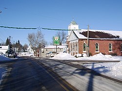
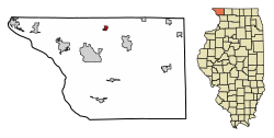
Scales Mound lies at the northwestern tip of Illinois in Jo Daviess County, part of the Driftless Area. Scales Mound is located at 42°28′41″N90°15′2″W / 42.47806°N 90.25056°W / 42.47806; -90.25056 (42.478098, −90.250544) [6] near the highest point in Illinois, Charles Mound, and on the Stagecoach Trail. It has an annual festival, Stagecoach Trail days. According to the 2010 census, Scales Mound has a total area of 0.23 square miles (0.60 km2), all land. [7]

Topography

Scales Mound is located in a region of the U.S. Midwest known as the Driftless Area, so called because it escaped glaciation during the last ice age. It covers parts of Illinois, Wisconsin, Minnesota and Iowa. The Illinois section is mostly limited to Jo Daviess County and small parts of Whiteside and Carroll County in northwest Illinois. The topography of the area is characterized by hilly terrain and wooded ridges. Common features found in the Scales Mound area include canyons, bluffs, ravines and palisades. [8] Near Charles Mound, the highest point in Illinois at 1235 feet, Scales Mound is said to be "At the Top of Illinois". [9]

Climate

Climate data for Scales Mound, Illinois
MonthJanFebMarAprMayJunJulAugSepOctNovDecYear
Average high °F (°C)27
(−3)
34
(1)
45
(7)
59
(15)
72
(22)
81
(27)
84
(29)
81
(27)
73
(23)
63
(17)
46
(8)
34
(1)
58
(15)
Average low °F (°C)3
(−16)
10
(−12)
21
(−6)
32
(0)
43
(6)
54
(12)
57
(14)
55
(13)
46
(8)
34
(1)
25
(−4)
12
(−11)
33
(0)
Average precipitation inches (mm)1.12
(28.4)
1.24
(31.5)
2.58
(65.5)
3.38
(85.9)
3.57
(90.7)
5.07
(128.8)
2.90
(73.7)
4.4
(113)
3.63
(92.2)
2.51
(63.8)
2.71
(68.8)
1.8
(45)
34.91
(887.3)
Source: weather.com [10]

Education

Scales Mound has one K-12 school (high school included). Its mascot is the Hornets.

Culture

Related Research Articles

<span class="mw-page-title-main">Jackson County, Iowa</span> County in Iowa, United States

Jackson County is a county located in the U.S. state of Iowa. As of the 2020 census, the population was 19,485. The county seat is Maquoketa.

<span class="mw-page-title-main">Stephenson County, Illinois</span> County in Illinois, United States

Stephenson County is a county located in the U.S. state of Illinois. According to the 2020 United States Census, it had a population of 44,630. Its county seat is Freeport.

<span class="mw-page-title-main">Jo Daviess County, Illinois</span> County in Illinois, United States

Jo Daviess County is the northwesternmost county in the U.S. state of Illinois. According to the 2010 census, it had a population of 22,678. Its county seat is Galena.

<span class="mw-page-title-main">Carroll County, Illinois</span> County in Illinois, United States

Carroll County is a county located in the U.S. state of Illinois. As of the 2010 census, the population was 15,387. Its county seat is Mount Carroll.

<span class="mw-page-title-main">Mound Station, Illinois</span> Village in Illinois, United States

Mound Station (Timewell) is a village in Brown County, Illinois, United States. The population was 117 at the 2020 census.

<span class="mw-page-title-main">Apple River, Illinois</span> Village in Illinois, United States

Apple River is a village in Jo Daviess County, Illinois, United States. The population was 366 at the 2010 census, down from 379 in 2000.

<span class="mw-page-title-main">East Dubuque, Illinois</span> City in Illinois, United States

East Dubuque is a city in Jo Daviess County, Illinois, United States. The population was 1,505 at the 2020 census, down from 1,704 in 2010. East Dubuque is located alongside the Mississippi River. Across the river is the city of Dubuque, Iowa. The city limits extend along the river to the Illinois – Wisconsin border.

<span class="mw-page-title-main">Elizabeth, Illinois</span> Village in Illinois, United States

Elizabeth is a village in Jo Daviess County, Illinois, United States. The population was 761 at the 2010 census.

<span class="mw-page-title-main">Hanover, Illinois</span> Village in Illinois, United States

Hanover is a village in Jo Daviess County, Illinois, United States, along the Apple River. The town was previously named Wapello, in honor of Chief Wapello of the Meskwaki tribe. The population was 844 at the 2010 census, up from 836 in 2000.

<span class="mw-page-title-main">Menominee, Illinois</span> Village in Illinois, United States

Menominee is a village in Jo Daviess County, Illinois, United States. The population was 248 at the 2010 census, up from 237 in 2000. The village is located on the Little Menominee River near East Dubuque and Galena.

<span class="mw-page-title-main">Nora, Illinois</span> Village in Illinois, United States

Nora is a village in Jo Daviess County, Illinois, United States. In 2020, the population was 107, down from 121 according to the 2010 census, which was up from 118 in 2000.

<span class="mw-page-title-main">Stockton, Illinois</span> Village in Illinois, United States

Stockton is a village in Jo Daviess County, Illinois, United States. The population was 1,862 at the 2010 census, down from 1,926 at the 2000 census.

<span class="mw-page-title-main">Warren, Illinois</span> Village in Illinois, United States

Warren is a village in Jo Daviess County, Illinois, United States. The population was 1,323 at the 2020 census, down from 1,428 at the 2010 census.

<span class="mw-page-title-main">Blue Mound, Illinois</span> Village in Illinois, United States

Blue Mound is a village in Macon County, Illinois, United States. The population was 1,133 at the 2020 census. It is included in the Decatur, Illinois Metropolitan Statistical Area.

<span class="mw-page-title-main">Fairmont City, Illinois</span> Village in Illinois, United States

Fairmont City is a village in St. Clair and Madison counties, Illinois, United States. The population was 2,265 at the 2020 census, down from 2,635 in 2010. In the 1990s Fairmont City's Hispanic population doubled, and as of 2020, over 79% of the population was of Hispanic descent.

<span class="mw-page-title-main">Hampton, Illinois</span> Village in Illinois, United States

Hampton is a village in Rock Island County, Illinois, United States. The population was 1,863 at the 2010 census.

<span class="mw-page-title-main">Corona, New Mexico</span> Village in New Mexico, United States

Corona is a village in Lincoln County, New Mexico, United States, located along U.S. Route 54. The population was 172 at the time of the 2010 census.

<span class="mw-page-title-main">Columbus, North Carolina</span> Town in North Carolina, United States

Columbus is a town in Polk County, North Carolina, United States. The population was 999 at the 2010 census. It is the county seat of Polk County.

<span class="mw-page-title-main">Monticello, Lafayette County, Wisconsin</span> Town in Wisconsin, United States

Monticello is a town in Lafayette County, Wisconsin, United States. The population was 133 at the 2010 census.

Gratiot is a town in Lafayette County, Wisconsin, United States. The population was 550 at the 2010 census, down from 653 at the 2000 census. The village of Gratiot is located within the town. The unincorporated community of Riverside and part of the unincorporated community of Dunbarton are also in the town.

References

  1. "2020 U.S. Gazetteer Files". United States Census Bureau. Retrieved March 15, 2022.
  2. "USGS detail on Newtown" . Retrieved 2007-10-21.
  3. 1 2 Mansberger, Floyd. "Scales Mound Historic District", (PDF), National Register of Historic Places Registration Form, May 2, 1990, Illinois Historic Preservation Agency , accessed May 17, 2008.
  4. "Census of Population and Housing". Census.gov. Retrieved June 4, 2015.
  5. "U.S. Census website". United States Census Bureau . Retrieved 2008-01-31.
  6. "US Gazetteer files: 2010, 2000, and 1990". United States Census Bureau. 2011-02-12. Retrieved 2011-04-23.
  7. "G001 - Geographic Identifiers - 2010 Census Summary File 1". United States Census Bureau. Archived from the original on 2020-02-13. Retrieved 2015-12-25.
  8. Suloway, Liane, Joselyn, Mark, and Brown, Patrick W. "Driftless Area", Inventory of Resource Rich Areas in Illinois: An Evaluation of Ecological Resources, Illinois Natural History Survey, 1996, Center for Wildlife Ecology, accessed May 17, 2008.
  9. Galena Jo Daviess Visitors Guide, 2012
  10. "Monthly Averages for Scales Mound, IL" . Retrieved February 29, 2008.

Government

Others