Mount Olive is an unincorporated community in Bradley County, Arkansas, United States. It is the location of Mt. Olive Rosenwald School, which is located on Bradley Rd. 45 and is listed on the National Register of Historic Places. Goepel was previously the name used for Mount Olive.
Odell is an unincorporated community in Boston Township in southwestern Washington County, Arkansas, United States. The community is one mile north of the county line and the north boundary of the Ozark–St. Francis National Forest. Evansville is four miles west-northwest on Arkansas Highway 59 adjacent to the Arkansas - Oklahoma state line.
Skylight is an unincorporated community in Boston Township, of southwestern Washington County, Arkansas, United States. Skylight lies about one mile west-northwest of Skylight Mountain.
Spring Valley is an unincorporated community in Brush Creek Township, Washington County, Arkansas, United States.
Walnut Grove is an unincorporated community in Center Township, Washington County, Arkansas, United States. It is located on Arkansas Highway 170, south of Farmington.
Strickler is an unincorporated community in Cove Creek Township, Washington County, Arkansas, United States. It is located on Arkansas Highway 265, northwest of Devil's Den State Park.
Black Oak is a community in White River Township, Washington County, Arkansas, United States. It is located between Greenland and Elkins and lies six miles southeast of Fayetteville.
Sexton is a former community in Dutch Mills Township, Washington County, Arkansas, United States. The community was located on a tributary of the Baron Fork approximately one-half mile east of the Arkansas - Oklahoma state line.
Harris is an unincorporated community in Elkins Township, Washington County, Arkansas, United States. It is located east of Fayetteville and within the city limits of Elkins near Arkansas Highway 16.
Hubbard is an unincorporated community in Valley Township, Washington County, Arkansas, United States. It is located near the intersection of Washington County Road 21 and Hubbard Road.
Oak Grove is an unincorporated community in Springdale Township of northern Washington County, Arkansas, United States. It is located on the northwest side of Springdale just east of the combined U.S. routes 62, 71, 540.
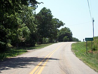
Blackburn is an unincorporated community in Lee's Creek Township, Washington County, Arkansas, United States. It is located on Arkansas Highway 74, northeast of Devil's Den State Park.
Pitkin Corner is an unincorporated community in West Fork Township, Washington County, Arkansas, United States. It is located on Washington County Road 35 west of the Woolsey Bridge.
Strain is an unincorporated community in Richland Township, Washington County, Arkansas, United States. It is located between Fayetteville and Elkins. The community consists of a small number of homes located around a road junction near the Middle Fork White River.
Mount Olive, Arkansas may refer to any one of many locations in the U.S. state of Arkansas:
Arnett is an unincorporated community in White River Township, Washington County, Arkansas, United States. It is located on Arkansas Highway 74.
Harmon is an unincorporated community in Harmon Township, Washington County, Arkansas, United States. It is located southwest of Tontitown on Harmon Road.
Mayfield is an unincorporated community in Goshen Township, Washington County, Arkansas, United States. It is located at the intersection of Arkansas highways 45 and 303.
Mount Olive is an unincorporated community and census-designated place (CDP) in Izard County, Arkansas, United States. Mount Olive is located on the White River, 11.1 miles (17.9 km) west-southwest of Melbourne.


