Current listings
| [3] | Name on the Register | Image | Date listed [4] | Location | City or town | Description |
|---|---|---|---|---|---|---|
| 1 | 4 Lazy F Dude Ranch | 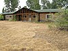 | April 23, 1990 (#90000611) | Off Teton Park Rd. 43°40′03″N110°42′27″W / 43.6675°N 110.7075°W | Moose | Summer residence and dude ranch, also known as Sun Star Ranch |
| 2 | AMK Ranch |  | April 23, 1990 (#90000615) | Off U.S. Routes 27/89 43°56′20″N110°38′30″W / 43.938889°N 110.641667°W | Moran | Summer residence and dude ranch |
| 3 | Bar B C Dude Ranch |  | April 23, 1990 (#90000624) | Off Teton Park Rd. 43°41′42″N110°41′42″W / 43.695°N 110.695°W | Moose | One of the first and largest dude ranches in Jackson Hole |
| 4 | The Brinkerhoff |  | April 23, 1990 (#90000622) | Teton Park Rd. 43°51′03″N110°35′35″W / 43.850833°N 110.593056°W | Moose | Summer residence, used as a presidential retreat |
| 5 | Cascade Canyon Barn |  | August 18, 1998 (#98001023) | Cascade Canyon 5 miles upstream from Jenny Lake 43°46′05″N110°49′22″W / 43.768056°N 110.822778°W | Moose | Backcountry ranger patrol cabin and barn |
| 6 | Andy Chambers Ranch Historic District |  | April 23, 1990 (#90000623) | Mormon Row east of Moose 43°39′29″N110°39′41″W / 43.658056°N 110.661389°W | Moose | Nearly complete family homestead in Jackson Hole |
| 7 | Chapel of the Transfiguration |  | April 10, 1980 (#80004055) | Grand Teton National Park 43°39′37″N110°42′52″W / 43.660278°N 110.714444°W | Moose | Chapel built around a view of the Cathedral Group of Teton peaks |
| 8 | Cunningham Cabin |  | October 2, 1973 (#73000225) | Northeast of Moose off U.S. Routes 26/89/187 in Grand Teton National Park 43°46′44″N110°33′28″W / 43.778889°N 110.557778°W | Moose | Early Jackson Hole homestead cabin |
| 9 | Death Canyon Barn |  | August 25, 1998 (#98001024) | 5 miles northwest of Phelps Lake near Alaska Basin 43°39′53″N110°49′45″W / 43.664722°N 110.829167°W | Moose | Backcountry ranger patrol cabin and barn |
| 10 | Double Diamond Dude Ranch Dining Hall |  | August 18, 1998 (#98001028) | 5 miles north of Moose, western side of Teton Park Rd. and Cottonwood Creek 43°42′07″N110°44′05″W / 43.701944°N 110.734722°W | Moose | Dude ranch lodge |
| 11 | Highlands Historic District |  | August 19, 1998 (#98001029) | 5 miles north of park headquarters, ¼ mile west of Teton Park Rd. 43°42′32″N110°43′45″W / 43.708889°N 110.729167°W | Moose | Former tourist camp used for NPS personnel |
| 12 | Hunter Hereford Ranch Historic District |  | August 24, 1998 (#98001031) | Southeastern corner of park, south of Shadow Mountain along Aspen Ridge 43°40′33″N110°36′36″W / 43.6759°N 110.60989°W | Moose | Former working ranch in Jackson Hole |
| 13 | Jackson Lake Lodge |  | July 31, 2003 (#03001039) | Teton Park Road 43°52′50″N110°34′32″W / 43.880556°N 110.575556°W | Moran | Designed by Gilbert Stanley Underwood, a modernist reinterpretation of lodge architecture. National Historic Landmark. |
| 14 | Jackson Lake Ranger Station |  | April 23, 1990 (#90000620) | Off Teton Park Rd. 43°52′18″N110°34′14″W / 43.871667°N 110.570556°W | Moose | Former U.S. Forest Service ranger station transferred to the National Park Service |
| 15 | Jenny Lake Boat Concession Facilities |  | August 24, 1998 (#98001032) | Southern end of Jenny Lake 43°45′04″N110°43′31″W / 43.751111°N 110.725278°W | Moose | Park concession facility |
| 16 | Jenny Lake CCC Camp NP-4 |  | July 7, 2006 (#98001033) | ¼ mile south of Jenny Lake on the western side of Cottonwood Creek 43°44′58″N110°43′28″W / 43.749444°N 110.724444°W | Moose | Only surviving Civilian Conservation Corps camp structure in the park |
| 17 | Jenny Lake Ranger Station Historic District |  | April 23, 1990 (#90000610) | Jenny Lake Rd. 43°45′13″N110°43′19″W / 43.753611°N 110.721944°W | Moose | Rustic ranger station |
| 18 | Kimmel Kabins |  | April 23, 1990 (#90000612) | Off Teton Park Rd. 43°44′38″N110°43′38″W / 43.743889°N 110.727222°W | Moose | Former tourist camp |
| 19 | Leek's Lodge |  | September 5, 1975 (#75000216) | 10 miles northwest of Moran in Grand Teton National Park off U.S. Routes 89/287 43°55′50″N110°38′20″W / 43.930556°N 110.638889°W | Moran | Former tourist camp |
| 20 | Leigh Lake Ranger Patrol Cabin |  | April 23, 1990 (#90000618) | Off Teton Park Teton Rd. at Lehigh Lake 43°49′36″N110°44′16″W / 43.826667°N 110.737778°W | Moose | Backcountry ranger station |
| 21 | Geraldine Lucas Homestead-Fabian Place Historic District |  | August 24, 1998 (#98001034) | 4.5 miles north of Moose 43°43′16″N110°44′03″W / 43.721111°N 110.734167°W | Moose | Former homesteader's cabin, associated in later years with the Snake River Land Company |
| 22 | Manges Cabin |  | August 19, 1998 (#98001035) | Southern end of park southeast of Taggart Lake 43°41′54″N110°43′59″W / 43.698333°N 110.733056°W | Moose | Homestead cabin that became part of a dude ranch |
| 23 | Menor's Ferry |  | April 16, 1969 (#69000016) | Across the Snake River just above park headquarters, Grand Teton National Park 43°39′30″N110°42′29″W / 43.658333°N 110.708056°W | Moose | Former ferry crossing on the Snake River operated by homesteader Bill Menor |
| 24 | Moose Entrance Kiosk |  | April 23, 1990 (#90000619) | Teton Park Rd. 43°39′30″N110°43′09″W / 43.658333°N 110.719167°W | Moose | Rustic style park entrance structure |
| 25 | Moran Bay Patrol Cabin | August 25, 1998 (#98001037) | Northern bank of Moran Bay on Jackson Lake 43°39′53″N110°49′45″W / 43.664722°N 110.829167°W | Moose | Backcounty patrol cabin built by the CCC | |
| 26 | Mormon Row Historic District | 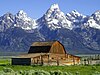 | June 5, 1997 (#97000495) | Roughly east of U.S. Routes 26/89/187 from Antelope Flats to Grand Teton National Park-Teton National Forest border 43°39′24″N110°37′06″W / 43.656667°N 110.618333°W | Moose | Group of Mormon homesteads in Jackson Hole, includes the Andy Chambers Ranch and the T. A. Moulton Barn |
| 27 | Murie Ranch Historic District |  | August 24, 1998 (#98001039) | ½ mile southwest of park headquarters 43°39′02″N110°43′37″W / 43.650556°N 110.726944°W | Moose | Former STS dude ranch incorporating the Murie Residence and the home of Olaus Murie's brother Adolph Murie, birthplace of the Wilderness Society. National Historic Landmark. |
| 28 | Murie Residence |  | April 23, 1990 (#90000616) | Off Moose Wilson Rd. 43°39′00″N110°43′37″W / 43.65°N 110.726944°W | Moose | Home of conservationists Olaus and Mardie Murie, part of Murie Ranch Historic District National Historic Landmark |
| 29 | Old Administrative Area Historic District |  | April 23, 1990 (#90000621) | Off Teton Park Rd. 43°41′10″N110°44′08″W / 43.686111°N 110.735556°W | Moose | Former park headquarters area built by the CCC |
| 30 | Ramshorn Dude Ranch Lodge |  | August 19, 1998 (#98001041) | Southeastern corner of park, 2.5 miles northwest of Kelly 43°40′11″N110°35′46″W / 43.669722°N 110.596111°W | Moose | Guest ranch and climbing school now used by the Teton Science School |
| 31 | Snake River Land Company Residence and Office | 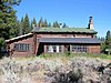 | July 7, 2006 (#98001036) | Western bank of the Snake River, ¼ north of Moran Junction 43°50′33″N110°30′44″W / 43.8425°N 110.512222°W | Moose | Guest ranch that became the headquarters for John D. Rockefeller, Jr.'s venture to buy land for the expansion of Grand Teton National Prk |
| 32 | String Lake Comfort Station |  | April 23, 1990 (#90000617) | Off Teton Park Rd. at String Lake 43°47′19″N110°43′47″W / 43.788611°N 110.729722°W | Moose | Rustic public toilet structure |
| 33 | Triangle X Barn |  | August 19, 1998 (#98001042) | Eastern side of park, north of Shadow Mountain 43°45′53″N110°34′01″W / 43.764722°N 110.566944°W | Moose | Local vernacular barn at the last dude ranch operating in the park |
| 34 | Upper Granite Canyon Patrol Cabin |  | August 19, 1998 (#98001043) | Southwestern corner of park at Granite Canyon, Rendezvous Pass 43°36′49″N110°53′50″W / 43.613611°N 110.897222°W | Moose | Backcountry patrol cabin |
| 35 | White Grass Dude Ranch |  | April 23, 1990 (#90000613) | Off Moose Wilson Rd. 43°39′28″N110°46′23″W / 43.657778°N 110.773056°W | Moose | Former dude ranch, now an architectural conservation training center |
| 36 | White Grass Ranger Station Historic District |  | April 23, 1990 (#90000614) | Off Moose Wilson Rd. 43°39′20″N110°46′48″W / 43.655556°N 110.78°W | Moose | Backcountry ranger station |