Nettleton's Addition Historic District

Last updated

Nettleton's Addition Historic District
Nettleton's Addition Sign.jpg
Sign at the entrance to Nettleton's Addition on Boone Ave.
USA Washington location map.svg
Red pog.svg
Usa edcp location map.svg
Red pog.svg
Location West Central, Spokane, Washington, United States
Coordinates 47°40′01.6″N117°26′54.7″W / 47.667111°N 117.448528°W / 47.667111; -117.448528
Area236 acres (96 ha)
Built1887–1954
ArchitectMultiple
Architectural style Queen Anne Revival, Shingle style, Colonial Revival, Tudor Revival, Bungalow, American Craftsman, Ranch-style
NRHP reference No. 06000176 [1]
Added to NRHPMarch 22, 2006

The Nettleton's Addition Historic District is a historic residential district in the West Central neighborhood of Spokane, Washington. It was listed on the National Register of Historic Places (NRHP) in 2006 because of the concentration of historic homes in one of Spokane's oldest residential neighborhoods and for its significance as an example of community planning and development and in the area of architecture. It is the largest national historic district in the state of Washington. [2]

Contents

Located on a flat plateau surrounded on three sides by a bend in the Spokane River about a mile-and-a-half northwest of the center of Downtown Spokane, the area's proximity to the city center made it one of the first residential areas developed in Spokane. The neighborhood was platted in 1887 and largely developed by 1911. Architectural styles represented in the district include Queen Anne Revival, shingle style, Colonial Revival, Tudor Revival, Bungalow, American Craftsman, as well as a dozen ranch-style homes which were built after 1937 and are not considered to be contributing properties to the historic district. At the time of its listing on the NRHP in 2006, Nettleton's Addition consisted of 949 properties on 1002 parcels, of which 536 are considered to be historic contributing buildings. Notable architects who worked in the neighborhood include Kirtland Cutter and Karl Malmgren. [3]

A working and middle-class neighborhood from the time of its development through to the present day, Nettleton's Addition consists primarily of one-to-two story single-family homes built of wood. Nettleton's Addition was laid out in a grid pattern with sidewalks on every street and alleys running east-to-west in the middle of each block. The only disruptions to this pattern come in the northern and southwestern edges of the district where the terrain drops off dramatically to the river and in one block in the northeastern portion of the district where the Holmes Elementary campus takes up the entire block. [3]

Setting

Nettleton's Addition is located in the western portion of the West Central neighborhood of Spokane, about a mile-and-a-half northwest of the center of Downtown Spokane. The district is located on a flat plateau at approximately 1,880 feet above sea level. The Spokane River bends around the district to the south, west and north forming a deep gorge which falls off from the plateau more than 200 feet over a distance of less than one city block. [4] The historic district is bounded by Summit Boulevard and Mission Avenue on the north, Chestnut Street on the east, Bridge Avenue on the south, and A Street and Summit Boulevard on the west. [5]

Typical homes on Mallon Avenue Nettleton's Mallon Ave.jpg
Typical homes on Mallon Avenue

The neighborhood, like those which surround it, was platted on a grid system with east-west blocks roughly 600 feet long and the north-south blocks varying between 250 and 360 feet. Mid-block alleyways run through the middle of each block east-to-west. Streets in the area are 60 feet wide with sidewalks separated from the road by a planting strip. [3] While surrounded by the river on three sides, the district is mostly inland from the river with the exception of two blocks in the north and one block in the south that overlook the river gorge. [5]

To the south, beyond Bridge Avenue, is the Kendall Yards development which was built in the 2010s on the site of a former rail yard. [6] This new development across the street from Nettleton's Addition has sparked fears that gentrification will come to the longtime working-class neighborhood. [7]

History

Nettleton's Addition circa 1909 Nettleton's Addition c. 1909.jpg
Nettleton's Addition circa 1909

The city of Spokane was first settled in 1873 and officially incorporated in 1881. [8] What is now Nettleton's Addition became one of the earliest residential areas in the city when it was platted as Nettleton's First Addition and Nettleton's Second Addition in 1887. The area was annexed into the city of Spokane in 1891. [9] The earliest construction in the district began in 1880, but most of the development took place in the years immediately following the turn of the century. As Spokane's population boomed in the first decade of the 20th century, Nettleton's Addition saw high levels of development, with 724 of the 949 buildings still standing in 2006 constructed between 1900 and 1912. [3]

Despite their proximity to the commercial center of Spokane, being roughly a mile-and-a-half from where the city was initially founded, Nettleton's Addition, West Central and the broader area north of the river from the original settlement were initially considered quite remote. The Spokane Falls and the river's gorge when extends downstream from there made crossing to the north bank difficult. Development was opened up in 1889 when a wooden precursor to the Monroe Street Bridge was built to span the river. [10]

Streetcar tracks visible on Dean Avenue Nettleton's Streetcar Dean Ave.jpg
Streetcar tracks visible on Dean Avenue

Developed as a streetcar suburb by William Nettleton along with his son and nephew, Nettleton's Addition reflected many traits of suburban development of the day. With an influx of workers moving into the rapidly growing city, simple homes were built on pattern book designs to house the growing population. Streetcars connected the neighborhood to the downtown core and the rest of the city, as well as to a destination recreational park on the other side of the addition to help draw visitors and potential residents into the area. [11] The park, located just west of Nettleton's Addition along the Spokane River, was developed in 1892 and 1893 and would eventually become known as Natatorium Park for its indoor swimming pool facility. [12]

The early history of development in Nettleton's Addition, and the wider West Central neighborhood as a whole, is inextricably linked to the streetcar lines. The Washington Water Power company was founded in 1889 to manage the city's hydroelectric potential. The company also took over management of the city's streetcar network, which had initially been built by real estate developers. Many of those developers would end up on the board of directors at Washington Water Power, including the developer of the Twickenham Addition to the west of Nettleton's Addition and across the river, the developer of Sherwood Addition immediately to the west of Nettleton's Addition, and the owner of the Pettet Tract immediately to the north of Nettletton's Addition. These developers also sat on the board of a cable railway company which served the area as well. Spokane's streetcars were replaced with busses in 1936, [13] but the tracks remain visible in the road in places around Nettleton's Addition. [14]

Doyle's Ice Cream Parlor Doyle's Ice Cream Parlor.png
Doyle's Ice Cream Parlor

After the boom years of the first decade of the 20th century, development came to a virtual halt not only in Nettleton's Addition but around the city as a whole. Spokane's population exploded from 36,000 in 1900 to 104,402 in 1910, but would only grow by 35 people between 1910 and 1920. This rapid decline in growth left some lots unoccupied in Nettleton's Addition until growth resumed again after World War II. [15]

Though the area is mostly residential, it is also home to Doyle's Ice Cream Parlor which has been in business in the neighborhood since 1939. Doyle's is listed as a contributing property to the historic district. [16]

The working class neighborhood fell into decline by the early 1970s, when the rail yards immediately south of the addition, in what is now the Kendall Yards development, were abandoned. Nettleton's Addition and the wider West Central neighborhood became known as a run-down and crime-infested part of the city. [17] The area became known as "Felony Flats" and the moniker stuck even into the 2010s as gentrification spurred by the construction of Kendall Yards began to encroach into the rest of West Central including Nettleton's Addition. [18]

See also

Related Research Articles

<span class="mw-page-title-main">Neighborhoods in Spokane, Washington</span>

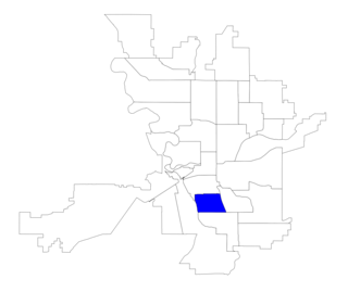
Neighborhoods in Spokane, Washington are officially grouped by the Spokane City Council into three main city council districts: 1, 2, and 3. Each city council district contains multiple, official neighborhoods that are recognized with a neighborhood council. Informally, neighborhoods are colloquially grouped by local geographical, geological, cultural, or historical features The list of neighborhoods below is organized based on the official designations by the City of Spokane. Unofficial neighborhoods and districts are listed within the official neighborhood in which they are located.

<span class="mw-page-title-main">Downtown Spokane</span> Central business district of Spokane in Washington, United States

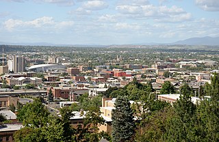
Downtown Spokane or Riverside is the central business district of Spokane, Washington. The Riverside neighborhood is roughly bounded by I-90 to the south, Division Street to the east, Monroe Street to the west and Boone Avenue to the north. The topography of Downtown Spokane is mostly flat except for areas downstream of the Spokane Falls which are located in a canyon; the elevation is approximately 1,900 feet (580 m) above sea level.

<span class="mw-page-title-main">Cambern Dutch Shop Windmill</span> United States historic place

Cambern Dutch Shop Windmill is a historic commercial building constructed in the shape of a windmill at 1102 S. Perry in Spokane, Washington, United States. It was built in 1929 and added to the National Register of Historic Places in 1989.

<span class="mw-page-title-main">West Central, Spokane</span> Neighborhood in Spokane, Washington, U.S.

West Central is a neighborhood in Spokane, Washington. As the name suggests it is located centrally on the west side of the city. Downtown Spokane is immediately east of the neighborhood, and spreads into West Central along Monroe Street in the Kendall Yards area. The neighborhood is diverse, with single and multi-family residential zones dating back to the early days of Spokane, a new mixed use development on the site of a former rail yard, the Spokane County Courthouse campus and associated government buildings and a few commercial districts. The Spokane River gorge winds around the southern and western edge of the neighborhood. It is home to Nettleton's Addition Historic District, which was added to the National Register of Historic Places in March 2006, and is also the largest historic district on the Washington State Heritage Register.

<span class="mw-page-title-main">Riverside Avenue Historic District</span> Historic district in Washington, United States

The Riverside Avenue Historic District is a 16.5 acres (6.7 ha) historic district in Downtown Spokane, Washington consisting of buildings constructed in the early 20th century, and was listed on the National Register of Historic Places in 1976. The listing includes 14 contributing properties, nine of which are considered primary and five are considered secondary.

<span class="mw-page-title-main">Eldridge Building</span> United States historic place

The Eldridge Building is a historic building in Spokane, Washington. It was designed by architect Gustav Albin Pehrson, and built in 1925. It has been listed on the National Register of Historic Places (NRHP) since November 12, 1992. It is one of three historic buildings listed on the NRHP at the intersection of First Avenue and Cedar Street. To the west across Cedar is the Grand Coulee building and to the northwest, kitty-corner from the Eldridge Building, is the former Carnegie Library.

<span class="mw-page-title-main">University District (Spokane, Washington)</span> District of Spokane in Washington, United States

The University District, also referred as the U-District or Spokane University District, is a 770-acre area, tax increment financing, and innovation district in Spokane, Washington. It is located just east of its Downtown Spokane in the East Central and Logan neighborhoods, and is home to a number of higher education institutions and their surrounding neighborhoods.

<span class="mw-page-title-main">Logan, Spokane</span> Spokane Neighborhood in Washington, United States

Logan is a neighborhood in Spokane, Washington. It is located immediately northeast of Downtown Spokane and is home to Gonzaga University. The Spokane River runs along its eastern and southern edge. Due to its proximity to the city center, Logan is home to some of the oldest and densest areas in the city. It is known for its tree-lined streets, historic buildings and population of college students. In addition to numerous individual properties, there are two historic districts listed on the National Register of Historic Places located within Logan: the Desmet Avenue Warehouse Historic District and the Mission Avenue Historic District.

<span class="mw-page-title-main">Rockwood, Spokane</span> Spokane Neighborhood in Washington, United States

Rockwood is a neighborhood in Spokane, Washington. It is located on the south side of the city to the southeast of Downtown Spokane and expanding southeasterly from close to the city center. Its proximity to downtown makes it one of Spokane's older neighborhoods, with mature trees lining most of its streets. Due to its location on the hill leading up from the Spokane River Valley, the street grid breaks down in many places around Rockwood. The most notable of these is along the winding Rockwood Boulevard, which was designed by the Olmsted Brothers and weaves its way from the northwesternmost corner of the neighborhood through the center and across to the eastern border, highlighting the basalt bluffs and other natural topography.

<span class="mw-page-title-main">Architecture of Spokane, Washington</span> Overview of the architecture in Spokane, Washington

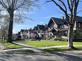
Spokane and its neighborhoods contain a patchwork of architectural styles that give them a distinct identity and illustrate the changes throughout the city's history. Spokane has a rich architectural history for a western city of its size and much of it is a product of its circumstances at the turn of the 20th century when as a rapidly growing city, the Great Fire of 1889 destroyed 32 blocks of the city center which was quickly rebuilt in a more grand fashion by a community flush with money coming from regional mining districts. Many of the architects that found work in the city and building on the blank slate of the downtown commercial district became highly esteemed architects such as Kirtland Cutter, who has been credited with giving the city a distinctive character. In particular, the city has a high concentration of Romanesque Revival style institutional and commercial buildings and American Craftsman bungalow residences. The architecture of Spokane gained national recognition in industry publications in the early 20th century.

<span class="mw-page-title-main">Manito/Cannon Hill, Spokane</span> Neighborhood in Spokane, Washington, United States

Manito/Cannon Hill is a neighborhood on the South Hill of Spokane, Washington. It is named after the two public parks that dominate its setting: Manito Park and Cannon Hill Park. Manito/Cannon Hill is a predominantly residential neighborhood made up mostly by single-family homes and city park land.

<span class="mw-page-title-main">Cliff/Cannon, Spokane</span> Neighborhood in Spokane, Washington, United States

Cliff/Cannon is a neighborhood in Spokane, Washington. It is located immediately south of Downtown, Spokane, and on the lower reaches of the broader South Hill. The neighborhood is home to a medical district with Sacred Heart and Deaconess both having their main hospital campuses along Cliff/Cannon's denser northern edge. To the south the neighborhood becomes more residential. City parks break up the residential zoning of the southern half of Cliff/Cannon. It is adjacent to the Cannon Hill area of the neighboring but separate Manito/Cannon Hill neighborhood. The Marycliff-Cliff Park Historic District, a National Historic District listed on the National Register of Historic Places, is located within the neighborhood.

<span class="mw-page-title-main">Emerson/Garfield, Spokane</span> Spokane Neighborhood in Washington, United States

Emerson/Garfield is a neighborhood in Spokane, Washington. It is located immediately north of Downtown Spokane's North Bank and extends out into the inner northwestern portion of the city. Emerson/Garfield is a diverse neighborhood with residential, commercial and civic zones all bordering one another, with density ranging from single-family homes to multi-use buildings. Due to its location in the central area of Spokane, Emerson/Garfield is criss-crossed by numerous arterials and thoroughfares. Along those main roads are numerous commercial and retail districts of importance to both the neighborhood and city as a whole.

<span class="mw-page-title-main">Lincoln Heights, Spokane</span> Spokane Neighborhood in Washington, United States

Lincoln Heights is a neighborhood in Spokane, Washington. It is located in the southeastern portion of the city in a broader area commonly known as the South Hill. As the name suggests, Lincoln Heights lies on the slopes and atop the crest of the South Hill area. Lincoln Heights is home to a mix of single-family residential, multi-family residential, and commercial areas and a significant amount of park land. The Lincoln Heights Shopping Center and surrounding area is one of the largest and most important commercial and retail districts on the entire south side of Spokane.

<span class="mw-page-title-main">Audubon/Downriver, Spokane</span> Spokane Neighborhood in Washington, United States

Audubon/Downriver is a neighborhood in Spokane, Washington, located on the northwest side of the city. There is a diversity of land use in the neighborhood, with single-family residential areas dating from the early 20th century through the Post–World War II economic expansion era, regionally important commercial districts, smaller neighborhood retail areas, numerous schools, large parks, a golf course, conservation areas and part of Riverside State Park along the Spokane River. The neighborhood is the site of the corporate offices for Rosauers Supermarkets, a regional grocery store chain with stores located across the Northwestern United States.

<span class="mw-page-title-main">Doyle's Ice Cream Parlor</span> United States historic place

Doyle's Ice Cream Parlor is a locally owned ice cream shop that has been located in Spokane's West Central neighborhood since 1939. Doyle's is open from spring to early fall, Wednesdays through Sundays.

<span class="mw-page-title-main">West Downtown Historic Transportation Corridor</span> Historic district in Spokane

The West Downtown Historic Transportation Corridor is a historic commercial district in Spokane, Washington located, as the name suggests, in the western portion of the city's downtown neighborhood. The district, which was listed on the National Register of Historic Places (NRHP) in 1999, consists mostly of buildings constructed between the late 19th century and 1949. It contained at the time of listing 65 buildings or structures, 50 of which are considered contributing properties to the district. Seven properties in the district are listed on the NRHP individually as well.

<span class="mw-page-title-main">Rockwood Historic District</span> Historic district in Spokane, Washington

The Rockwood Historic District is a historic residential area in the Rockwood neighborhood on the south side of Spokane, Washington. The district was listed on the National Register of Historic Places (NRHP) in 1997 due to the concentration of historic homes within the district as well as its significance in the areas of architecture, landscape architecture, and community planning and development.

<span class="mw-page-title-main">Ninth Avenue Historic District</span> Historic district in Spokane, Washington

The Ninth Avenue Historic District is a National Register of Historic Places (NRHP) listed historic district located along and around Ninth Avenue in the Cliff/Cannon neighborhood of Spokane, Washington. It stretches from Monroe Street on the east to Chestnut Street on the west, running the length of Ninth Avenue and extending to include portions of Eighth, 10th and 11th Avenues, mostly in the western half of the district.

References

  1. "NPGallery Asset Detail". npgallery.nps.gov. National Park Service. Retrieved April 12, 2024.
  2. Prager, Mike (October 25, 2017). "Metal sculpture marks spot where old meets new: The historic district Nettleton's Addition and emerging Kendall Yards neighborhood". The Spokesman-Review. Retrieved April 13, 2024.
  3. 1 2 3 4 "National Register of Historic Places Registration Form" (PDF). properties.historicspokane.org. National Park Service. p. 1-18. Retrieved April 12, 2024.
  4. "Spokane NW Quadrangle". usgs.gov. U.S. Geological Survey. 2020. Retrieved April 12, 2024.
  5. 1 2 "District Map" (PDF). historicspokane.org. City - County of Spokane Historic Preservation Office. Retrieved April 12, 2024.
  6. "Kendall Yards - Olmstead Brothers and the Power of Public Places". The Spokesman-Review. Retrieved April 12, 2024.
  7. Walters, Daniel (September 29, 2016). "Bridging the Gap". The Inlander. Retrieved April 12, 2024.
  8. "Spokane History". historicspokane.org. City - County of Spokane Historic Preservation Office. Retrieved April 13, 2024.
  9. "Annexation History". City of Spokane. Retrieved April 13, 2024.
  10. "National Register of Historic Places Continuation Sheet" (PDF). historicspokane.org. National Park Service. p. 491. Retrieved April 13, 2024.
  11. "National Register of Historic Places Continuation Sheet" (PDF). historicspokane.org. National Park Service. pp. 477–478. Retrieved April 13, 2024.
  12. Deshais, Nicholas (August 25, 2018). "50 years on, remembering Spokane's Natatorium Park". The Spokesman-Review. Retrieved April 13, 2024.
  13. "National Register of Historic Places Continuation Sheet" (PDF). historicspokane.org. National Park Service. pp. 484–490. Retrieved April 13, 2024.
  14. Kershner, Jim (January 25, 2007). "Spokane's Streetcars". historylink.org. The State of Washington Washington State Department of Archeology and Historic Preservation. Retrieved April 13, 2024.
  15. "National Register of Historic Places Continuation Sheet" (PDF). historicspokane.org. National Park Service. pp. 484–485. Retrieved April 13, 2024.
  16. Percy, Joanne. "Doyle's Ice Cream Parlor". spokanehistorical.org. Eastern Washington University. Retrieved April 13, 2024.
  17. Block, Alexa (January 23, 2019). "West Central neighborhood rises above its reputation". KREM-TV. Retrieved April 13, 2024.
  18. Thomas, Jake (July 28, 2016). "West Central". The Inlander. Retrieved April 13, 2024.