North Fork Township | |
---|---|
Former Township | |
Coordinates: 35°36′00″N93°00′16″W / 35.60008°N 93.00434°W | |
Country | United States |
State | Arkansas |
County | Pope |
Elevation | 232 m (761 ft) |
GNIS feature ID | 70146 |
North Fork Township is a former township of Pope County, Arkansas. It was located in the north central part of the county. [1]
Sharp County is a county located in the U.S. state of Arkansas. As of the 2020 census, the population was 17,271. The county seat is Ash Flat. The county was formed on July 18, 1868, and named for Ephraim Sharp, a state legislator from the area.
Sebastian County is a county located in the U.S. state of Arkansas. As of the 2020 census, the population was 127,799, making it the fourth-most populous county in Arkansas. The county has two county seats, Greenwood and Fort Smith.
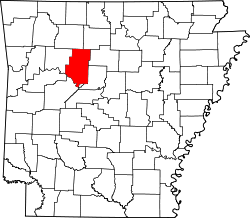
Pope County is a county in the U.S. state of Arkansas. As of the 2020 census, the population was 63,381. The county seat is Russellville. The county was formed on November 2, 1829, from a portion of Crawford County and named for John Pope, the third governor of the Arkansas Territory. Pope County was the nineteenth county formed. The county's borders changed eighteen times in the 19th century with the creation of new counties and adjustments between counties. The current boundaries were set on March 8, 1877.
Pike County is a county located in the U.S. state of Arkansas. As of the 2020 census, the population was 10,171. The county seat is Murfreesboro. Pike County is Arkansas's 25th county, formed on November 1, 1833, and named for Lieutenant Zebulon Pike, the explorer for whom Pikes Peak is named. It is an alcohol prohibition or dry county.
Marion County is located in the Ozark Mountains in the U.S. state of Arkansas. The county is named for Francis Marion, the famous "Swamp Fox" of the Revolutionary War. Created as Arkansas's 35th county in 1836, Marion County is home to one incorporated town and four incorporated cities, including Yellville, the county seat. The county is also the site of numerous unincorporated communities and ghost towns. The county included part of what is now Searcy County, Arkansas, with many opposing to dividing them, which helped fueled the bloody Tutt-Everett War between 1844 and 1850.
Izard County is a county located in the U.S. state of Arkansas. As of the 2020 census, the population was 13,577. The county seat is Melbourne. Izard County is Arkansas's 13th county, formed on October 27, 1825, and named for War of 1812 General and Arkansas Territorial Governor George Izard. It is an alcohol prohibition or dry county.
Howard County is a county located in the U.S. state of Arkansas. As of the 2020 census, the population was 12,785. The county seat is Nashville. Howard County is Arkansas's 74th county, formed on April 17, 1873, and named for James Howard, a state senator. It is a dry county.
Faulkner County is located in the Central Arkansas region of the U.S. state of Arkansas. As of the 2020 census, the population was 123,498, making it the fifth most populous of Arkansas's 75 counties. The county seat and largest city is Conway. Faulkner County was created on April 12, 1873, one of nine counties formed during Reconstruction, and is named for Sandford C. Faulkner, better known as Sandy Faulkner, a popular figure in the state at the time.
Desha County is a county located in the southeast part of the U.S. state of Arkansas, with its eastern border the Mississippi River. At the 2020 census, the population was 11,395. The county seat is Arkansas City.
Conway County is a county located in the U.S. state of Arkansas. Created as Arkansas's 11th county on October 20, 1825, Conway County has four incorporated municipalities, including Morrilton, the county seat and most populous city. The county is also the site of numerous unincorporated communities and ghost towns. The county is named for Henry Wharton Conway, a politician from a powerful political family who served as the delegate from the Arkansas Territory to the U.S. Congress from 1823 to 1827.
The North Fork River or the North Fork of White River is a 109-mile-long (175 km) tributary of the White River, into which it flows near Norfork, Arkansas.
Illinois Township is one of nineteen current townships in Pope County, Arkansas, USA. As of the 2010 census, its total population was 29,813, with 91.8 percent contained in urban Russellville.
Hill Township was a township of Pope County, Arkansas. It was located in the northeast part of the county.
Hogan Township was a township of Pope County, Arkansas. It was located in the central part of the county. Hogan Township was created between 1910 and 1920 using parts from Allen, Jackson, Liberty, Martin and North Fork Townships.
Independence Township is a former township of Pope County, Arkansas. It was located in the northeastern part of the county.
Lee Township is a former township of Pope County, Arkansas. It was located in the southeast corner of the county.
Sand Spring Township is a former township of Pope County, Arkansas. It was located on the western edge of the county.
Sulphur Township is a former township of Pope County, Arkansas. It was located on the northern edge of the county.
Woolsey, Arkansas is an unincorporated community in Crawford Township, Washington County, Arkansas, United States. It is located on U.S. Route 71 between West Fork and Winslow. The community contains the Woolsey Cemetery and Brown Bluff (3WA10), and is the namesake of the Woolsey Bridge, all on the National Register of Historic Places.
Dry Fork Township is one of twenty-one current townships in Carroll County, Arkansas, USA. As of the 2010 census, its total population was 292.