Ovid, Michigan | |
---|---|
City of Ovid | |
Coordinates: 43°00′11″N84°22′27″W / 43.00306°N 84.37417°W Coordinates: 43°00′11″N84°22′27″W / 43.00306°N 84.37417°W [1] | |
Country | United States |
State | Michigan |
Counties | Clinton and Shiawassee |
Founded | 1867 |
Incorporated | 1869 (village) 2015 (city) |
Government | |
• Type | Mayor–council |
• Mayor | William Lasher |
• Clerk | Josefina Medina |
Area | |
• Total | 1.04 sq mi (2.70 km2) |
• Land | 1.01 sq mi (2.62 km2) |
• Water | 0.03 sq mi (0.08 km2) |
Elevation | 725 ft (221 m) |
Population (2020) | |
• Total | 1,481 |
• Density | 1,466.34/sq mi (566.24/km2) |
Time zone | UTC-5 (Eastern (EST)) |
• Summer (DST) | UTC-4 (EDT) |
ZIP code(s) | 48866 |
Area code | 989 |
FIPS code | 26-61860 [3] |
GNIS feature ID | 2399601 [1] |
Website | Official website |
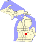
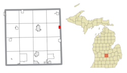
Ovid is a city in the U.S. state of Michigan. Nearly all of the city is located within Clinton County with only a very small portion extending east into Shiawassee County. The population was 1,603 at the 2010 census. [4]
The city is located along M-21, about 9 miles (14 km) east of St. Johns and about 10 miles (16 km) west of Owosso. Ovid incorporated as a city in 2015, making it Michigan's most-recently incorporated city.
Ovid was named after Ovid, New York, the hometown of a settler named William Swarthout who migrated here in the mid-1800s. [5]
According to the United States Census Bureau, the city has a total area of 0.92 square miles (2.38 km2), all land.
The city is located in both Clinton County to the west and Shiawassee County to the east. The vast majority of the city's boundaries are within Clinton County. Only a very small portion extends east of Meridian Street, which serves as the county line. [6] The 2010 census lists all 0.92 square miles (2.38 km2) of Ovid within Clinton County and no land area within Shiawassee County. However, the 2010 census listed six residents out of 1,603 (0.37%) as being in Shiawassee County. [4]
Census | Pop. | Note | %± |
---|---|---|---|
1880 | 1,479 | — | |
1890 | 1,423 | −3.8% | |
1900 | 1,293 | −9.1% | |
1910 | 1,078 | −16.6% | |
1920 | 1,067 | −1.0% | |
1930 | 1,131 | 6.0% | |
1940 | 1,248 | 10.3% | |
1950 | 1,410 | 13.0% | |
1960 | 1,505 | 6.7% | |
1970 | 1,650 | 9.6% | |
1980 | 1,712 | 3.8% | |
1990 | 1,442 | −15.8% | |
2000 | 1,514 | 5.0% | |
2010 | 1,603 | 5.9% | |
2020 | 1,481 | −7.6% | |
U.S. Decennial Census [7] |
As of the census [8] of 2010, there were 1,603 people, 578 households, and 398 families living in the city. The population density was 1,742.4 inhabitants per square mile (672.7/km2). There were 618 housing units at an average density of 671.7 per square mile (259.3/km2). The racial makeup of the city was 95.7% White, 0.4% African American, 0.3% Native American, 0.1% Asian, 0.1% Pacific Islander, 1.3% from other races, and 2.1% from two or more races. Hispanic or Latino of any race were 5.7% of the population.
There were 578 households, of which 41.3% had children under the age of 18 living with them, 43.1% were married couples living together, 18.9% had a female householder with no husband present, 6.9% had a male householder with no wife present, and 31.1% were non-families. 25.6% of all households were made up of individuals, and 10% had someone living alone who was 65 years of age or older. The average household size was 2.63 and the average family size was 3.12.
The median age in the city was 35 years. 29.4% of residents were under the age of 18; 7.7% were between the ages of 18 and 24; 27.2% were from 25 to 44; 20.5% were from 45 to 64; and 15.2% were 65 years of age or older. The gender makeup of the city was 45.6% male and 54.4% female.
As of the census [3] of 2000, there were 1,514 people, 575 households, and 400 families living in the city. The population density was 1,634.9 inhabitants per square mile (631.2/km2). There were 604 housing units at an average density of 652.2 per square mile (251.8/km2). The racial makeup of the city was 96.30% White, 0.13% African American, 0.59% Native American, 0.13% Pacific Islander, 1.25% from other races, and 1.59% from two or more races. Hispanic or Latino of any race were 4.23% of the population.
There were 575 households, out of which 38.1% had children under the age of 18 living with them, 51.1% were married couples living together, 14.8% had a female householder with no husband present, and 30.3% were non-families. 23.5% of all households were made up of individuals, and 8.3% had someone living alone who was 65 years of age or older. The average household size was 2.63 and the average family size was 3.13.
In the city, the population was spread out, with 29.6% under the age of 18, 10.8% from 18 to 24, 29.6% from 25 to 44, 18.5% from 45 to 64, and 11.6% who were 65 years of age or older. The median age was 32 years. For every 100 females, there were 90.2 males. For every 100 females age 18 and over, there were 85.1 males.
The median income for a household in the city was $33,333, and the median income for a family was $38,235. Males had a median income of $33,438 versus $22,083 for females. The per capita income for the city was $15,324. About 10.5% of families and 11.5% of the population were below the poverty line, including 16.9% of those under age 18 and 3.1% of those age 65 or over.
Ovid and nearby Elsie are served by the Ovid-Elsie Area Schools, [9] which operates two elementary schools, one middle school, and one high school.
Clinton County is a county in the U.S. state of Michigan. As of the 2020 Census, the population was 79,128. The county seat is St. Johns. The county was created in 1831 and organized in 1839. It is named after early American politician DeWitt Clinton. Clinton County is included in the Lansing-East Lansing, MI Metropolitan Statistical Area.
Shiawassee County is a county located in the U.S. state of Michigan. As of the 2020 United States Census, the population was 68,094. The county seat is Corunna, and the largest city in the county is Owosso. In 2010, the center of population of Michigan was located in Shiawassee County, in Bennington Township.
Duplain Township is a civil township of Clinton County in the U.S. state of Michigan. The population was 2,363 at the 2010 census.
Elsie is a village in Clinton County in the U.S. state of Michigan. The population was 966 at the 2010 census. The village consists of two noncontiguous portions within Duplain Township in the northeast portion of Clinton County—the smaller of which contains the village's Riverside Cemetery.
Ovid Township is a civil township of Clinton County in the U.S. state of Michigan. As of the 2010 census, the township had a population of 3,795. The population has decreased significantly after the village of Ovid separated from the township and incorporated into a city in 2015.
Victor Township is a civil township of Clinton County in the U.S. state of Michigan. The population was 3,460 at the 2010 census.
Fenton is a city in the U.S. state of Michigan that lies mostly in Genesee County, with small portions in neighboring Oakland County and Livingston County. It is part of the Flint Metropolitan statistical area.
Antrim Township is a civil township of Shiawassee County in the U.S. state of Michigan. As of the 2010 census, the township population was 2,161. The township is believed to be named after either Antrim, Northern Ireland or Antrim, New Hampshire.
Bancroft is a village in Shiawassee County in the U.S. state of Michigan. The population was 545 at the 2010 census. The village is located within Shiawassee Township.
Corunna ( CORE-UN-NUH) is a city and county seat of Shiawassee County in the U.S. state of Michigan. The population was 3,497 at the 2010 census. The city is surrounded by Caledonia Charter Township and is slightly east of the city of Owosso.
Fairfield Township is a civil township of Shiawassee County in the U.S. state of Michigan. As of the 2010 census, the township population was 755.
Laingsburg is a city in Shiawassee County in the U.S. state of Michigan. The population was 1,283 at the 2010 census.
Middlebury Township is a civil township of Shiawassee County in the U.S. state of Michigan. As of the 2010 census, the township population was 1,510.
Perry is a city in Shiawassee County in the U.S. state of Michigan. The population was 2,188 at the 2010 census. The city is surrounded by Perry Township, but the two are administered autonomously.
Rush Township is a civil township of Shiawassee County in the U.S. state of Michigan. The population was 1,291 at the 2010 census.
Shiawassee Township is a civil township of Shiawassee County in the U.S. state of Michigan. The population was 2,840 at the 2010 census.
Vernon is a village in Shiawassee County in the U.S. state of Michigan. The population was 783 at the 2010 census. The village is located within Vernon Township.
Vernon Township is a civil township of Shiawassee County in the U.S. state of Michigan. The population was 4,614 at the 2010 census. The village of Vernon is located within the township. The township also surrounds the city of Durand, but the two are administered autonomously.
Yale is a city in St. Clair County in the U.S. state of Michigan. The population was 1,955 at the 2010 census. Yale is considered unofficially as the Bologna Capital of the world, in part due to its Yale Bologna Festival, which began in 1989. Yale bologna is sold in grocery stores throughout the area. Yale is also home to the Yale Airport, and farms.
Lennon is a village in the U.S. state of Michigan. The population was 511 at the 2010 census. The village is located along M-13 within Venice Township in Shiawassee County to the west and Clayton Township in Genesee County to the east.