McCreary County is a county located in the U.S. state of Kentucky. As of the 2010 census, the population was 18,306. Its county seat is Whitley City. The county is named for James B. McCreary, a Confederate war hero and two-time Governor of Kentucky. During his second term as Governor, McCreary County was created by the Legislature and was named in his honor.

The Amundsen Sea, an arm of the Southern Ocean off Marie Byrd Land in western Antarctica, lies between Cape Flying Fish to the east and Cape Dart on Siple Island to the west. Cape Flying Fish marks the boundary between the Amundsen Sea and the Bellingshausen Sea. West of Cape Dart there is no named marginal sea of the Southern Ocean between the Amundsen and Ross Seas. The Norwegian expedition of 1928–1929 under Captain Nils Larsen named the body of water for the Norwegian polar explorer Roald Amundsen while exploring this area in February 1929.

The Chequamegon–Nicolet National Forest is a 1,530,647-acre (6,194.31 km2) U.S. National Forest in northern Wisconsin in the United States. Much of the old growth forest in this region was destroyed by logging in the early part of the 20th century. Some of the trees that grow there today were planted by the Civilian Conservation Corps in the 1930s. The national forest lands contain trees and vegetation corresponding to the North Woods Ecoregion that is prevalent throughout the upper Great Lakes region.

Saco Bay is a small curved embayment of the Gulf of Maine on the Atlantic coast of Maine in the United States. The name derives "from a map of the coastline made in 1525 by the Spanish explorer Esteban Gómez. He named the bay Bahio de Saco ."

Quetico Provincial Park is a large wilderness park in Northwestern Ontario, Canada, known for its excellent canoeing and fishing. The 4,760 km2 (1,180,000-acre) park shares its southern border with Minnesota's Boundary Waters Canoe Area Wilderness, which is part of the larger Superior National Forest. These large wilderness parks are often collectively referred to as the Boundary Waters or the Quetico-Superior Country.
Pine Ridge is an unincorporated community in Oden Township, Montgomery County, Arkansas, United States. It is located at 34°35′9″N93°54′36″W.

The ensign of the United States is the flag of the United States when worn as an ensign. International maritime law—see International Treaty on Law of the Sea, articles 91 and 92—provides that vessels have a "national character" and thus should display a flag (ensign) that corresponds to this national character, especially when in international or foreign waters. Vessels that are formally documented under the federal vessel documentation act, vessels owned by government bodies in the United States, and vessels in the U.S. military unquestionably have U.S. national character, and thus properly hoist a U.S. ensign to show their national character. Vessels that are numbered by the states and small, non-registered craft owned by U.S. citizens and not registered in other countries may also hoist a U.S. ensign to show their national character.
KCLA was an American radio station licensed to serve the community of Pine Bluff, Arkansas, United States. The station was most recently owned by Community Broadcast Group Inc., and the broadcast license held by M.R.S. Ventures, Inc. When it went off the air permanently in early 2007, KCLA broadcast programming from Fox Sports, Westwood One, Hog Sports Talk, and ESPN Radio in a sports radio format branded as "The Fan, SportsRadio 1400".
Pine Creek is a tributary of Mahantango Creek in Schuylkill and Dauphin counties, Pennsylvania, in the United States. It is approximately 23.7 miles (38.1 km) long. The creek flows through Foster Township, Hegins Township, Hubley Township, and Upper Mahantango Township in Schuylkill County and Lykens Township in Dauphin County. The creek's watershed has an area of 76.8 square miles (199 km2) and its tributaries include Rausch Creek and Deep Creek. Pine Creek is considered by the Pennsylvania Department of Environmental Protection to be impaired by abandoned mine drainage and resource extraction. However, it is designated as a coldwater fishery.

Little Pine Creek is a tributary of Pine Creek in Lycoming County, Pennsylvania, in the United States. It is approximately 15.8 miles (25.4 km) long and flows through Pine Township and Cummings Township.

Little Pine State Park is a Pennsylvania state park on 2,158 acres (873 ha) in Cummings Township, Lycoming County, Pennsylvania in the United States. Little Pine State park is along 4.2 miles (6.8 km) of Little Pine Creek, a tributary of Pine Creek, in the midst of the Tiadaghton State Forest. A dam on the creek has created a lake covering 94 acres (38 ha) for fishing, boating, and swimming. The park is on Pennsylvania Route 4001, 4 miles (6.4 km) northeast of the unincorporated village of Waterville or 8 miles (13 km) southwest of the village of English Center. The nearest borough is Jersey Shore, Pennsylvania, about 15 miles (24 km) south at the mouth of Pine Creek on the West Branch Susquehanna River.

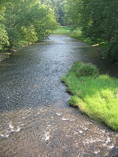
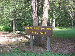
Upper Pine Bottom State Park is a 5-acre (2.0 ha) Pennsylvania state park in Lycoming County, Pennsylvania in the United States. The park is in Cummings Township on Pennsylvania Route 44 and is surrounded by the Tiadaghton State Forest. It is on Upper Pine Bottom Run, which gave the park its name and is a tributary of Pine Creek. Upper Pine Bottom State Park is in the Pine Creek Gorge, where the streams have cut through five major rock formations from the Devonian and Carboniferous periods.
The Dan Hole River is a 5.1-mile (8.2 km) long river in the town of Ossipee in eastern New Hampshire in the United States. Its waters flow via the Beech River, Pine River, Ossipee Lake, the Ossipee River, and the Saco River to the Gulf of Maine, an arm of the Atlantic Ocean.

McCalls Dam State Park is a Pennsylvania state park on 8 acres (3.2 ha) in Miles Township, Centre County, Pennsylvania in the United States. The park is in the easternmost tip of Centre County, south of Clinton County and north of Union County. McCalls Dam State Park is in a remote location on a gravel road between R. B. Winter State Park on Pennsylvania Route 192 and Eastville on Pennsylvania Route 880. The park can only be accessed in the winter months by snowmobiling or cross-country skiing.

The natural history of Minnesota covers many plant and animal species in the U.S. state of Minnesota. The continental climate and location of Minnesota at the physiographic intersection of the Laurentian and the Interior Plains influences its plant and animal life. Three of North America's biomes converge in Minnesota: prairie grasslands in the southwestern and western parts of the state, the eastern temperate deciduous forests in the east-central and the southeast and the coniferous forest in the north-central and northeast.

Winnecunnet Pond or Winneconnet Pond or Winnecunnett Pond, very often called Lake Winnecunnet or Lake Winneconnet or Lake Winnecunnett although it is a pond rather than a lake, is a body of water in Norton, Massachusetts, United States.
Lac la Croix Research Natural Area is a natural area that is protected by the United States Department of Agriculture, specifically through the branch of the Forest Service. It was established in 1942 and consists of 973 acres (3.94 km2) of land. It is located in St. Louis County, Minnesota and is part of the Superior National Forest.

The Burntside State Forest is a state forest located near the town of Ely in Lake and Saint Louis counties, Minnesota. 82% of the forest land falls within the limits of the Boundary Waters Canoe Area Wilderness to the north which belongs to the Superior National Forest, and thus falls under the federal jurisdiction of the United States Forest Service.

The Jeanette State Forest is a state forest located in St. Louis County, Minnesota. The forest is within the limits of the Superior National Forest's Boundary Waters Canoe Area Wilderness, and thus falls under the federal jurisdiction and management of the United States Forest Service.

Three Waters Mountain is located in the northern Wind River Range in the U.S. state of Wyoming. Three Waters Mountain straddles the Continental Divide and is in both Bridger-Teton and Shoshone National Forests. The mountain receives its name from being the triple point between the watersheds of the Colorado, Columbia, and Mississippi Rivers.


