
Pohick Bay Regional Park is a regional park on Pohick Bay of the Potomac River, in Fairfax County, in Northern Virginia.
Pohick Bay Regional Park is a regional park on Pohick Bay of the Potomac River, in Fairfax County, in Northern Virginia.
The park is located on State Route 242, north of Mason Neck State Park.
It is protected and operated by the NOVA Parks agency of Northern Virginia, formerly the Northern Virginia Regional Park Authority.
Pohick Bay Regional Park includes a boat launch; and the Pirate's Cove water park.
38°40′30″N77°10′37″W / 38.675°N 77.177°W
| | This Fairfax County, Virginia state location article is a stub. You can help Wikipedia by expanding it. |

West Springfield is a census-designated place (CDP) in Fairfax County, Virginia, United States. The population was 23,369 at the 2020 census.

Haymarket is a town in Prince William County, Virginia, United States. The population was 1,545 as of the 2020 census.
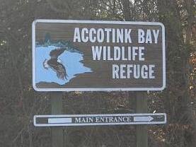
Accotink Bay Wildlife Refuge is a nature preserve on the grounds of Fort Belvoir in Fairfax County, Virginia, United States. Several other parks, including Mason Neck State Park, Pohick Bay Regional Park, and the Jackson Miles Abbott Wetland Refuge are located nearby.

The Fairfax County Parkway, numbered State Route 286, is a primary state highway in the U.S. state of Virginia, acting as an expressway in Fairfax County with a mix of interchanges and signalized and unsignalized intersections. Its alignment runs from southeast to northwest and roughly corresponds to part of the once-proposed Outer Beltway around Washington, D.C. The first segment of the roadway opened in 1987; the road was completed in 2010.

The Washington and Old Dominion Railroad Regional Park is a linear regional park in Northern Virginia. The park's primary feature is the Washington and Old Dominion Railroad Trail, an asphalt-surfaced paved rail trail that runs through densely populated urban and suburban communities as well as through rural areas. Most of the trail travels on top of the rail bed of the former Washington and Old Dominion Railroad, which closed in 1968.
NOVA Parks is an inter-jurisdictional organization that owns and operates more than 10,000 acres of woodlands, streams, parks, trails, nature reserves, countryside and historic sites in Northern Virginia in the United States. The Authority was organized in 1959. NOVA Parks presently operates 34 regional parks.

Four Mile Run is a 9.4-mile-long (15.1 km) stream in Northern Virginia that starts near Interstate 66, at Gordon Avenue in Fairfax County and proceeds southeast through Falls Church to Arlington County in the U.S. state of Virginia. Most of the stretch is parkland and is paralleled by two paved non-motorized transport and recreational trails, the Washington and Old Dominion Railroad Trail and the Four Mile Run Trail.

Mason Neck is a peninsula jutting into the Potomac River in Fairfax County, Virginia, southwest of Washington, D.C.. It is surrounded by Belmont Bay to the west, the Potomac River to the south and east, Gunston Cove to the northeast, and Pohick Bay to the north-northeast. Mason Neck forms the southernmost section of Fairfax County in Northern Virginia. It comprises an area of 20.0 square miles (51.8 km2), two-thirds of which is preserved as parkland by regional, state, and national authorities. The population of the Mason Neck CDP was 2,005 as of the 2010 census.

The Great Falls and Old Dominion Railroad (GF&OD) was an interurban trolley line that ran in Northern Virginia during the early 20th century.

State Route 242 is a primary state highway in the U.S. state of Virginia. Known as Gunston Road, the state highway runs 3.58 miles (5.76 km) from U.S. Route 1 near Lorton east to SR 600 at the entrance to Gunston Hall, the plantation of George Mason, on Mason Neck in southeastern Fairfax County.

Mason Neck State Park is located in Fairfax County, Virginia. The park is on a peninsula formed by Pohick Bay on the north, Belmont Bay on the south and the Potomac River to the east, which was once known as "Dogue Neck" but now as "Mason Neck". The park adjoins the Elizabeth Hartwell Mason Neck National Wildlife Refuge and encompasses 1,814 acres (7.34 km2). It is home to bald eagles, great blue herons, ospreys, and many other types of wildlife. The park also contains white-tailed deer and many species of lichen.
The Piney River is an 8.3-mile-long (13.4 km) river in the U.S. state of Virginia. Rising in the northern part of Shenandoah National Park, it is a tributary of the Thornton River, and via the Hazel and Rappahannock rivers is part of the Chesapeake Bay watershed.
Bull Run Regional Park is a 1,568-acre (635 ha) multi-use facility located in Centreville, Virginia, owned and operated by the Northern Virginia Regional Park Authority.
Gunston Cove is an inlet of the Potomac River, at the confluence of Accotink Creek and Pohick Creek in Northern Virginia. The Cove forms the northern boundary of Mason Neck, once home to the revolutionary hero George Mason and now site of several regional parks and the Mason Neck National Wildlife Refuge.

Occoquan Regional Park is a regional park along a tributary of the Potomac River, located in Lorton in Fairfax County in Northern Virginia, USA.
Upton Hill Regional Park is a regional park located in Arlington, Northern Virginia. The park contains a waterpark, batting cages and a miniature golf course. The batting cages include nine baseball and softball cages. It is owned and operated by the NOVA Parks agency of Northern Virginia.
Algonkian Regional Park is located on the Potomac River in Sterling, Virginia at Cascades, Virginia. The 838-acre park is owned and operated by the Northern Virginia Regional Park Authority and contains open fields, picnic shelters, rental cottages, an event center for weddings and meetings, a boat launch with access to the Potomac River, the Volcano Island water park open from May to September, and an 18-hole golf course. The park is bisected by the Potomac Heritage Trail.

Widewater State Park is a state park on a 1,100 acres (450 ha) peninsula in the Potomac River in Stafford County, Virginia. It and Leesylvania State Park to the north on Occoquan Bay, and several wildlife refuges and regional parks are on the Captain John Smith Chesapeake National Historic Trail. Current facilities include a visitor center and staff building along Aquia Creek, as well as picnic shelters, children's play areas and canoe launches on both sides of the peninsula and a soft boat launch and campgrounds.
The Turning Point Suffragist Memorial is a monument to American suffragists. The memorial is located in Lorton, Virginia's Occoquan Regional Park and stands in close proximity to Occoquan Workhouse, a prison where 168 suffragists were once held during the 1910s Silent Sentinels demonstrations.