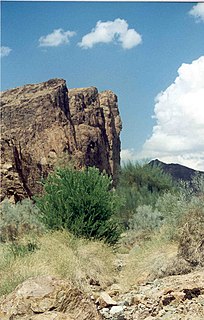
Red Mountain is a long ridge running southwest-northeast and dividing Jones Valley from Shades Valley south of Birmingham, Alabama. It is part of the Ridge-and-Valley region of the Appalachian mountains. The Red Mountain Formation of hard Silurian rock strata lies exposed in several long crests, and was named "Red Mountain" because of the rust-stained rock faces and prominent seams of red hematite iron ore. The mountain was the site of the Sloss Mines, which supplied ore to Birmingham's iron furnaces. The best displays of the mountain's geological strata occur at the Twentieth Street cut near the Vulcan statue and at the U.S. Route 31 highway cut leading into the suburb of Homewood. Most of Birmingham's television and radio stations have their transmission towers located on Red Mountain.

The Modoc National Forest is a 1,654,392-acre (6,695 km2) national forest in northeastern California.

Klamath National Forest is a 1,737,774-acre national forest, in the Klamath Mountains and Cascade Range, located in Siskiyou County in northern California, but with a tiny extension into southern Jackson County in Oregon. The forest contains continuous stands of ponderosa pine, Jeffrey pine, Douglas fir, red fir, white fir, lodgepole pine, Baker Cypress, and incense cedar. Old growth forest is estimated to cover some 168,000 acres (680 km2) of the forest land. Forest headquarters are located in Yreka, California. There are local ranger district offices located in Fort Jones, Happy Camp, and Macdoel, all in California. The Klamath was established on May 6, 1905. This forest includes the Kangaroo Lake and the Sawyers Bar Catholic Church is located within the boundaries of the Forest. The Forest is managed jointly with the Butte Valley National Grassland.

The Chemehuevi Mountains are found at the southeast border of San Bernardino County in southeastern California adjacent the Colorado River. Located south of Needles, California and northwest of the Whipple Mountains, the mountains lie in a north-south direction in general, and are approximately 15 miles in length.

The Zuni Mountains are a mountain range located mainly in Cibola County of northwestern New Mexico, with a small portion extending into McKinley County. The range is located largely in the Cibola National Forest, lying south of Interstate 40 from southeast of Gallup to southwest of Grants. The range is about sixty miles (97 km) long and forty miles (64 km) wide. The highest point is Mount Sedgwick, 9,256 feet ; elevations in the range go down to 6,400 feet.

Black Cap is a mountain located in the town of Conway, New Hampshire, United States. It is located between Kearsarge North Mountain and Peaked Mountain. The rocky summit provides views of Maine and New Hampshire's White Mountains. Cranmore Mountain Resort is located on its western subpeak, Cranmore Mountain.

The Yunnan–Guizhou Plateau or Yungui Plateau is a highland region located in southwest China. The region is primarily spread over the provinces of Yunnan and Guizhou. In the southwest, the Yungui is a true plateau with relatively flatter highland areas, while in the northeast, the Yungui is a generally mountainous area of rolling hills, gorges, and karst topography.

The Muggins Mountains is a mountain range in southwest Arizona east of Yuma, Arizona, northeast of the Gila Mountains, and east of the Laguna Mountains. The Castle Dome Mountains lie to the northeast across the broad Castle Dome Plain. The Muggins Mountains Wilderness occupies the southwest portion of the range.
Misery Mountain, 2,671 feet (814 m), with at least ten well-defined summits, is a prominent 6 mi (9.7 km) long ridgeline in the Taconic Mountains of western Massachusetts and adjacent New York. The west side of the mountain is located in New York; the east side and high point lie within Massachusetts. The summit ridge is part meadow and part wooded with red spruce, balsam fir, and northern hardwood tree species. It is notable for its views of the Hudson River Valley to the west. The 35 mi (56 km) Taconic Crest Trail traverses the crest of the ridgeline, but does not cross the summit.

The Paint Hills Islands are located in James Bay, a part of the Qikiqtaaluk Region, in the Canadian territory of Nunavut. They are southwest of Wemindji, Quebec, a Cree community on Paint Hills Bay, and northeast of Solomons Temple Islands.

Cinco is an unincorporated community in Kern County, California.

Not to be confused with Red Mountain Wilderness (Nevada), which is a separate entity

Spanish Oak Mountain is a mountain in the North Carolina High Country, located southwest from the town of Newland. Its elevation reaches 4,531 ft (1,381 m). Most feeder streams from the mountain flow to the North Toe River; except for White Pine Creek, from its southeastern slope, which flows to the Linville River. The mountain is partitioned by the Eastern Continental Divide.

The Whipple Mountains Wilderness is a 76,122-acre (30,805 ha) wilderness administered by the Bureau of Land Management (BLM). Most of the Whipple Mountains are within the wilderness area. It is located in the northeastern Colorado Desert near the Colorado River. Lake Havasu and Lake Havasu City are 25 miles (40 km) to the North. Earp, California and Parker, Arizona are 20 miles (32 km) to the South. The Parker Dam is 8 miles (13 km) due east.

The Big Burro Mountains are a moderate length 35-mile (56 km) long, mountain range located in central Grant County, New Mexico. The range's northwest-southeast 'ridgeline' is located 15 mi southwest of Silver City.

The South Fork Eel River Wilderness is a 12,868-acre (5,207 ha) wilderness area located in Mendocino County, California. The wilderness was added to the National Wilderness Preservation System when the United States Congress passed the Northern California Coastal Wild Heritage Wilderness Act in 2006. The Department of the Interior's Bureau of Land Management (BLM) is the agency in charge.

The Moccasin Mountains is an 11-mile-long (18 km) mountain range located at the Arizona–Utah border in Mohave County, Arizona, and a small north section in Kane County, Utah.

Red House Hill is a mountain in the Central New York Region of New York. It is located south-southwest of the Hamlet of Springfield Center, New York, west of Hutter Point and Six Mile Point of Otsego Lake, and southeast of Rum Hill. Mohican Brook flows eastward along the southern edge of the hill.

Red Ridge Hill is a mountain located in Central New York region of New York southwest of Milford, New York.

Richtmyer Peak is a mountain in Greene County, New York and partly in Schoharie County, New York. It is located in the Catskill Mountains southwest of West Durham. Mount Pisgah is located east, and Richmond Mountain is located southwest of Richtmyer Peak.


