Rushville, New York | |
---|---|
Coordinates: 42°45′40″N77°13′34″W / 42.76111°N 77.22611°W | |
Country | United States |
State | New York |
Counties | Yates, Ontario |
Settled | 1790 |
Incorporated | April 24, 1866 |
Named for | Benjamin Rush |
Area | |
• Total | 0.68 sq mi (1.75 km2) |
• Land | 0.68 sq mi (1.75 km2) |
• Water | 0.00 sq mi (0.00 km2) |
Elevation | 876 ft (267 m) |
Population (2020) | |
• Total | 651 |
• Density | 961.60/sq mi (371.54/km2) |
Time zone | UTC-5 (Eastern (EST)) |
• Summer (DST) | UTC-4 (EDT) |
ZIP code | 14544 |
Area code | 585 |
FIPS code | 36-64199 |
GNIS feature ID | 0963107 |
Website | www |
Rushville is a village situated in both Ontario and Yates Counties in the U.S. state of New York. As of the 2019 American Community Survey, the population was 655. The majority of the Village of Rushville lies within the Town of Potter in Yates County, while a smaller portion extends into the Town of Gorham in Ontario County. It is one of two villages in Ontario County that spans across two townships and the only village in the county divided between two counties. [2]
Rushville was initially known as Federal Hollow, a name derived from its early settlers affinity for the Federalist political party, and its location within one of Canandaigua Lake's many hollows, or valleys. Elias Gilbert became the first settler in the area, and established one of the first saw mills on the West River in 1800. [3]
The community was renamed Rushville in 1819, upon the establishment of a Post Station. [4] The new name was chosen in honor of Dr. Benjamin Rush, a hero of the American Revolution, at the suggestion of local doctor Ira Bryant. Chester Loomis was appointed to be the first chestmaster.
The Milton Wilson House, a historic landmark, was listed on the National Register of Historic Places in 1994. [5]
In 2017, the village residents voted against dissolution, with 179 votes against and 96 in favor. [6]
Rushville is located at 42°45′40″N77°13′34″W / 42.76111°N 77.22611°W (42.761136, -77.226177). [6]
According to the United States Census Bureau, the village has a total area of 0.6 square miles (1.7 km2), all land.
Rushville is in the Finger Lakes District of New York and lies between Canandaigua Lake and Seneca Lake. The West River flows southwest through the village.
Marcus Whitman Middle/High School is located just outside Rushville.
New York State Route 245 and New York State Route 247, pass, partly conjoined, through the Village of Rushville.
Census | Pop. | Note | %± |
---|---|---|---|
1880 | 503 | — | |
1890 | 450 | −10.5% | |
1900 | 416 | −7.6% | |
1910 | 463 | 11.3% | |
1920 | 541 | 16.8% | |
1930 | 452 | −16.5% | |
1940 | 428 | −5.3% | |
1950 | 465 | 8.6% | |
1960 | 465 | 0.0% | |
1970 | 568 | 22.2% | |
1980 | 548 | −3.5% | |
1990 | 609 | 11.1% | |
2000 | 621 | 2.0% | |
2010 | 677 | 9.0% | |
2020 | 651 | −3.8% | |
U.S. Decennial Census [7] |
According to 2019 American Community Survey, [8] there were 655 people, 237 households, and 155 families residing in the village. The population density was 1026 people per square mile. There were 313 housing units. The racial makeup of the village was 96.8% White, 1.1% African American, 0% Native American, 0% Asian, and 0.3% two or more races. Hispanic or Latino of any race were 1.8% of the population.
There were 237 households, out of which 30.4% had children under the age of 18 living with them. 60.3% were married couples living together, 15.3% had a female householder with no husband present, and 19.9% were non-families. 24.1% of all households were made up of individuals, and 48.5% of households had one or more people 60 years of age and over. The average household size was 2.7.
In the village, the population was spread out, with 22% under the age of 18, 12% from 20 to 29, 14% from 30 to 39, 10% from 40 to 49, 13% from 50 to 59, and 16% from 60 to 69. Overall, 17% of Rushville's population is 65 and older. The average age of a Rushville citizen is 39.7 years old.
The per capita income for a household in the village was $27,359, and the median income for a family was $43,047. Males had a median income of $30,833 versus $27,961 for females. About 6.1% of families and 10.1% of the population were below the poverty line. 33.4% of the village has a high school education, with another 34.8marcu % completing some college. 9.4% have completed a bachelor's degree.
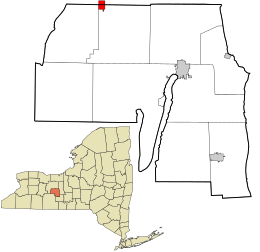
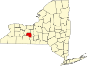
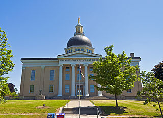
Ontario County is a county in the U.S. State of New York. As of the 2020 census, the population was 112,458. The county seat is Canandaigua. The county is part of the Finger Lakes region of the state.
Sheridan County is a county in the U.S. state of Nebraska. As of the 2020 United States Census, the population was 5,127. Its county seat is Rushville. The county was formed in 1885, and was named for General Philip H. Sheridan.
Sinclairville is a village in Chautauqua County, New York, United States. The population was 578 at the 2020 census. The village is named after Major Samuel Sinclear, its founder. Sinclairville is north of Jamestown and is on the border of the towns of Charlotte and Gerry.
Bloomfield is a village in Ontario County, New York, United States. The population was 1,361 at the 2010 census.
Bristol is a town in Ontario County, New York, United States. The population was 2,298 at the 2020 census. Bristol was named after Bristol County, Massachusetts, by settlers from New England. The town of Bristol is in the western half of the county, southwest of the city of Canandaigua.
East Bloomfield is a town in Ontario County, New York, United States. The population was 3,661 at the 2020 census.
Gorham is a town in Ontario County, New York, United States. The population was 4,130 at the 2020 census. The town is named after Nathaniel Gorham.
Hopewell is a town in Ontario County, New York, United States. The population was 3,931 at the 2020 census.
Richmond is a town in Ontario County, New York, United States. The population was 3,380 at the 2020 census. The town is named after Abigail Richmond Pitts, an early settler. The town of Richmond is on the western border of the county, south of Rochester.
Shortsville, officially the Village of Shortsville, is a village in Ontario County, New York, United States. The population was 1,439 at the time of the 2010 U.S. Census. Shortsville encompasses the southwestern part of the Town of Manchester and is located north of the City of Canandaigua.
South Bristol is a town in Ontario County, New York, United States. The population was 1,651 at the 2020 census. The name is derived from its separation from the Town of Bristol.
West Bloomfield is a town in Ontario County, New York, United States. The population was 2,760 at the 2020 census.
Italy is a town located in Yates County, New York, United States. As of the 2010 census, the town had a total population of 1,141. The town takes its name from the country of Italy.
Middlesex is a town in Yates County, New York, USA. The population was 1,495 at the 2010 census. The name originates from a historic region of the UK.
Canandaigua is a town in Ontario County, New York, United States. The population was 11,109 at the 2020 census.
Canandaigua is a city in Ontario County, New York, United States. Its population was 10,545 at the 2010 census. It is the county seat of Ontario County; some administrative offices are at the county complex in the adjacent town of Hopewell.
Naples is a village in Ontario County, New York, United States. The population was 1,041 at the 2010 census. It is a part of the Town of Naples, known as an important grape-growing region.
Naples is a town in Ontario County, New York, United States. The population was 2,417 at the 2020 census.
Phelps is a village in Ontario County, New York, United States. The population was 1,989 at the 2010 census. The village is named after an original proprietor, Oliver Phelps.
Kanadaseaga, was a major village, perhaps a capital, of the Seneca nation of the Iroquois Confederacy in west-central New York State, United States. It was located between the northern ends of Seneca and Canandaigua lakes, one and a half miles northwest of the present-day city of Geneva in the township of Seneca. The village was situated on both sides of Kanadaseaga Creek. The Seneca established this village at least as early as 1687. It was likely established by the former residents of Ganondagan, after its destruction by the French.
{{cite web}}
: |first=
has generic name (help){{cite web}}
: |first=
has generic name (help){{cite web}}
: |first=
has generic name (help){{cite web}}
: |last=
has generic name (help)Media related to Rushville, New York at Wikimedia Commons