Russell, New York

Last updated

Russell, New York
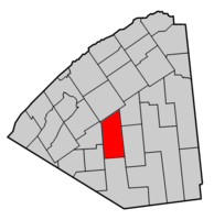
Russell NY Locator Map.png
Map highlighting Russell's location within St. Lawrence County.
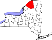
New York Adirondack.svg
Red pog.svg
Russell, New York
Location within the state of New York
Coordinates: 44°24′11″N75°8′28″W / 44.40306°N 75.14111°W / 44.40306; -75.14111
CountryUnited States
State New York
County St. Lawrence
Area
[1]
  Total97.29 sq mi (251.99 km2)
  Land96.49 sq mi (249.92 km2)
  Water0.80 sq mi (2.07 km2)
Elevation
823 ft (251 m)
Population
 (2010)
  Total1,856
  Estimate 
(2016) [2]
1,804
  Density18.70/sq mi (7.22/km2)
Time zone UTC-5 (Eastern (EST))
  Summer (DST) UTC-4 (EDT)
FIPS code 36-64221
GNIS feature ID0979442

Russell is a town in St. Lawrence County, New York, United States. The population was 1,856 at the 2010 census. The town is named after Russell Attwater, the pioneer land owner.

Contents

The Town of Russell is centrally located in the county and is south of Canton.

History

The town land was purchased by Russell Atwater in 1798. The town was first settled in 1805.

Russell Attwater was elected the first town supervisor, when the town was formed in 1807 from Hopkinton from previously named townships: Dewitt, Ballybean and Sarahsburg. In 1813 and 1816, part of Russell was removed to form the Town of Fowler. More of Russell was taken to form, in whole or part, the Towns of Rossie (1813), Pierrepont (1818), and Fine (1849).

During the War of 1812, an arsenal was located in the town near Russell village. Sold in 1865, it served as a school for many years. The Arsenal was destroyed by fire in 1945.

The Russell Town Hall was listed on the National Register of Historic Places in 1996. [3]

Notable people

Geography

According to the United States Census Bureau, the town has a total area of 97.3 square miles (252 km2), of which 96.8 square miles (251 km2) is land and 0.5 square miles (1.3 km2) (0.54%) is water.

The Grasse River flows northward through the town.

Demographics

Historical population
CensusPop.Note
1820 486
1830 65935.6%
1840 1,373108.3%
1850 1,80831.7%
1860 2,38031.6%
1870 2,68812.9%
1880 2,403−10.6%
1890 2,132−11.3%
1900 2,067−3.0%
1910 1,842−10.9%
1920 1,757−4.6%
1930 1,585−9.8%
1940 1,529−3.5%
1950 1,472−3.7%
1960 1,5887.9%
1970 1,586−0.1%
1980 1,6383.3%
1990 1,7164.8%
2000 1,8015.0%
2010 1,8563.1%
2016 (est.)1,804 [2] −2.8%
U.S. Decennial Census [4]

As of the census [5] of 2000, there were 1,801 people, 650 households, and 482 families residing in the town. The population density was 18.6 people per square mile (7.2/km2). There were 854 housing units at an average density of 8.8 per square mile (3.4/km2). The racial makeup of the town was 99.00% White, 0.17% African American, 0.22% Native American, 0.22% Asian, 0.06% from other races, and 0.33% from two or more races. Hispanic or Latino of any race were 0.11% of the population.

There were 650 households, out of which 39.8% had children under the age of 18 living with them, 59.2% were married couples living together, 8.9% had a female householder with no husband present, and 25.8% were non-families. 19.4% of all households were made up of individuals, and 8.3% had someone living alone who was 65 years of age or older. The average household size was 2.77 and the average family size was 3.14.

In the town, the population was spread out, with 29.4% under the age of 18, 7.5% from 18 to 24, 30.0% from 25 to 44, 23.2% from 45 to 64, and 9.9% who were 65 years of age or older. The median age was 35 years. For every 100 females, there were 99.4 males. For every 100 females age 18 and over, there were 99.1 males.

The median income for a household in the town was $31,080, and the median income for a family was $36,118. Males had a median income of $31,927 versus $22,895 for females. The per capita income for the town was $13,530. About 15.7% of families and 19.2% of the population were below the poverty line, including 27.1% of those under age 18 and 8.4% of those age 65 or over.

Communities and locations in Russell

Related Research Articles

<span class="mw-page-title-main">Bleecker, New York</span> Town in New York, United States

Bleecker is a town in Fulton County, New York, United States. The population was 533 at the 2010 census. The name is from Barent Bleecker, one of the original landowners of the region.

<span class="mw-page-title-main">Litchfield, New York</span> Town in New York, United States

Litchfield is a town in Herkimer County, New York, United States. The population was 1,513 at the 2010 census. The town is named after Litchfield, Connecticut, the source of some early settlers of the city.

Worth is a town in Jefferson County, New York, United States. The population was 231 at the 2010 census. The town is named after William Worth, a commander of troops during the Battle of Sackett's Harbor.

Watson is a town in Lewis County, New York, United States. The population was 1,881 at the 2010 census. The town is named after early landowner James Watson. The town is at the eastern border of the county and is east of Lowville, the county seat.

<span class="mw-page-title-main">Royalton, New York</span> Town in New York, United States

Royalton is a town in Niagara County, New York, United States. The population was 7,660 at the 2010 census.

<span class="mw-page-title-main">Vienna, New York</span> Town in New York, United States

Vienna is a town in Oneida County, New York, United States. The population was 5,440 at the 2010 census. The town is named after the capital of Austria.

<span class="mw-page-title-main">Hastings, New York</span> Town in New York, United States

Hastings is a town in Oswego County, New York, United States. Its population was 9,450 at the 2010 census. It is named after Hastings Curtiss, a prominent citizen and member of the State Assembly in 1824.

<span class="mw-page-title-main">Clare, New York</span> Town in New York, United States

Clare is a town in St. Lawrence County, New York, United States. The population was 105 at the 2010 census.

<span class="mw-page-title-main">De Kalb, New York</span> Town in New York, United States

DeKalb is a town in St. Lawrence County, New York, United States. The population was 2,434 at the 2010 census. The town is named after American general Baron de Kalb, a German officer serving under George Washington.

<span class="mw-page-title-main">Fowler, New York</span> Town in New York, United States

Fowler is a town in St. Lawrence County, New York, United States. The population was 2,202 at the 2010 census.

<span class="mw-page-title-main">Louisville, New York</span> Town in New York, United States

Louisville is a town in St. Lawrence County, New York, United States. The population was 3,145 at the 2010 census. The town is reportedly named after French king Louis XIV, but is pronounced as "Lewis-ville."

<span class="mw-page-title-main">Madrid, New York</span> Town in New York, United States

Madrid is a town in St. Lawrence County, New York. The population was 1,735 at the time of the 2010 census. The town is named after the capital of Spain. Madrid is in the northern part of the county, north of Canton.

<span class="mw-page-title-main">Rossie, New York</span> Town in New York, United States

Rossie is a town in St. Lawrence County, New York, United States. The population was 877 at the 2010 census. The town is named after the sister of an early land owner.

<span class="mw-page-title-main">Galen, New York</span> Town in New York, United States

Galen is a town in Wayne County, New York, United States. The population was 4,290 at the 2010 census. The town is named after the classical physician Galen.

Broadalbin is a town in Fulton County, New York, on the eastern border of the county and northwest of Albany. The town was named after the Breadalbane Region in Scotland by an early settler. The town contains a village also called Broadalbin. The population was 5,260 at the 2010 census.

<span class="mw-page-title-main">Adams, New York</span> Town in New York, United States

Adams is a town in Jefferson County, New York, United States. Named after President John Adams, the town had a population of 5,143 at the 2010 census. The town contains a village also named Adams. The village and town are south of Watertown.

<span class="mw-page-title-main">Phelps, New York</span> Town in New York, United States

Phelps is a town in Ontario County, New York, United States. The population was 6,637 at the 2020 census. The Town of Phelps contains a village called Phelps. Both are north of Geneva.

Waddington is a town in St. Lawrence County, New York, United States. The population was 2,266 at the 2010 census. The town was named after its principal village.

<span class="mw-page-title-main">Cobleskill, New York</span> Town in New York, United States

Cobleskill is a town in Schoharie County, New York, United States. The population was 6,086 at the 2020 census. The town contains a village, also named Cobleskill, as well as the State University of New York at Cobleskill.

Groton is a town in Tompkins County, New York, United States. The population was 5,950 at the 2010 census. The name is taken from Groton, Massachusetts.

References

  1. "2016 U.S. Gazetteer Files". United States Census Bureau. Retrieved July 5, 2017.
  2. 1 2 "Population and Housing Unit Estimates" . Retrieved June 9, 2017.
  3. "National Register Information System". National Register of Historic Places . National Park Service. March 13, 2009.
  4. "Census of Population and Housing". Census.gov. Retrieved June 4, 2015.
  5. "U.S. Census website". United States Census Bureau . Retrieved January 31, 2008.