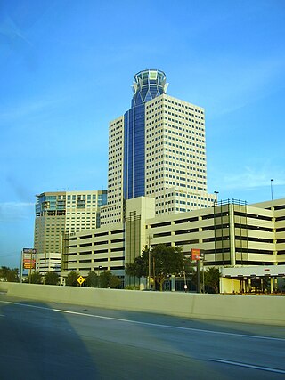
Highland is a town in Lake County, Indiana, United States. The population was 23,984 at the 2020 census. The town was incorporated on April 4, 1910. It is a part of the Chicago metropolitan area and North Township, and is surrounded by Hammond to the north, Munster to the west, Schererville to the south and Griffith to the east.
Anderson Mill is a neighborhood of Austin and a former census-designated place (CDP) in Travis and Williamson counties in the U.S. state of Texas. The population was 7,199 at the 2010 census.

Highland Park is a neighborhood in Los Angeles, California, located in the city's Northeast region. It was one of the first subdivisions of Los Angeles and is inhabited by a variety of ethnic and socioeconomic groups.

The Memorial area of Houston, Texas is located west of Downtown, northwest of Uptown, and south of Spring Branch. The Memorial Super Neighborhood, as defined by the City of Houston, is bounded by Buffalo Bayou to the south, Barker Reservoir to the west, Westview to the north, and the Memorial Villages, a contiguous group of independent municipalities, to the east.

Highland Park is a neighborhood in the southwestern corner of Saint Paul, Minnesota, United States. Also known as Highland District Council, it lies along the Mississippi River just north of Fort Snelling and across the river from Minneapolis–Saint Paul International Airport. According to the 2000 census Highland Park had a population of 23,202.

The El Paso Independent School District is the largest school district serving El Paso, Texas (USA). Originally organized in 1883, it is currently the largest district in the Texas Education Agency's Educational Service Center (ESC) Region 19, as well as the largest district within the city of El Paso and El Paso County. The EPISD also provides public education to the children of U.S. Army soldiers stationed at Fort Bliss. The district headquarters are located in El Paso.
Greenland Hills is a neighborhood in east Dallas, Texas, United States. It is bounded on the west by North Central Expressway, on the south by Vanderbilt Avenue, on the east by Greenville Avenue and on the north by McCommas Boulevard.

Bluffview is a neighborhood in North Dallas, Texas (USA). It is bounded by Northwest Highway and the Preston Hollow neighborhood on the north, Inwood Road and the Devonshire neighborhood on the east, University Boulevard and the Elm Thicket/North Park neighborhood on the south, and Midway Road, Bluebonnett Road, Bluff View Blvd., and the Shorecrest and Cochran's Chapel neighborhoods on the west.

Oak Hill is an unincorporated community and collection of neighborhoods located in southwestern Austin, Texas, United States.
Canyon Creek is a residential neighborhood located in far northwest Austin, Texas. The neighborhood is located in ZIP Code 78726 and is bordered by Ranch to Market Road 2222 (RM 2222) on the south, Ranch to Market Road 620 (RM 620) on the west, Anderson Mill Road on the north, and a major headwater tributary of Bull Creek to the east as well as the Balcones Canyonlands National Wildlife Refuge. The major bisecting road is Boulder Lane, a loop which crosses RM 620 at the north and south entrances. The neighborhood is approximately 5 miles (8.0 km) from Lake Travis and Lake Austin.

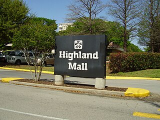
Highland Mall was a shopping mall located in north Austin, Texas, United States, on Airport Boulevard west of I-35 and north of US Route 290. Opened in 1971, Highland Mall was Austin's first suburban shopping mall. Highland Mall was jointly owned by General Growth and Simon Property Group until 2011. On April 29, 2015, Highland Mall officially closed its doors; the space has since been repurposed primarily as a campus for Austin Community College.

Dove Springs, nicknamed the "44" after the area ZIP Codes, is a neighborhood in Austin, Texas.
East Riverside-Oltorf is a neighborhood in Austin, Texas, located southeast of the city's urban core. The East Riverside, Parker Lane, and Pleasant Valley neighborhoods together form the East Riverside-Oltorf Combined Neighborhood Planning Area. The region is bounded on the north by Lake Lady Bird, to the east by Grove Boulevard and the Montopolis neighborhood, Texas State Highway 71 to the south, and Interstate 35 and South River City to the west.
Dawson is a neighborhood in South Austin, Texas bordered by Oltorf Road on the north, Ben White/290 on the south, South 1st Street on the west, and Congress Avenue on the east.
Allandale, Austin, Texas is a neighborhood in North Central Austin, in the U.S. State of Texas known for its large lots, mature trees, and central location.
Westgate is a neighborhood in Austin, Texas, located southwest of the city's urban core. It includes ZIP code 78745.
Galindo is a neighborhood in Austin, Texas. The area covers part of ZIP code 78704 in south Austin.
Spyglass-Barton's Bluff is a neighborhood in Austin, Texas. It is located southwest of the city's urban core, and encompasses ZIP codes 78746 and 78704.
Hancock is a neighborhood in Austin, Texas. Located in North Central Austin, Hancock encompasses ZIP code 78751 and 78705.
North Burnet–Gateway (NBG) is a 2,300 acre neighborhood in northwest Austin, Texas bordered by Walnut Creek to the north, US 183 to the south and southwest, Metric Boulevard to the east, Braker Lane to the northwest, and MoPac to the west.


