The Greater Richmond, Virginia area has many neighborhoods and districts.

Alamo Square is a residential neighborhood in San Francisco, California with a park of the same name. Located in the Western Addition, its boundaries are Buchanan Street on the east, Turk Street on the north, Baker Street on the west, and Page Street Street on the south.

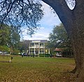
Hyde Park is a neighborhood and historic district in Austin, Texas. Located in Central Austin, Hyde Park is defined by 38th Street to the south, 45th Street to the north, Duval Street to the east, and Guadalupe Street to the west. It is situated just north of the University of Texas and borders the neighborhoods of Hancock and North Loop.
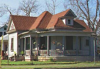
Mechanicsville is a neighborhood in Knoxville, Tennessee, United States, located northwest of the city's downtown area. One of the city's oldest neighborhoods, Mechanicsville was established in the late 1860s for skilled laborers working in the many factories that sprang up along Knoxville's periphery. The neighborhood still contains a significant number of late-19th-century Victorian homes, and a notable concentration of early-20th-century shotgun houses. In 1980, several dozen properties in Mechanicsville were added to the National Register of Historic Places as the Mechanicsville Historic District. The neighborhood was also designated as a local historic district in 1991, subject to historic zoning and design standards.

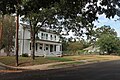
The Old West Austin Historic District is a residential community in Austin, Texas, United States. It is composed of three neighborhoods located on a plateau just west of downtown Austin: Old Enfield, Pemberton Heights, and Bryker Woods. Developed between 1886 and 1953, the three historic neighborhoods stretch from Mopac Expressway east to Lamar Boulevard, and from 13th Street north to 35th Street. It borders Clarksville Historic District and the West Line Historic District to the south.

Italian Village is a neighborhood in Columbus, Ohio, that contains an array of residential, commercial, and industrial buildings. It is a designated historic district, known for its historical and cultural preservation. The building types and architecture reflect Italian influence. With its parks and preserved historic homes, Italian Village has the highest home value appreciation in Columbus.

Heritage Hill is a residential neighborhood in Grand Rapids, Michigan. It is listed on the National Register of Historic Places and is one of the largest urban historic districts in the United States. It is bounded by Crescent Street (north), Union Avenue (east), Pleasant Street (south), and Lafayette Avenue (west). Heritage Hill was designated by the American Planning Association as one of 2012's Great Places in America.
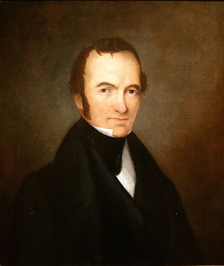
After declaring its independence from Mexico in March, 1836, the Republic of Texas had numerous locations as its seat of government. This being seen as a problem attempts were made to select a permanent site for the capital. January, 1839, with Mirabeau B. Lamar as the newly elected president, a site selection commission of five commissioners was formed. Edward Burleson had surveyed the planned townsite of Waterloo, near the mouth of Shoal Creek on the Colorado River, in 1838; it was incorporated January 1839. By April of that year the site selection commission had selected Waterloo to be the new capital. A bill previously passed by Congress in May, 1838, specified that any site selected as the new capital would be named Austin, after the late Stephen F. Austin; hence Waterloo upon selection as the capital was renamed Austin. The first lots in Austin went on sale August 1839.
Columbus, the state capital and Ohio's largest city, has numerous neighborhoods within its city limits. Neighborhood names and boundaries are not officially defined. They may vary or change from time to time due to demographic and economic variables.
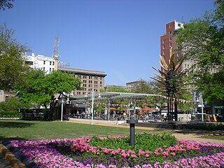
Market Square Park is a public park in Downtown Houston, Texas, United States. Originally set aside by the Houston Town Company as "Congress Square," the public square was used as a marketplace and city hall, which assumed the name, "Market Square." The City of Houston constructed four different market house/city halls, the first of which opened in 1840. The fourth was constructed in 1904. Market Square is a central feature of the Main Street/Market Square Historic District, a historic district listed on the National Register of Historic Places. The square is surrounded by a combination of nineteenth-century architecture and modern residential towers, with ground leases housing a variety of restaurants and bars.

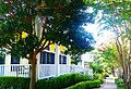
The Clarksville Historic District in Austin, Texas, is an area located west of downtown Austin near Lady Bird Lake and just northeast of the intersection of the Missouri Pacific Railroad and West Tenth Street. Many historic homes and structures are located within the Clarksville Historic District. While Clarksville is geographically part of the Old West Austin Historic District, it is distinct from the two historic neighborhoods of Old Enfield, which lies immediately to the north on the eastern side of Texas State Highway Loop 1, and Tarrytown, which is situated to the west and northwest on the western side of Mopac.

The Southgate–Lewis House is located one mile east of the Texas State Capitol in Austin, Texas, at 1501 East 12th Street. The house was constructed in 1888, and now stands as an African-American historical landmark. It is also a repository for African-American History and Culture in the region of east Austin, which historically became an African-American neighborhood. The City of Austin has now declared this region to be "Austin's Black Cultural District." The Southgate–Lewis House is located in the center of the "African American Cultural Heritage District".

Saint Paul, Minnesota, consists of 17 officially defined city districts or neighborhoods.
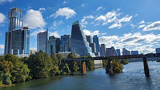
Downtown Austin is the central business district of Austin, Texas, United States. The area of the district is bound by Lamar Boulevard to the west, Martin Luther King Jr. Boulevard to the north, Interstate 35 to the east, and Lady Bird Lake to the south.

The Rainey Street Historic District is a street of historic homes, many of the bungalow style, in downtown Austin, Texas.
The Willow–Spence Streets Historic District is a neighborhood that lies east of downtown Austin, Texas. Its houses, churches, and commercial buildings were built in the early twentieth century. It is bounded roughly by Interstate 35 to the west, East César Chávez Street to the north, and Spence Street to the south. It extends a few houses east of San Marcos Street along Willow and Canterbury Streets. It thus includes portions of Willow, Spence, Canterbury, San Marcos, and Waller Streets. It was added to the National Register of Historic Places in 1985.
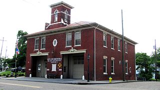
The Sixth Ward is a community in Houston, Texas, United States, one of the city's historic wards.

The Cottage Home Historic District is a historic district and neighborhood located on the near east side of Indianapolis, Indiana. A small portion of Cottage Home is listed on the National Register of Historic Places while a larger area is listed on the state and local levels. Known for its preponderance of "cottage-style" homes built with strong Victorian influences, Cottage Home has historically been a working class neighborhood. Numerous industrial buildings are also scattered throughout the district, providing a base of economic activity. Today, however, many of these buildings are vacant, providing a special challenge to preservation and urban renewal efforts.
South River City is a community located in Austin, Texas. Also frequently called Travis Heights, the neighborhood is located south of the city's urban core, just below Lake Lady Bird in South Austin. The area encompasses a portion of ZIP code 78704.
East César Chávez, historically and originally named Masontown or Masonville, is a neighborhood in Austin, Texas. It is located in the central-east part of Austin's urban core on the north bank of the Colorado River. The neighborhood encompasses much of ZIP code 78702.