
Travis Early College High School is a high school located in south Austin, Texas, United States, which is part of the Austin Independent School District. It was opened in 1953 and is named after William B. Travis, who was one of the commanding officers at the Battle of the Alamo. It is Austin's oldest high school south of the Colorado River.

Lyndon Baines Johnson (LBJ) Early College High School is a public high school in northeast Austin, Texas. At the time of its opening in 1974, LBJ was only the second high school in the U.S. to be named for the 36th President. In 1985, LBJ became the host of a new academic magnet program, the Science Academy of Austin (SA), which drew students from all over the city. A second high school magnet program, the Liberal Arts Academy of Austin (LAA), was opened at Albert Sidney Johnston High School in 1987; the two programs were merged in 2002, forming the Liberal Arts and Science Academy (LASA) magnet within LBJ. In 2007, the Austin Independent School District split LASA and LBJ into separate high schools with their own principals, faculty, and staff in order for LBJ to be eligible for a grant from the Bill & Melinda Gates Foundation to implement the "First Things First" educational enrichment program. After the split, LBJ and LASA were housed on the same campus, though largely on different floors. The two schools continued to share athletic teams through the end of the 2019-20 school year, but shared certain extracurricular activities and electives through the end of the 2020-21 school year. In 2011, via a partnership with the Austin Community College, LBJ established a new program through which students could earn up to 60 college credits while still in high school, earning it the "Early College High School" (ECHS) designation it bears today. In 2021, LASA relocated to the former Eastside Memorial Early College High School campus.
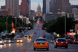
Congress Avenue is a major thoroughfare in Austin, Texas. The street is a six-lane, tree lined avenue that cuts through the middle of the city from far south Austin and goes over Lady Bird Lake leading to the Texas State Capitol in the heart of Downtown.
Austin Independent School District (AISD) is a school district based in the city of Austin, Texas, United States. Established in 1881, the district serves most of the City of Austin, the neighboring municipalities of Sunset Valley and San Leanna, and unincorporated areas in Travis County. The district operates 116 schools including 78 elementary schools, 19 middle schools, and 17 high schools. As of 2013, AISD covers 54.1% of the City of Austin by area and serves 73.5% of its residents.
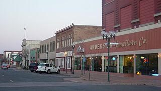
Lincoln Park is a neighborhood in Duluth, Minnesota, United States. Located between Garfield Avenue and Carlton Street, it stretches up the hillside to Skyline Parkway. The neighborhood is named after the municipal park within its boundaries.
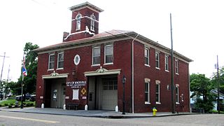
Mechanicsville is a neighborhood in Knoxville, Tennessee, United States, located northwest of the city's downtown area. One of the city's oldest neighborhoods, Mechanicsville was established in the late 1860s for skilled laborers working in the many factories that sprang up along Knoxville's periphery. The neighborhood still contains a significant number of late-19th-century Victorian homes, and a notable concentration of early-20th-century shotgun houses. In 1980, several dozen properties in Mechanicsville were added to the National Register of Historic Places as the Mechanicsville Historic District. The neighborhood was also designated as a local historic district in 1991, subject to historic zoning and design standards.

The Old West Austin Historic District is a residential community in Austin, Texas, United States. It is composed of three neighborhoods located on a plateau just west of downtown Austin: Old Enfield, Pemberton Heights, and Bryker Woods. Developed between 1886 and 1953, the three historic neighborhoods stretch from Mopac Expressway east to Lamar Boulevard, and from 13th Street north to 35th Street. It borders Clarksville Historic District and the West Line Historic District to the south.
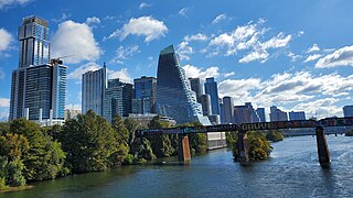
Downtown Austin is the central business district of Austin, Texas, United States. The area of the district is bound by Lamar Boulevard to the west, Martin Luther King Jr. Boulevard to the north, Interstate 35 to the east, and Lady Bird Lake to the south.

South Congress is a neighborhood located on South Congress Avenue in Austin, Texas, United States. It is also a nationally known shopping and cultural district known for its many eclectic small retailers, restaurants, music and art venues and, more recently, food trucks.
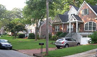
Glennwood Estates is a historic neighborhood located in the northeast section of Decatur, Georgia. It is a residential neighborhood chiefly of single-family homes including a nature preserve and an adjoining park. At least a third of the homes were built in the 1920s and were relatively large for the time. Glenn Creek and the South Fork of Peachtree Creek Tributary run through the neighborhood.
East Riverside-Oltorf is a neighborhood in Austin, Texas, located southeast of the city's urban core. The East Riverside, Parker Lane, and Pleasant Valley neighborhoods together form the East Riverside-Oltorf Combined Neighborhood Planning Area. The region is bounded on the north by Lake Lady Bird, to the east by Grove Boulevard and the Montopolis neighborhood, Texas State Highway 71 to the south, and Interstate 35 and South River City to the west.
Dawson is a neighborhood in South Austin, Texas bordered by Oltorf Road on the north, Ben White/290 on the south, South 1st Street on the west, and Congress Avenue on the east.
Galindo is a neighborhood in Austin, Texas. The area covers part of ZIP code 78704 in south Austin.
South River City is a community located in Austin, Texas. Also frequently called Travis Heights, the neighborhood is located south of the city's urban core, just below Lake Lady Bird in South Austin. The area encompasses a portion of ZIP code 78704.

Pemberton Heights is a neighborhood of Austin, Texas, and part of the Old West Austin Historic District. The area is bounded by Northwood Road on the north, Lamar Boulevard/Shoal Creek on the east, 24th Street/Windsor Road on the south, and Texas State Highway Loop 1 ("MoPac") on the west. It is Austin's wealthiest and most historic neighborhood.

The Larry Monroe Forever Bridge is a bridge mural and memorial to Austin broadcaster and musical scholar Larry Monroe. The bridge's two low walls are decorated with mosaic tiles relating to Monroe and the music he played on Austin radio for more than 30 years. Artist Stefanie Distefano designed and directed the project. The bridge is located on East Side Drive as it crosses Blunn Creek between Stacy Park and Little Stacy Park in the Travis Heights neighborhood in South Austin, Texas.
Dawson Elementary School is an elementary school in the Austin Independent School District (AISD) currently serving students in pre-kindergarten through fifth grade. The school is located at 3001 South First Street in South Austin, Texas, and is named after Mary Jane "Mollie" Dawson, a teacher and school administrator who worked in Austin in the late nineteenth century.

The Third Street Railroad Trestle is a historic wooden railroad trestle bridge crossing Shoal Creek in downtown Austin, Texas. Built around 1922 by the International–Great Northern Railroad, it replaced an earlier bridge in the same place. The bridge was used by the I–GN Railroad, the Missouri Pacific Railroad, and the Missouri–Kansas–Texas Railroad until 1964, when commercial rail traffic stopped; after 1991 the bridge was abandoned. It was added to the National Register of Historic Places in 2021.


