
Sand Hill Road, often shortened to just "Sand Hill", is an arterial road in western Silicon Valley, California, running through Palo Alto, Menlo Park, and Woodside, notable for its concentration of venture capital companies. The road has become a metonym for that industry; nearly every top Silicon Valley company has been the beneficiary of early funding from firms on Sand Hill Road.

Averill Park is a census-designated place in Rensselaer County, New York, United States. The population was 1,693 at the 2010 census.

The Sand Creek massacre was a massacre of Cheyenne and Arapaho people by the U.S. Army in the American Indian Wars that occurred on November 29, 1864, when a 675-man force of Colorado U.S. Volunteer Cavalry under the command of U.S. Army Colonel John Chivington attacked and destroyed a village of Cheyenne and Arapaho people in southeastern Colorado Territory, killing and mutilating an estimated 70–500 Native Americans, about two-thirds of whom were women and children. The location has been designated the Sand Creek Massacre National Historic Site and is administered by the National Park Service.

Beige is variously described as a pale sandy fawn color, a grayish tan, a light-grayish yellowish brown, or a pale to grayish yellow. It takes its name from French, where the word originally meant natural wool that has been neither bleached nor dyed, and hence also the color of natural wool. It has come to be used to describe a variety of light tints chosen for their neutral or pale warm appearance.

The Sandhills, often written Sand Hills, is a region of mixed-grass prairie on grass-stabilized sand dunes in north-central Nebraska, covering just over one quarter of the state. The dunes were designated a National Natural Landmark in 1984.
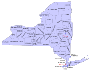
Buildings, sites, districts, and objects in New York listed on the National Register of Historic Places:

Topsail Hill Preserve State Park is a 1,640-acre (6.6 km2) Florida State Park located in Santa Rosa Beach, ten miles (16 km) east of Destin, off U.S. 98, in northwestern Florida. The address is 7525 W. Scenic Highway 30A.
Sand Hill, Sandhill, Sand Hills, or Sandhills may refer to:

Sandy Island Beach State Park is a New York State park on the eastern shore of Lake Ontario. Its highlight is a 1,500-foot (460 m) natural sandy beach. The park is near the southern end of a notable 17-mile (27 km) length of sandy shoreline, coastal dunes, and wetlands ; a 1959 study noted that "The eastern end of Lake Ontario contains not only the finest beaches on the entire lake, but also the finest wildlife habitat."

New York State Route 150 (NY 150) is a north–south state highway in Rensselaer County, New York, in the United States. The southern terminus of the route is at NY 9J in Castleton-on-Hudson. Its northern terminus is at a junction with NY 66 in the hamlet of Wynantskill, located within the town of North Greenbush.

Sand Hills is a formerly active lighthouse on the shore of Lake Superior converted into a bed and breakfast. It is located in Ahmeek in Keweenaw County Michigan in the Keweenaw Peninsula, which is the northern part of the Upper Peninsula. It was listed in the National Register of Historic Places in 1994.

Sand is a granular material composed of finely divided rock and mineral particles. It is defined by size, being finer than gravel and coarser than silt. Sand can also refer to a textural class of soil or soil type; i.e., a soil containing more than 85 percent sand-sized particles by mass.
Averill Park Central School District (APCSD) is a Suburban and rural fringe public school district located east of the city of Rensselaer in south central Rensselaer County, New York. The district has five operating school buildings: three elementary schools, one middle school, and one high school. The district is a member of the Rensselaer-Columbia-Greene Board of Cooperative Educational Services (BOCES), known as Questar III.

Sand Hill Wildlife Management Area is located near Parkersburg, West Virginia in Wood and Ritchie counties. Sand Hill WMA is located on 1,987 acres (804 ha) of rugged, hilly oak-hickory woodlands interspersed with timber, oil and gas development sites.

Watch Hill is a campground and marina located on Fire Island, a barrier island off the south shore of New York's Long Island. The park is located across the Great South Bay from Patchogue and is contained within the Fire Island National Seashore.

Desert sand is a very light and very weakly saturated reddish yellow colour which corresponds specifically to the coloration of sand. It may also be regarded as a deep tone of beige.
Sand Hill, New York is a hamlet in the town of Newstead in Erie County, New York, United States.
The Watchung Outliers include six areas of isolated low hills and rock outcrops of volcanic and sedimentary origin in the U.S. states of New York, New Jersey, and Pennsylvania. These geologic outliers are primarily diminutive and detached remnants of the Triassic/Jurassic age Watchung Mountain basalt flows with intervening layers of sedimentary rock. All six of the outliers are found along the western edge of the Newark Basin, occupying small synclines adjacent to the Ramapo fault system. The outliers, from north to south, are known as: Ladentown, Union Hill, New Germantown/Oldwick, Prospect Hill, Sand Brook, and Jacksonwald.

Sand Hills is an unincorporated community located along the border of Edison and Woodbridge townships in Middlesex County, New Jersey, United States.
Sand Hills is an unincorporated community located within South Brunswick Township in Middlesex County, New Jersey, United States. The settlement is named for Sand Hills, a small group of diabase hills which contains Middlesex County's highest point. The settlement is located approximately at the intersection of U.S. Route 1, Sand Hills Road, and Major Road. There is a small cluster of houses and small businesses on Major Road just south of US 1 while more housing developments are found on the north side of the highway. Fast food restaurants, stores, and repair shops line US 1 through the area; this area of US 1 also has large inclines on both sides of the hills to climb from the relatively low and flat areas of the Atlantic coastal plain.


