Sand Spring Township | |
---|---|
Former Township | |
Coordinates: 35°27′05″N93°15′26″W / 35.45147°N 93.25712°W [1] | |
Country | United States |
State | Arkansas |
County | Pope |
Area | |
• Total | 12.0 sq mi (31 km2) |
Elevation | 833 ft (254 m) |
GNIS feature ID | 70147 |
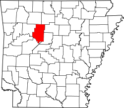
Sand Spring Township is a former township of Pope County, Arkansas. It was located on the western edge of the county. [2]
Van Buren County is a county located in the U.S. state of Arkansas. As of the 2020 census, the population was 15,796. The county seat is Clinton. The county was formed on November 11, 1833, and named for Martin Van Buren, President of the United States, who was Vice President at the time of the county's formation. Van Buren County was a dry county until November 3, 2020, as the county residents voted to make it a wet county.
Searcy County is a county located in the U.S. state of Arkansas. As of the 2020 census, the population was 7,828. The county seat is Marshall. The county was formed December 13, 1838, from a portion of Marion County and named for Richard Searcy, the first clerk and judge in the Arkansas Territory. The city of Searcy, Arkansas, some 70 miles away, shares the name despite having never been part of Searcy County. The county is an alcohol prohibition or dry county.
Saline County is located in the U.S. state of Arkansas. As of the 2020 census, the population was 123,416. Its county seat and largest city is Benton. Saline County was formed on November 2, 1835, and named for the salt water (brine) springs in the area, despite a differing pronunciation from saline. Until November 2014, it was an alcohol prohibition or dry county.
Jefferson County, Arkansas is a county located in the U.S. state of Arkansas in the area known as the Arkansas Delta that extends west of the Mississippi River. Jefferson County consists of five cities, two towns, and 20 townships. It is bisected by the Arkansas River, which was critical to its development and long the chief transportation byway. In 2020, Jefferson County's population was estimated at 67,260. The county seat and largest city is Pine Bluff. The county is included in the Pine Bluff metropolitan statistical area. The county seat and the most populous city is Pine Bluff.
Howard County is a county located in the U.S. state of Arkansas. As of the 2020 census, the population was 12,785. The county seat is Nashville. Howard County is Arkansas's 74th county, formed on April 17, 1873, and named for James Howard, a state senator. It is a dry county.
Garland County is located in the U.S. state of Arkansas. As of the 2020 census, the population was 100,180. The county seat is Hot Springs.
Fulton County is a county located in the U.S. state of Arkansas. As of the 2020 census, the population was 12,075. The county seat is Salem. Fulton County was formed on December 21, 1842, and named for William Fulton, the last governor of the Arkansas Territory. It is an alcohol prohibition or dry county.
Cleburne County is a county located in the U.S. state of Arkansas. As of the 2020 census, the population was 24,711. The county seat and most populous city is Heber Springs. The county was formed on February 20, 1883, as the last of Arkansas's 75 counties to be formed. It is named for Confederate Major-General Patrick Cleburne. Cleburne is an alcohol prohibition or dry county.
Boone County is located in the U.S. state of Arkansas, along the Missouri border. As of the 2020 census, the population was 37,373. The county seat is Harrison. It is Arkansas's 62nd county, formed on April 9, 1869.
Liberty Township is one of nineteen current townships in Pope County, Arkansas, USA. As of the 2010 census, its unincorporated population was 837.
Griffin Township is one of nineteen current townships in Pope County, Arkansas, USA. As of the 2010 census, its total population was 839.
Hill Township was a township of Pope County, Arkansas. It was located in the northeast part of the county.
Hogan Township was a township of Pope County, Arkansas. It was located in the central part of the county. Hogan Township was created between 1910 and 1920 using parts from Allen, Jackson, Liberty, Martin and North Fork Townships.
Independence Township is a former township of Pope County, Arkansas. It was located in the northeastern part of the county.
Lee Township is a former township of Pope County, Arkansas. It was located in the southeast corner of the county.
North Fork Township is a former township of Pope County, Arkansas. It was located in the north central part of the county.
Sulphur Township is a former township of Pope County, Arkansas. It was located on the northern edge of the county.
Oak Grove is an unincorporated community and census-designated place (CDP) in Moreland Township, Pope County, Arkansas, United States. It was first listed as a CDP in the 2020 census with a population of 177.
Sand Gap is an unincorporated community in Freeman Township, Pope County, Arkansas, United States. Sand Gap is located at the junction of Arkansas highways 7 and 16.
Antioch Township is a township in Hot Spring County, Arkansas, United States. Its total population was 432 as of the 2010 United States Census, an increase of 12.21 percent from 385 at the 2000 census.