Arkansas is a state in the south central region of the United States, home to more than three million people as of 2018. Its name is from the Osage language, of Siouan derivation; it denoted their related kin, the Quapaw people. The state's diverse geography ranges from the mountainous regions of the Ozark and the Ouachita Mountains, which make up the U.S. Interior Highlands, to the densely forested land in the south known as the Arkansas Timberlands, to the eastern lowlands along the Mississippi River and the Arkansas Delta.

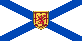
Nova Scotia is a province in eastern Canada. With a population of 923,598 as of 2016, it is the most populous of Canada's three Maritime provinces and the four Atlantic provinces. It is the country's second most-densely populated province and second-smallest province by area, both after neighbouring Prince Edward Island. Its area of 55,284 square kilometres (21,345 sq mi) includes Cape Breton Island and 3,800 other coastal islands. The peninsula that makes up Nova Scotia's mainland is connected to the rest of North America by the Isthmus of Chignecto, on which the province's land border with New Brunswick is located. The province borders the Bay of Fundy to the northwest and the Atlantic Ocean to the south and east, and is separated from Prince Edward Island and the island of Newfoundland by the Northumberland and Cabot straits, respectively.
A county seat is an administrative center, seat of government, or capital city of a county or civil parish. The term is used in Canada, China, Romania, Taiwan and the United States. County towns have a similar function in the United Kingdom and Republic of Ireland, and historically in Jamaica.
Lake George or George Lake may refer to:
St. Francis or Saint Francis may refer to:
Blue Mountain may refer to:
Miller Lake may refer to:
Lüneburg is a city in the District of Lüneburg in Lower Saxony, Germany.
Scotia is an ancient name for Scotland.
The following radio stations broadcast on FM frequency 102.5 MHz:
The following radio stations broadcast on FM frequency 107.1 MHz:

U.S. Route 64 is a U.S. highway running from Teec Nos Pos, Arizona east to Nags Head, North Carolina. In the U.S. state of Arkansas, the route runs 246.35 miles (396.46 km) from the Oklahoma border in Fort Smith east to the Tennessee border in Memphis. The route passes through several cities and towns, including Fort Smith, Clarksville, Russellville, Conway, Searcy, and West Memphis. US 64 runs parallel to Interstate 40 until Conway, when I-40 takes a more southerly route.


