
Indian Lake is a town in Hamilton County, New York, United States. The population was 1,352 at the 2010 census. The name is from a lake of the same name that is largely inside the town. There are no permanent stop lights in the town. Law enforcement is provided by New York State Troopers.

The Berkshires are a highland geologic region located in the western parts of Massachusetts and Connecticut. The term "Berkshires" is normally used by locals in reference to the portion of the Vermont-based Green Mountains that extends south into western Massachusetts; the portion extending further south into northwestern Connecticut is locally referred to as either the Northwest Hills or Litchfield Hills.
Hamilton East was a federal electoral district in Ontario, Canada. It was represented in the House of Commons of Canada from 1904 to 2004. It consisted of the eastern part of the city of Hamilton, Ontario. It is considered a working class district.

The Chemehuevi Mountains are found at the southeast border of San Bernardino County in southeastern California adjacent the Colorado River. Located south of Needles, California and northwest of the Whipple Mountains, the mountains lie in a north-south direction in general, and are approximately 15 miles in length.

The Yunnan–Guizhou Plateau or Yungui Plateau is a highland region located in southwest China. The region is primarily spread over the provinces of Yunnan and Guizhou. In the southwest, the Yungui is a true plateau with relatively flatter highland areas, while in the northeast, the Yungui is a generally mountainous area of rolling hills, gorges, and karst topography.

Alander Mountain, 2,239 feet (682 m) is a prominent peak of the south Taconic Mountains; it is located in southwest Massachusetts and adjacent New York. Part of the summit is grassy and open and part is covered with scrub oak and shrubs; the sides of the mountain are wooded with northern hardwood tree species. Views from the top include the southern Taconic Mountains, the Hudson River Valley including the Catskills. Several trails traverse Alander Mountain, most notably the 15.7 mi (25.3 km) South Taconic Trail, which passes just beneath the summit.

The Lenne Mountains, or Lenne Uplands (Lennebergland), is a range of hills up to 656 m above sea level (NN) high in the German state of North Rhine-Westphalia. It is part of the Süder Uplands within the Rhine Massif.

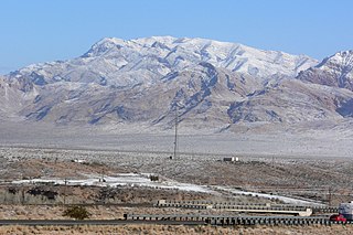
The Buckskin Mountains, of Arizona, are a mountain range in west-central Arizona, USA. The range lies just east of the north-south Colorado River, and borders south of the east-west, west-flowing Bill Williams River.

The Little Rincon Mountains are a small range of mountains, lying to the east of the Rincon Mountains, at Tucson, of eastern Pima County, Arizona. The range is located in northwest Cochise County and is part of the western border of the San Pedro River and Valley, the major valley and river of western Cochise County. The river is northward flowing to meet the Gila River; its headwaters are south of the US-Mexico border in northern Sonora. A small part of the Little Rincon range's southwest lies in Pima County.
The Black Hills of Greenlee County are a 20 mi (32 km) long mountain range of the extreme northeast Sonoran Desert bordering the south of the White Mountains of eastern Arizona's transition zone.
The 5,080-acre (20.6 km2) Coyote Mountains Wilderness of Arizona is part of the Coyote Mountains of southern Arizona in the center of Pima County. The wilderness lies about 40 mi southwest of Tucson, in the northwest of the Altar Valley. Kitt Peak is 4 mi WSW.
The Date Creek Mountains are a short, arid range in southwest Yavapai County, Arizona. Congress is on its southeast foothills, and Wickenburg lies 15 mi (24 km) southeast.

The New River Mountains are a small 14-mi (23 km) long, mountain range in central Arizona, and on the north border of the Phoenix valley; the range is located on the southwest perimeter of the Arizona transition zone. The range is a sub-part of landforms extending south from the Black Hills of Yavapai County. Rivers and canyons border east and west; the south of the range is located in Maricopa County, the location of much of the Phoenix metropolitan area.
The Beaver Dam Mountains are a 23 miles (37 km) long mountain range located mostly in extreme southwest Washington County, Utah, west of St. George, with the south of the range extending into the Arizona Strip.

Sherman is a ghost town in Albany County, Wyoming, United States. Sherman is 19 miles (31 km) southeast of Laramie in the Laramie Mountains. It is named for William Tecumseh Sherman. The town was located at the summit of the original grade of the First Transcontinental Railroad. Although the railroad has been regraded and relocated through this portion of Wyoming, the name Sherman, or Sherman Summit or Sherman Hill Summit has been applied to the nearby summits of the modern transportation arteries in the Laramie Mountains.
Coldwater Canyon Avenue is a street, primarily within the City of Los Angeles, in Los Angeles County, California. It runs from Beverly Drive in Beverly Hills north to Roscoe Boulevard in Sun Valley, where it changes into Sheldon Street.

Lawton Hill is a mountain located in the Catskill Mountains of New York south-southwest of Franklin. Gallop Hill is located south, Hodges Hill is located south-southwest, and Johnson Hill is located east-southeast of Sherman Hill.
Gallop Hill is a mountain located in the Catskill Mountains of New York south-southwest of Franklin. Sherman Hill is located north-northeast and Loomis Mountain is located south-southeast of Gallop Hill.

Van Loan Hill is a mountain in Greene County, New York. It is located in the Catskill Mountains southwest of Maplecrest. Round Hill is located west, Elm Ridge is located north-northeast, and East Jewett Range is located south of Van Loan Hill.


