Skycrest, Lexington

Last updated

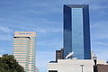
Skycrest is a neighborhood in southwestern Lexington, Kentucky, United States. It takes its name from its location on a ridge between Wolf Run Creek and Vaughns Branch Creek that provides a panoramic view downtown Lexington. Its boundaries are Della Drive to the north, Beacon Hill Drive to the west, Furlong Drive and Spring Meadows Drive to the south, and Harrodsburg Road to the east.

Neighborhood statistics
Public school districts

Related Research Articles

Garden Springs is a neighborhood in Southwestern Lexington, Kentucky, United States. Its boundaries are Georgian Way to the west, Lane Allen Road to the north, Harrodsburg Road to the east, and New Circle Road to the south. Turfland Mall and the Lexington campus of Sullivan University are located in the neighborhood.

Gardenside is a neighborhood in southwestern Lexington, Kentucky, United States. Its boundaries are a combination of Darien Drive, Traveler Road, Appomattox Drive, and Alexandria Drive to the west, Wolf Run Creek to the north, Beacon Hill Drive to the east, and Lane Allen Road to the south.

Rabbit Run is a neighborhood in southwestern Lexington, Kentucky, United States. Its boundaries are Harrodsburg Road to the west, Man O War Boulevard to the south, and a combination that includes both Bleinheim Way and Gladman Way to the east.

Southland Park is a neighborhood in southwestern Lexington, Kentucky, United States. Its boundaries are Pasadena Drive to the south, Clays Mill Road to the east, Lane Allen Road to the north, and Harrodsburg Rd to the west.

South Hill is a neighborhood and historic district located immediately south of downtown Lexington, Kentucky, United States. Its boundaries are South Limestone Street to the east, Pine Street to the south, South Broadway to the west, and High Street to the north.

Deerfield is a neighborhood in southwestern Lexington, Kentucky, United States. Its boundaries are Nicholasville Road to the east, Cincinnati Southern Railroad tracks to the west, Pasadena Drive to the north, and New Circle Road to the south.

Hill N Dale is a neighborhood in southwestern Lexington, Kentucky, United States. Its boundaries are Southview Drive to the west, Cincinnati Southern railroad tracks to the east, Southland Drive to the north, and Pasadena Drive to the south.

Columbia Heights is a neighborhood in southeastern Lexington, Kentucky, United States. Its boundaries are the University of Kentucky to the south, Woodland Avenue to the west, Euclid Avenue to the north, and Marquis Avenue to the east.

Open Gates is a neighborhood in southwestern Lexington, Kentucky, United States. Its boundaries are New Circle Road to the south, Clays Mill Road to the west, Norfolk Southern railroad tracks to the east, and Pasadena Drive to the north.

Golf View Estates is a neighborhood in southwestern Lexington, Kentucky, United States. Its name is derived from its location next to the Campbell House golf course. Its boundaries are the Campbell House and its golf course to the south, Addison Park to the west, Red Mile Road to the north, and South Broadway to the east.

Pine Meadow is a neighborhood in southwestern Lexington, Kentucky, United States. Its boundaries are Mason Headley Road to the west, Pine Meadow Park to the north, Addison Park to the east, and the Campbell House golfcourse to the south.

Indian Hills is a neighborhood in southwestern Lexington, Kentucky, United States. It is bounded by New Circle Road and Harrodsburg Road. Its southern boundary varies depending on the development rates of it and the neighboring Stonewall neighborhood. Indian Hills is the latest to be built.

Mason Headley is a neighborhood in southwestern Lexington, Kentucky, United States. Its boundaries are Mason Headley Road to the north, Laurel Hill Road to the south, Beacon Hill Drive to the west, and Cold Harbor Drive to the east.

Dogwood Trace is a neighborhood in southwestern Lexington, Kentucky, United States. Its boundaries are South Elkhorn Creek to the north and east, Harrodsburg Road to the west, and the Jessamine County line to the south.

Rosemill is a neighborhood in southwestern Lexington, Kentucky, United States. Its boundaries are Southland Drive and Rosemont Garden to the north, Clays Mill Road to the west, and Hill-N-Dale Road to the south. Lexington Catholic High School has been located in the center of the neighborhood since 1957.

North Elizabeth Street is a neighborhood in southwestern Lexington, Kentucky, United States. It is located just west of the University of Kentucky and most of its residents are college students.

South Broadway Park is a neighborhood in southwestern Lexington, Kentucky, United States. Its boundaries are Bucoto Court to the north, Norfolk Southern railroad tracks to the east, South Broadway to the west, and Virginia Avenue to the south. It is located just west of the University of Kentucky.

Elizabeth Street is a neighborhood in southwestern Lexington, Kentucky, United States. Its boundaries are Dantzler Drive to the south, Norfolk Southern railroad tracks to the west, South Limestone Street to the east, and Waller Avenue to the north.

WGPL is a neighborhood in southwestern Lexington, Kentucky, United States. Its name is an acronym for the main streets in the neighborhood - Wabash Drive, Goodrich Avenue, Pensacola Drive and Lackawanna Drive. It is located between Rosemont Garden, Southland Drive, Nicholasville Road, and the Norfolk Southern railroad tracks. WGPL is part of a larger neighborhood in Lexington called Pensacola Park, which includes Suburban Court, Rosemont Garden, and Penmoken Park, according to the Fayette County Property Value Administrator.

Pasadena is a neighborhood in southwestern Lexington, Kentucky, United States. Its name is derived from its location just south of Pasadena Drive. All streets in the neighborhood are named after western American cities. Its boundaries are a combination of New Circle Road, Waco Road, and Nakomi Drive to the south, Harrodsburg Road to the west, Pasadena Drive to the north, and a combination of Waco Road and Clays Mill Road to the east.

References

38°01′55″N84°32′10″W / 38.032°N 84.536°W / 38.032; -84.536