Stowe Township is a township in Allegheny County, Pennsylvania, United States. The population was 6,362 at the 2010 census.

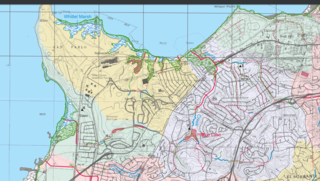
Garrity Creek is a 3.0-mile-long (4.8 km) creek in Richmond, California's Hilltop neighborhood. It runs into San Pablo Bay. It is sometimes called Hilltop Creek.

Bell Court is a neighborhood and historic district immediately southeast of Downtown Lexington, Kentucky, United States. Its boundaries are East Main Street to the south, Walton Avenue to the south, Midland Avenue to the north, and Boonesborough Avenue to the east.
Kenwick is a neighborhood in southeastern Lexington, Kentucky, United States. Its boundaries are Sherman Avenue to the south, East Main Street to the west, railroad tracks to the north, and Richmond Avenue to the north.
Highland Parks is a neighborhood in northwest Lexington, Kentucky, United States. It is a new subdivision started in the mid-2000s, located between the older Highlands and Oakwood neighborhoods. It is located south of Birch Drive and north of Boxwood Drive. It is bounded by Georgetown Road to the west and Oakwood Park to the east.
Palomar Hills is a neighborhood in southwestern Lexington, Kentucky, United States. Its boundaries are Harrodsburg Road to the east, Man o' War Boulevard to the north, Bowman Mill Road to the south, and the Lexington urban growth boundary to the west.
Eastside is a neighborhood in southeastern Lexington, Kentucky, United States. Its boundaries are Walton Avenue to the north, CSX railroad tracks to the east, Richmond Avenue to the south, and Main Street to the west.
Plantation is a neighborhood in southwestern Lexington, Kentucky, United States. It is bounded by Man O War Boulevard, Harrodsburg Road, and Old Higbee Mill Road.
Mason Headley is a neighborhood in southwestern Lexington, Kentucky, United States. Its boundaries are Mason Headley Road to the north, Laurel Hill Road to the south, Beacon Hill Drive to the west, and Cold Harbor Drive to the east.
Colony is a neighborhood in southwestern Lexington, Kentucky, United States. Its boundaries are Parkers Mill Road to the south and east, Versailles Road to the north, and New Circle Road to the west.
Dogwood Trace is a neighborhood in southwestern Lexington, Kentucky, United States. Its boundaries are South Elkhorn Creek to the north and east, Harrodsburg Road to the west, and the Jessamine County line to the south.
Rosemill is a neighborhood in southwestern Lexington, Kentucky, United States. Its boundaries are Southland Drive and Rosemont Garden to the north, Clays Mill Road to the west, and Hill-N-Dale Road to the south. Lexington Catholic High School has been located in the center of the neighborhood since 1957.
Spindletop is a rural neighborhood north of Lexington, Kentucky, United States. Its boundaries are I-75 to the west and Berea Road to the south and east. It is located just south of the Kentucky Horse Park. It is named for Spindletop hall, a historic mansion once owned by Miles Franklin Yount, which is located within the neighborhood.
North Elizabeth Street is a neighborhood in southwestern Lexington, Kentucky, United States. It is located just west of the University of Kentucky and most of its residents are college students.
Elizabeth Street is a neighborhood in southwestern Lexington, Kentucky, United States. Its boundaries are Dantzler Drive to the south, Norfolk Southern railroad tracks to the west, South Limestone Street to the east, and Waller Avenue to the north.
Highlands is a neighborhood in northwestern Lexington, Kentucky, United States. Its boundaries are Georgetown Road to the west, Oakwood Park to the east, and Citation Boulevard to the east. There are plans to develop a vacant field north of Highlands, it is unclear whether it will become part of Highlands or be a separate neighborhood.
Oakwood is a neighborhood in northwestern Lexington, Kentucky, United States. Its boundaries are Georgetown Road to the west, Oakwood Park to the east, the Nandino Parkway industrial complex to the south, and the newer Highland Park neighborhood to the north.
South Point is a neighborhood in southeastern Lexington, Kentucky, United States. Its boundaries are Nicholasville Road to the west, the Jessamine County line to the south, the newer Waterford neighborhood to the east, and Waveland Museum Lane to the north.
Brigadoon is a neighborhood in southeastern Lexington, Kentucky, United States. its boundaries are Reynolds Road to the north, Lansdowne Drive to the east, Wilson Downing Road to the south, and Nicholasville Road to the west.
Belleau Woods is a neighborhood in southeastern Lexington, Kentucky, United States. Its boundaries are Man o' War Boulevard to the south, Hickman Creek to the north and east, and a combination of Belleau Woods Drive and Greenfield Drive to the west. This neighborhood features a volunteer neighborhood association, the Belleau Wood Neighborhood Association.


