
Washington Dulles International Airport, typically referred to as Dulles International Airport, Dulles Airport, Washington Dulles or simply Dulles, is an international airport in the Eastern United States, located in Loudoun County and Fairfax County in Virginia, 26 miles (42 km) west of Downtown Washington, D.C.

Loudoun County is located in the northern part of the Commonwealth of Virginia in the United States. In 2019, the population was estimated at 413,538, making it Virginia's third-most populous county. Loudoun County's seat is Leesburg. Loudoun County is part of the Washington–Arlington–Alexandria, DC–VA–MD–WV Metropolitan Statistical Area.

Fairfax County, officially the County of Fairfax, is located in the Commonwealth of Virginia in the United States. Part of Northern Virginia, Fairfax County borders both the City of Alexandria and Arlington County and forms part of the suburban ring of Washington, D.C. The county is thus predominantly suburban in character, with some urban and rural pockets.
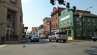
Leesburg is the county seat of Loudoun County, Virginia. It was built in 1740, and it is occupied by some of Virginia’s most famous families, being named for Thomas Lee, ancestor of Robert E. Lee. In the War of 1812, it became the temporary seat of the United States government, and in the Civil War, it changed hands several times.

State Route 267 is a primary state highway in the US state of Virginia. It consists of two end-to-end toll roads – the Dulles Toll Road and Dulles Greenway – as well as the Dulles Access Road, which lies in the median of Dulles Toll Road and then extends east to Falls Church. The combined roadway provides a toll road for commuting and a free road for access to Washington Dulles International Airport. The three sections are operated and maintained by separate agencies: Dulles Toll Road and Dulles Access Road are maintained by the Metropolitan Washington Airports Authority (MWAA); the Dulles Greenway is owned by TRIP II, a limited partnership, but is maintained by Atlas Arteria, an Australian company which owns the majority stake in the partnership. The Dulles Access Road's median hosts the Silver Line of the Washington Metro between Reston and Falls Church.

Dulles is an unincorporated area in Loudoun County, Virginia, which is part of the Washington metropolitan area. The headquarters of Northrop Grumman Innovation Systems, Radiant Solutions, and ODIN Technologies and the former headquarters of MCI Inc. and AOL are located in Dulles. The National Weather Service Baltimore/Washington forecast office and the National Weather Service's Sterling Field Support Center are also both in Dulles.

Northern Virginia, locally referred to as NOVA or NoVA, comprises several counties and independent cities in the Commonwealth of Virginia in the United States. It is a widespread region radiating westward and southward from Washington, D.C. With an estimated 3,159,639 residents in 2019, it is the most populous region of Virginia and the Washington metropolitan area.

Sterling, Virginia refers most specifically to a census-designated place (CDP) in Loudoun County, Virginia. The population of the CDP as of the 2010 United States Census was 27,822. The CDP boundaries are confined to a relatively small area between Virginia State Route 28 on the west and Virginia State Route 7 on the northeast, excluding areas near SR 606 and the Dulles Town Center.

Ashburn is a census-designated place (CDP) in Loudoun County, Virginia. As of the 2010 United States Census, its population was 43,511. It is 30 miles (48 km) northwest of Washington, D.C. and part of the Washington metropolitan area.

South Riding is a census-designated place and planned community in Loudoun County, Virginia. South Riding was founded as a homeowner association in January 1995 to provide services to the community. Neighboring U.S. Route 50 and State Route 28 provide access to the Dulles/Reston/Tysons Corner technology corridor and other major employment centers in Northern Virginia and Washington, D.C.
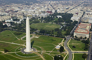
The Washington metropolitan area is the metropolitan area centered on Washington, D.C., the capital of the United States. The area includes all of the federal district and parts of the U.S. states of Maryland, Virginia and West Virginia. It is part of the larger Baltimore–Washington metropolitan area.

State Route 28 is a primary state highway that traverses the counties of Loudoun, Fairfax, Prince William, and Fauquier in the U.S. state of Virginia. It is a major artery through Northern Virginia, particularly the portions within western Fairfax County and eastern Loudoun County, where most of the route is a 6-lane freeway.
The 4A Dulles District is a high school conference in the state of Virginia that includes schools from Northern Virginia, with all of its full-time members from Loudoun County. 4A is the third largest enrollment class of the Virginia High School League and is typically very competitive in Virginia high school sports.

Washington, D.C. has a number of different modes of transportation available for use. Commuters have a major influence on travel patterns, with only 28% of people employed in Washington, D.C. commuting from within the city, whereas 33.5% commute from the nearby Maryland suburbs, 22.7% from Northern Virginia, and the rest from Washington, D.C.'s outlying suburbs.
The former unincorporated community of Willard was located in what is now a part of Washington Dulles International Airport in the U.S. state of Virginia.
Loudoun County Transit is a public-transportation service provided by the Loudoun County, Virginia government. The buses operate from Dulles, Leesburg, and Purcellville to Washington Metro stations as well as directly to Rosslyn, Virginia, The Pentagon, and Washington, D.C.. The service is attractive because the buses, unlike normal traffic, are permitted to travel on the express lanes of the Dulles Toll Road. This allows for a shorter trip and also bypasses commuter tolls. The Loudoun County Commuter Bus accepts payment via SmarTrip, a reloadable transit card issued by the Washington Metropolitan Area Transit Authority.
Cascades is a census-designated place (CDP) in Loudoun County, Virginia. The population as of the 2010 United States Census was 11,912. Along with nearby Countryside and Lowes Island, it is considered one of the three main components of the Potomac Falls community within Sterling, Virginia.

The National Weather Service Baltimore/Washington is a local office of the National Weather Service responsible for monitoring weather conditions in 44 counties in eastern West Virginia, northern and central Virginia, the majority of the state of Maryland, as well as the city of Washington, D.C. Although labeled as the NWS Baltimore/Washington, its actual location is off Old Ox Road in the Dulles section of Sterling, Virginia, adjacent to Washington Dulles International Airport.

McNair is a census-designated place located in the Oak Hill section of Fairfax County, Virginia, United States. It is directly to the east of Washington Dulles International Airport. The population as of the 2010 census was 17,513. Much of the population resides in the McNair Farms planned community. The community has a school called McNair Elementary.
The Northern Virginia region is served by numerous mediums of transit. Transportation in the region is overseen by the Northern Virginia Transportation Commission and the Northern Virginia Transportation Authority.


