A mountain is an elevated portion of the Earth's crust, generally with steep sides that show significant exposed bedrock. A mountain differs from a plateau in having a limited summit area, and is larger than a hill, typically rising at least 300 metres above the surrounding land. A few mountains are isolated summits, but most occur in mountain ranges.

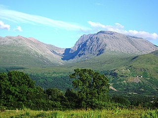
A Munro is defined as a mountain in Scotland with a height over 3,000 feet (914.4 m), and which is on the Scottish Mountaineering Club (SMC) official list of Munros; there is no explicit topographical prominence requirement. The best known Munro is Ben Nevis, the highest mountain in the British Isles at 4,413 feet (1,345 m).

A roller coaster is a type of amusement ride that employs a form of elevated railroad track designed with tight turns, steep slopes, and sometimes inversions. People ride along the track in open cars, and the rides are often found in amusement parks and theme parks around the world. LaMarcus Adna Thompson obtained one of the first known patents for a roller coaster design in 1885, related to the Switchback Railway that opened a year earlier at Coney Island. The track in a coaster design does not necessarily have to be a complete circuit, as shuttle roller coasters demonstrate. Most roller coasters have multiple cars in which passengers sit and are restrained. Two or more cars hooked together are called a train. Some roller coasters, notably Wild Mouse roller coasters, run with single cars.

The Great Northern Railway was an American Class I railroad. Running from Saint Paul, Minnesota, to Seattle, Washington, it was the creation of 19th-century railroad entrepreneur James J. Hill and was developed from the Saint Paul & Pacific Railroad. The Great Northern's route was the northernmost transcontinental railroad route in the U.S.

The Inland Northwest, historically and alternatively known as the Inland Empire, is a region of the American Northwest centered on the Greater Spokane Area, that includes all of Eastern Washington and North Idaho. Northeastern Oregon and Western Montana are also sometimes considered part of the Inland Northwest, but Western Montana generally is not considered part of the Inland Empire. Under some definitions, the Inland Empire also excludes Central Washington or Idaho County, Idaho.

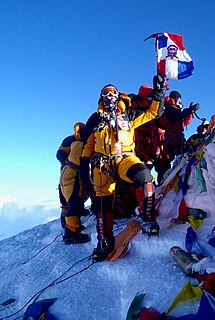
A summit is a point on a surface that is higher in elevation than all points immediately adjacent to it. The topographic terms acme, apex, peak, and zenith are synonymous.

Big Thunder Mountain Railroad is a mine train roller coaster located at Disneyland, Magic Kingdom, Tokyo Disneyland and Disneyland Park in Paris. In Tokyo and Paris, the attraction is named Big Thunder Mountain. Big Thunder Mountain Railroad is also the name of the fictional rail line the roller coaster depicts.

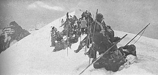
A hill is a landform that extends above the surrounding terrain. It often has a distinct summit.

The Mountaineers is an alpine club serving the state of Washington. Founded in 1906, it is organized as an outdoor recreation, education, and conservation 501(c)(3) nonprofit, and is based in Seattle, Washington. The Mountaineers host a wide range of outdoor activities, primarily alpine mountain climbing and hikes. The club also hosts classes, training courses, and social events.
"King of the Hill" is the twenty-third episode in the ninth season of the American animated television series The Simpsons. It originally aired on the Fox network in the United States on May 3, 1998. It was written by John Swartzwelder and directed by Steven Dean Moore, and guest stars Brendan Fraser and Steven Weber. The episode sees Homer trying to climb a large mountain to impress Bart after he humiliates him at a church picnic with his lack of fitness.

The Santa Ynez Valley is located in Santa Barbara County, California, between the Santa Ynez Mountains to the south and the San Rafael Mountains to the north. The Santa Ynez River flows through the valley from east to west. The Santa Ynez Valley is separated from the Los Alamos Valley, to the northwest, by the Purisima Hills, and from the Santa Maria Valley by the Solomon Hills. The Santa Rita Hills separate the Santa Ynez Valley from the Santa Rita and Lompoc Valleys to the west.

Black Mountain is a summit on Monte Bello Ridge in the Santa Cruz Mountains of west Santa Clara County, California, south of Los Altos and Los Altos Hills, and west of Cupertino; it is within the Palo Alto city limits though not near the developed part of the city. It is located on the border between Rancho San Antonio Open Space Preserve and Monte Bello Open Space Preserve, with the summit located in the former. Early Spanish explorers commonly named tree- or chaparral-covered summits which look black in the distance Loma Prieta, from the Spanish . The Spanish also called the middle portion of the Santa Cruz Mountains the Sierra Morena meaning, extending from Half Moon Bay Road south to a gap at Lexington Reservoir, and which includes a summit called Sierra Morena. There are over 100 "Black Mountains" in California.

Alander Mountain, 2,239 feet (682 m), is a prominent peak of the south Taconic Mountains; it is located in southwest Massachusetts and adjacent New York. Part of the summit is grassy and open and part is covered with scrub oak and shrubs; the sides of the mountain are wooded with northern hardwood tree species. Views from the top include the southern Taconic Mountains, the Hudson River Valley including the Catskills. Several trails traverse Alander Mountain, most notably the 15.7 mi (25.3 km) South Taconic Trail, which passes just beneath the summit.

Krell Hill, also known as Tower Mountain, is a peak at the southern end of the Selkirk Mountains in Spokane County, Washington, within the Dishman Hills. It rises abruptly to the south east of the relatively flat Moran Prairie neighborhood of Spokane's South Hill. The northwestern portion of the mountain is known as Browne's Mountain and is a residential neighborhood just outside the Spokane city limits. Directly to the south of the mountain the vast farmland of the Palouse region extends as far as the eye can see. An area of high topographical relief continues to the east of the mountain towards Mica Peak and the Coeur d'Alene Mountains of the Bitterroot Range, in turn part of the Rocky Mountains. To the north of the mountain, it descends slowly into the Dishman Hills, before it further descends into the valley of the Spokane River and the City of Spokane Valley. Tower Mountain, while not the official name, is commonly used because there are many tall television and radio towers along the ridge atop the mountain.

West Santa Clara is an unincorporated census county division (CCD) located on the eastern side of the Santa Cruz Mountains in northwest Santa Clara County, California. The area covers approximately 50 square miles (130 km2), much of it open space, and contains Boronda Lake, Felt Lake, and Lake Ranch reservoirs, as well as Sanborn and Stevens Creek county parks. The Foothills, Los Trancos, Monte Bello, Pearson-Arastradero, Picchetti Ranch, Rancho San Antonio and Saratoga Gap preserves are also located in the area.

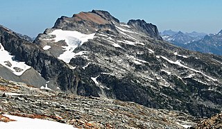
Mount Booker, with an elevation of 8,284 feet (2,525 m), is located in the North Cascades of Washington, about 1.5 miles SE of Mount Buckner, between Park Creek and Stehekin River.

Red Hill is a mountain located in the Catskill Mountains of New York east-south of Frost Valley. Woodhull Mountain is located northeast of Red Hill.

The Wovoka Wilderness is a wilderness area in Lyon County in the state of Nevada in the United States. Part of Humboldt–Toiyabe National Forest, Wovoka Wilderness was designated part of the National Wilderness Preservation System in December 2014. Totaling 49,018 acres (19,837 ha), it is the largest remaining tract of wilderness in Lyon County. Named after Wovoka, was Wovoka Wilderness' total acreage includes 23,000 acres (9,308 ha) that are protected from leasing and mining.


