
Washington County is a regional economic, educational, and cultural hub in the Northwest Arkansas region. Created as Arkansas's 17th county on November 30, 1848, Washington County has 13 incorporated municipalities, including Fayetteville, the county seat, and Springdale. The county is also the site of small towns, bedroom communities, and unincorporated places. The county is named for George Washington, the first President of the United States.

Arkansas County is a county located in the U.S. state of Arkansas. As of the 2020 census, the population was 17,149. Located in the Arkansas Delta, the county has two county seats, DeWitt and Stuttgart.

Springdale is the fourth-most populous city in Arkansas, United States. It is located in both Washington and Benton counties in Northwest Arkansas. Located on the Springfield Plateau deep in the Ozark Mountains, Springdale has long been an important industrial city for the region. In addition to several trucking companies, the city is home to the world headquarters of Tyson Foods, the world's largest meat producing company. Originally named Shiloh, the city changed its name to Springdale when applying for a post office in 1872. It is included in the four-county Northwest Arkansas Metropolitan Statistical Area, which is ranked 102nd in terms of population in the United States with 546,725 in 2020 according to the United States Census Bureau. The city had a population of 84,161 at the 2020 Census.

Fayetteville is the second-most populous city in the U.S. state of Arkansas, the county seat of Washington County, and the most populous city in Northwest Arkansas. The city had a population of 93,949 as of the 2020 census, which was estimated to have increased to 101,680 by 2023. The city is on the outskirts of the Boston Mountains, deep within the Ozarks. It was named after Fayetteville, Tennessee, from which many settlers had come, and was incorporated on November 3, 1836. Fayetteville is included in the three-county Fayetteville–Springdale–Rogers metropolitan statistical area, with 576,403 residents in 2020.
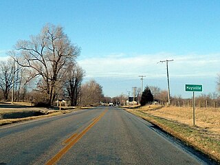
Maysville is an unincorporated community and census-designated place (CDP) in Benton County, Arkansas, United States. It is the westernmost settlement in the state of Arkansas. Per the 2020 census, the population was 117. It is located in the Northwest Arkansas region.
Savoy is an unincorporated community in Litteral Township, Washington County, Arkansas, United States. It is located on County Route 845 east of Lake Wedington. The Ozark National Forest is just west of the community. The Savoy area is marked with bluffs and streams. A distinctive feature is the dam on Clear Creek where a flour mill was once in operation. Savoy had a post office and businesses that no longer exist.

Combs is an unincorporated community in southern Madison County, Arkansas, United States. It is located on Arkansas Highway 16 at the southern terminus of AR 295. The community is within the Ozark-St. Francis National Forest and just south of the upper White River. The community of Brashears is about two miles east on route 16. The population was 431 as of the 2021 census, the overwhelming majority of which was white.
Strickler is an unincorporated community in Cove Creek Township, Washington County, Arkansas, United States. It is located on Arkansas Highway 265, northwest of Devil's Den State Park.
Sexton is a former community in Dutch Mills Township, Washington County, Arkansas, United States. The community was located on a tributary of the Baron Fork approximately one-half mile east of the Arkansas - Oklahoma state line.
Harris is an unincorporated community in Elkins Township, Washington County, Arkansas, United States. It is located east of Fayetteville and within the city limits of Elkins near Arkansas Highway 16.
Hogeye is an unincorporated community in Valley Township, Washington County, Arkansas, United States. It is located on Arkansas Highway 265 and Arkansas Highway 156.
Hubbard is an unincorporated community in Valley Township, Washington County, Arkansas, United States. It is located near the intersection of Washington County Road 21 and Hubbard Road.
Blackburn is an unincorporated community in Lee's Creek Township, Washington County, Arkansas, United States. It is located on Arkansas Highway 74, northeast of Devil's Den State Park.
Pitkin Corner is an unincorporated community in West Fork Township, Washington County, Arkansas, United States. It is located on Washington County Road 35 west of the Woolsey Bridge.
Arnett is an unincorporated community in White River Township, Washington County, Arkansas, United States. It is located on Arkansas Highway 74.
Viney Grove is an unincorporated community in Marrs Hill Township, Washington County, Arkansas, United States. It is located north of Prairie Grove and Prairie Grove Battlefield State Park along County Road 37.
Hazel Valley is an unincorporated community in Reed Township, Washington County, Arkansas, United States. It is located along County Route 47 northeast of Winslow.
Sunset is an unincorporated community in Reed Township, Washington County, Arkansas, United States. It is located at the intersection of Sunset Road and CR 110.
Tolu is an unincorporated community in Vineyard Township in western Washington County, Arkansas, United States. It is located at the intersection of Highway 59 and Bellamy Road about one half mile from the Arkansas - Oklahoma border. The community of Evansville lies approximately 1.3 miles to the south, across Evansville Creek.
McGuire is an extinct town in Washington County, in the U.S. state of Arkansas. The community is located southeast of Fayetteville on Arkansas Highway 74. The White River flows past the southwest side of the community.


