
Washington County is a regional economic, educational, and cultural hub in the Northwest Arkansas region. Created as Arkansas's 17th county on November 30, 1848, Washington County has 13 incorporated municipalities, including Fayetteville, the county seat, and Springdale. The county is also the site of small towns, bedroom communities, and unincorporated places. The county is named for George Washington, the first President of the United States.

Highway 265 is a designation for three state highways in Northwest Arkansas. The southern segment of 19.70 miles (31.70 km) runs from Highway 170 near Strickler north to I-49/US 71/Highway 112 in south Fayetteville. A second segment begins in east Fayetteville at Highway 16 and runs north through Springdale to Highway 94 in Rogers. Further north, a third segment of 3.324 miles (5.349 km) runs from Highway 94 in Pea Ridge north to the Missouri state line. The highways are maintained by the Arkansas Department of Transportation (ARDOT).
Floss is an unincorporated community in Boston Township in southwestern Washington County, Arkansas, United States. The community is located on Cove Creek. Odell is to the southwest and Strickler lies to the northeast.

Township of Cove Creek is one of 37 townships in Washington County, Arkansas, USA. As of the 2000 census, its total population was 683. Part of Devil's Den State Park is located in Cove Creek Township.
Sexton is a former community in Dutch Mills Township, Washington County, Arkansas, United States. The community was located on a tributary of the Baron Fork approximately one-half mile east of the Arkansas - Oklahoma state line.
Harris is an unincorporated community in Elkins Township, Washington County, Arkansas, United States. It is located east of Fayetteville and within the city limits of Elkins near Arkansas Highway 16.
Hogeye is an unincorporated community in Valley Township, Washington County, Arkansas, United States. It is located on Arkansas Highway 265 and Arkansas Highway 156.
Hubbard is an unincorporated community in Valley Township, Washington County, Arkansas, United States. It is located near the intersection of Washington County Road 21 and Hubbard Road.
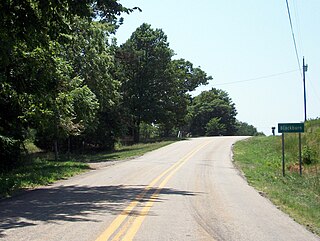
Blackburn is an unincorporated community in Lee's Creek Township, Washington County, Arkansas, United States. It is located on Arkansas Highway 74, northeast of Devil's Den State Park.
Pitkin Corner is an unincorporated community in West Fork Township, Washington County, Arkansas, United States. It is located on Washington County Road 35 west of the Woolsey Bridge.
Strain is an unincorporated community in Richland Township, Washington County, Arkansas, United States. It is located between Fayetteville and Elkins. The community consists of a small number of homes located around a road junction near the Middle Fork White River.
Arnett is an unincorporated community in White River Township, Washington County, Arkansas, United States. It is located on Arkansas Highway 74.
Morrow is an unincorporated community and census-designated place (CDP) in Washington County, Arkansas, United States. A post office has been in operation at Morrow since 1883; The community had the name of G. W. Morrow, an early postmaster. it was first listed as a CDP in the 2020 census with a population of 263;
Hazel Valley is an unincorporated community in Reed Township, Washington County, Arkansas, United States. It is located along County Route 47 northeast of Winslow.
Rhea is an unincorporated community in Rhea's Mill Township, Washington County, Arkansas, United States. It is located on a county road north of Lincoln and Lincoln Lake. Weddington Mountain is just to the west.
Sulphur City is an unincorporated community in White River Township, Washington County, Arkansas, United States. It is located at the intersection of Black Oak Road and Whitehouse Road (CR 43). The community is on the east bank of the Middle Fork of the White River. The community of Black Oak lies approximately 1.5 miles to the northwest on the opposite side of the river.
Sunset is an unincorporated community in Reed Township, Washington County, Arkansas, United States. It is located at the intersection of Sunset Road and CR 110.
Carter (1960–2018) was an unincorporated community in Washington County, Arkansas, United States. It is located on Arkansas Highway 74 between Arnett and Sulphur City. At times it was also known as Carter's Store, Carter Store, and Hicks. A post office, for all these names at different times existed from 1875 to 1953. The community has the name of John C. Carter, first postmaster.
Tolu is an unincorporated community in Vineyard Township in western Washington County, Arkansas, United States. It is located at the intersection of Highway 59 and Bellamy Road about one half mile from the Arkansas - Oklahoma border. The community of Evansville lies approximately 1.3 miles to the south, across Evansville Creek.
McGuire is an extinct town in Washington County, in the U.S. state of Arkansas. The community is located southeast of Fayetteville on Arkansas Highway 74. The White River flows past the southwest side of the community.


