Sulphur Township, Pope County, Arkansas

Last updated

Sulphur Township
Former Township
Coordinates: 35°40′30″N92°59′51″W / 35.67508°N 92.99740°W / 35.67508; -92.99740 [1]
Country Flag of the United States (23px).png  United States
State Flag of Arkansas.svg  Arkansas
County Pope
Area
  Total30 sq mi (80 km2)
Elevation
1,286 ft (392 m)
GNIS feature ID 70148

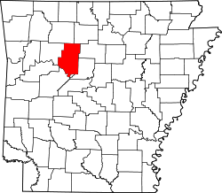
Sulphur Township is a former township of Pope County, Arkansas. It was located on the northern edge of the county. [2]
Contents

Cities, towns, and villages

Related Research Articles

<span class="mw-page-title-main">Yell County, Arkansas</span> County in Arkansas, United States

Yell County is a county in the U.S. state of Arkansas. As of the 2020 census, the population was 20,263. The county has two county seats, Dardanelle and Danville. Yell County is Arkansas's 42nd county, formed on December 5, 1840, from portions of Scott and Pope counties. It was named after Archibald Yell, who was the state's first member of the United States House of Representatives and the second governor of Arkansas. He died in combat at the Battle of Buena Vista during the Mexican–American War.

<span class="mw-page-title-main">Van Buren County, Arkansas</span> County in Arkansas, United States

Van Buren County is a county located in the U.S. state of Arkansas. As of the 2020 census, the population was 15,796. The county seat is Clinton. The county was formed on November 11, 1833, and named for Martin Van Buren, President of the United States, who was Vice President at the time of the county's formation. Van Buren County was a dry county until November 3, 2020, as the county residents voted to make it a wet county.

<span class="mw-page-title-main">Jefferson County, Arkansas</span> County in Arkansas, United States

Jefferson County, Arkansas is a county located in the U.S. state of Arkansas in the area known as the Arkansas Delta that extends west of the Mississippi River. Jefferson County consists of five cities, two towns, and 20 townships. It is bisected by the Arkansas River, which was critical to its development and long the chief transportation byway. In 2020, Jefferson County's population was estimated at 67,260. The county seat and largest city is Pine Bluff. The county is included in the Pine Bluff metropolitan statistical area. The county seat and the most populous city is Pine Bluff.

<span class="mw-page-title-main">Independence County, Arkansas</span> County in Arkansas, United States

Independence County is a county located in the U.S. state of Arkansas. As of the 2020 census, the population was 37,938. The county seat is Batesville. Independence County is Arkansas's ninth county, formed on October 20, 1820, from a portion of Lawrence County and named in commemoration of the Declaration of Independence. It is an alcohol prohibition or dry county.

<span class="mw-page-title-main">Sulphur River</span> River in Texas and Arkansas in the United States

The Sulphur River is a 175-mile-long (282 km) river in northeast Texas and southwest Arkansas in the United States.

Phoenix Township is one of nineteen current townships in Pope County, Arkansas, USA. As of the 2010 census, its unincorporated population was 313.

Bayliss Township is one of nineteen current townships in Pope County, Arkansas, USA. As of the 2010 census, its unincorporated population was 824.

Clark Township is one of nineteen current townships in Pope County, Arkansas, USA. As of the 2010 census, its unincorporated population was 3,386. The Arkansas Nuclear One power plant is located here near the city of London, just outside Russellville.

Griffin Township is one of nineteen current townships in Pope County, Arkansas, USA. As of the 2010 census, its total population was 839.

Hill Township was a township of Pope County, Arkansas. It was located in the northeast part of the county.

Hogan Township was a township of Pope County, Arkansas. It was located in the central part of the county. Hogan Township was created between 1910 and 1920 using parts from Allen, Jackson, Liberty, Martin and North Fork Townships.

Independence Township is a former township of Pope County, Arkansas. It was located in the northeastern part of the county.

Lee Township is a former township of Pope County, Arkansas. It was located in the southeast corner of the county.

North Fork Township is a former township of Pope County, Arkansas. It was located in the north central part of the county.

Sand Spring Township is a former township of Pope County, Arkansas. It was located on the western edge of the county.

Oak Grove is an unincorporated community and census-designated place (CDP) in Moreland Township, Pope County, Arkansas, United States. It was first listed as a CDP in the 2020 census with a population of 177.

Black Oak is a community in White River Township, Washington County, Arkansas, United States. It is located between Greenland and Elkins and lies six miles southeast of Fayetteville.

Sulphur Springs, also known as White Sulphur Springs, is a census-designated place (CDP) in Spring Township, Jefferson County, Arkansas, United States. Per the 2020 census, the population was 1,032.

Township 11 is one of thirteen current townships in Benton County, Arkansas, USA. As of the 2010 census, its total population was 12,273.

Sulphur City is an unincorporated community in White River Township, Washington County, Arkansas, United States. It is located at the intersection of Black Oak Road and Whitehouse Road (CR 43). The community is on the east bank of the Middle Fork of the White River. The community of Black Oak lies approximately 1.5 miles to the northwest on the opposite side of the river.

References

  1. "Township of Sulphur (historical)". Geographic Names Information System. United States Geological Survey. Retrieved January 13, 2014.
  2. "National Highway Map - Pope County, Arkansas." 1964 Edition. AHTD map with Townships. [ permanent dead link ] Retrieved June 23, 2010.