Swansboro | |
---|---|
![]() Downtown Swansboro | |
Motto: "The Friendly City by the Sea" | |
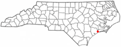
Location within the state of North Carolina | |
Coordinates: 34°41′48″N77°07′13″W / 34.69667°N 77.12028°W | |
Country | United States |
State | North Carolina |
County | Onslow |
Government | |
• Mayor | John Davis |
Area | |
• Total | 2.38 sq mi (6.16 km2) |
• Land | 2.23 sq mi (5.79 km2) |
• Water | 0.14 sq mi (0.37 km2) |
Elevation | 30 ft (9 m) |
Population (2020) | |
• Total | 3,744 |
• Density | 1,675.17/sq mi (646.90/km2) |
Time zone | UTC-5 (Eastern (EST)) |
• Summer (DST) | UTC-4 (EDT) |
ZIP code | 28584 |
Area codes | 910, 472 |
FIPS code | 37-66360 [3] |
GNIS feature ID | 2406700 [2] |
Website | swansboro-nc |
Swansboro is a resort town in Onslow County, North Carolina, located along the Crystal Coast. At the 2020 census, the population was 3,744. [4]
Swansboro started as a settlement around the plantation of Theophilus Weeks. In 1783, Swansboro was incorporated as a town, taking its name from Samuel Swann, a Speaker in the North Carolina House of Commons and a resident of Onslow County. In 1818, Otway Burns built the Prometheus, the first river steamboat constructed in North Carolina.
The town, originally spelled Swannsborough, is sometimes called "The Friendly City by the Sea". M.N. Lisk, a popular Swansboro mayor, initiated the annual Mullet Festival, [5] one of the first coastal seafood festivals in North Carolina.
The town is featured as the setting of Nicholas Sparks' novel The Guardian.
The Swansboro Historic District was listed on the National Register of Historic Places in 1990. [6]
In 2018, Swansboro was among the hardest hit cities by Hurricane Florence. A record 30.58 inches (77 cm) of rain fell at Swansboro, North Carolina, breaking the previous state record of 24.06 inches (61 cm). [7]
According to the United States Census Bureau, the town has a total area of 1.3 square miles (3.4 km2), of which 1.2 square miles (3.1 km2) is land and 0.1 square miles (0.26 km2) (8.96%) is water.
The Town of Swansboro is governed by five Board of Commissioner members and the Mayor. The Commissioners are elected for four-year and two-year terms. The Mayor is elected for a four-year term. They are elected as Town-wide representatives. The Mayor presides at all meetings as the "Chairman" of the Board of Commissioners. The mayor votes only to break a tie, and the Mayor Pro Tem is appointed by the Commissioners and conducts the meetings in the absence of the Mayor. [8]
Census | Pop. | Note | %± |
---|---|---|---|
1850 | 801 | — | |
1870 | 141 | — | |
1880 | 128 | −9.2% | |
1890 | 233 | 82.0% | |
1900 | 265 | 13.7% | |
1910 | 390 | 47.2% | |
1920 | 420 | 7.7% | |
1930 | 394 | −6.2% | |
1940 | 454 | 15.2% | |
1950 | 559 | 23.1% | |
1960 | 1,104 | 97.5% | |
1970 | 1,207 | 9.3% | |
1980 | 976 | −19.1% | |
1990 | 1,165 | 19.4% | |
2000 | 1,426 | 22.4% | |
2010 | 2,663 | 86.7% | |
2020 | 3,744 | 40.6% | |
U.S. Decennial Census [9] |
Race | Number | Percentage |
---|---|---|
White (non-Hispanic) | 3,091 | 82.56% |
Black or African American (non-Hispanic) | 121 | 3.23% |
Native American | 14 | 0.37% |
Asian | 77 | 2.06% |
Pacific Islander | 4 | 0.11% |
Other/Mixed | 201 | 5.37% |
Hispanic or Latino | 236 | 6.3% |
As of the 2020 United States census, there were 3,744 people, 1,360 households, and 755 families residing in the town.
As of the census of 2000, there were 1,426 people, 655 households, and 419 families residing in the town. The population density was 1,168.2 inhabitants per square mile (451.0/km2). There were 770 housing units at an average density of 630.8 per square mile (243.6/km2). The racial makeup of the town was 90.18% White, 4.63% African American, 0.21% Native American, 0.77% Asian, 0.91% from other races, and 3.30% from two or more races. Hispanic or Latino of any race were 2.81% of the population.
There were 655 households, out of which 28.9% had children under the age of 18 living with them, 44.6% were married couples living together, 15.0% had a female householder with no husband present, and 36.0% were non-families. 32.4% of all households were made up of individuals, and 13.1% had someone living alone who was 65 years of age or older. The average household size was 2.18 and the average family size was 2.72.
In the town, the population was spread out, with 24.4% under the age of 18, 7.6% from 18 to 24, 28.1% from 25 to 44, 23.1% from 45 to 64, and 16.8% who were 65 years of age or older. The median age was 38 years. For every 100 females, there were 83.5 males. For every 100 females age 18 and over, there were 81.2 males.
The median income for a household in the town was $37,740, and the median income for a family was $45,357. Males had a median income of $32,188 versus $25,556 for females. The per capita income for the town was $19,625. About 10.3% of families and 11.9% of the population were below the poverty line, including 18.9% of those under age 18 and 7.6% of those age 65 or over.
Swansboro sits across the Intracoastal Waterway from Hammocks Beach State Park and is a popular destination for tourists, outdoor enthusiasts and recreational fishermen.
The Rotary Club of Swansboro is active in the community and regularly hosts events such as the annual King Mackerel Tournament and numerous fundraising gatherings. The Mullet Festival is the most notable and longest running Annual festival of 68 years that features a parade, street vendors, and live music. [11]
Yancey County is a county located in the U.S. state of North Carolina. As of the 2020 census, the population was 18,470. Its county seat is Burnsville.
Pender County is a county located in the U.S. state of North Carolina. As of the 2020 census, the population was 60,203. Its county seat is Burgaw. Pender County is part of the Wilmington, NC Metropolitan Statistical Area.
Onslow County is a county located in the U.S. state of North Carolina. As of the 2020 census, the population was 204,576. Its county seat is Jacksonville. The county was created in 1734 as Onslow Precinct and gained county status in 1739. Onslow County comprises the Jacksonville, NC Metropolitan Statistical Area. The southern border of the county is the coast of the Atlantic Ocean.
Cedar Point is a town in Carteret County, North Carolina, United States. At the 2020 census, the population was 1,764. In 2022, the population estimate was 2,198.
Peletier is a town in Carteret County, North Carolina, United States. The population was 644 at the 2010 census.
Clemmons is a village in Forsyth County, North Carolina, United States and a suburb of Winston-Salem. The population was 21,177 at the 2020 census, with an estimated population of 21,517 in 2021.
Benson is a town in Johnston County, North Carolina, United States, near the intersection of Interstates 95 and 40. Benson celebrates Mule Days on the fourth Saturday of September, a festival that attracts over 60,000 people each year. In 2010, the population was 3,311, up from 2,923 in 2000.
Micro is a town in Johnston County, North Carolina, United States. The population was 458 as of the 2020 census, up from 441 in the 2010 census.
Holly Ridge is a town in Onslow County, North Carolina, United States. The 2010 population was 1,268. The 2020 census population was 4,171.
Jacksonville is a city in Onslow County, North Carolina, United States. As of the 2020 census, the population was 72,723, which makes Jacksonville the 14th-most populous city in North Carolina. Jacksonville is the county seat and most populous community of Onslow County, which is coterminous with the Jacksonville, NC Metropolitan Statistical Area. Demographically, Jacksonville is the youngest city in the United States, with an average age of 22.8 years old, which can be attributed to the large military presence. The low age may also be in part due to the population drastically increasing over the past 80 years, from 783 in the 1930 census to 72,723 in the 2020 census.
North Topsail Beach is a town in Onslow County, North Carolina, United States. As of the 2020 U.S. census, the population was 1,005. It is located on Topsail Island. North Topsail Beach is part of the Jacksonville, North Carolina Metropolitan Statistical Area.
Richlands is a town in Onslow County, North Carolina, United States. In the 2020 U.S. census, the population was 2,287. It is included in the Jacksonville, North Carolina Metropolitan Statistical Area. Incorporated on March 29, 1880, it was the first town in Onslow County to have its own library and museum. Richlands was also the first town in Onslow County to have a female mayor, Annette Hargett.
Sneads Ferry is a census-designated place (CDP) in Onslow County, North Carolina, United States. It is the second largest municipality in Onslow County, behind Jacksonville and is part of the Jacksonville, North Carolina Metropolitan Statistical Area. Once a rural fishing village, Sneads Ferry has experienced a surge in development since 2000. Based on U.S. Census data, the study area has grown from 5,425 residents in 2000 to approximately 9,750 residents in 2014, an 80% increase. Growth primarily has been driven by accessibility to MCB Camp Lejeune from the gate on NC 172 and expansion of the United States Marine Corps Special Operations Command (MARSOC) accessed from NC 210. Sneads Ferry is expected to continue growing rapidly at 3.3% annually, adding 17,500 new residents through 2040 reaching 20,000 in total population by 2030.
Ayden is a town in Pitt County, North Carolina, United States. The population was 4,977 at the 2020 census. The town is a part of the Greenville Metropolitan Area of North Carolina's Inner Banks region.
Garland is a town in Sampson County, North Carolina, United States. The population was 595 at the 2020 census.
Newton Grove is a town in Sampson County, North Carolina, United States. It was chartered in 1879. The population was 585 at the 2020 census.
New London is a town in Stanly County, North Carolina, United States. The population was 600 at the 2010 census, and was estimated to be 724 as of 2019. The town lies between Albemarle and Richfield along U.S. 52 in the southern Piedmont region of the state, approximately 45 miles (72 km) east-northeast of Charlotte. It was the site of a gold mine, which was active during periods of the mid-1800s and early 1900s.
Unionville is a rural town in Union County, North Carolina, United States. The population was 6,643 at the 2020 census.
Weddington is a suburban town in Union County, North Carolina, United States. The population was 9,459 at the 2010 census. It is a suburb in the Charlotte metropolitan area. The current mayor of Weddington is Jim Bell.
Surf City is a town in Onslow and Pender counties in the U.S. state of North Carolina. The population was 3,867 at the 2020 census. It is located on Topsail Island.