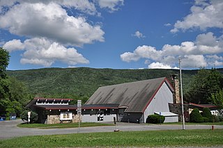
Windsor County is a county located in the U.S. state of Vermont. As of the 2020 census, the population was 57,753. The shire town is the town of Woodstock. The county's largest municipality is the town of Hartford.

Starksboro is a town in Addison County, Vermont, United States. The population was 1,756 at the 2020 census.

Stamford is a town in Bennington County, Vermont, United States. The population was 861 at the 2020 census.

Lyndon is a town in Caledonia County, Vermont, United States. As of the 2020 census, the population was 5,491. Lyndon is the home of Lyndon State College. The town contains five unincorporated villages, Lyndonville just east of the geographic center of town, Lyndon Corner in the south, Lyndon Center in the center of town on the west side of Lyndonville, Little Egypt in the north, and East Lyndon in the southeast.

Hinesburg is a town in Chittenden County, Vermont, United States. The town was named for Abel Hine, town clerk. The population was 4,698 at the 2020 census.

Shelburne is a town in Chittenden County, Vermont, United States. Located along the shores of Lake Champlain, Shelburne's town center lies approximately 7 miles (11 km) south of the city center of Burlington, the largest city in the state of Vermont. As of the 2020 census, the population of Shelburne was 7,717.

Williston is a town in Chittenden County, Vermont, United States. Originally rural and laid out with many farms, in recent decades it has developed into a thriving suburb of Burlington, the largest city in the state of Vermont. As of the 2020 census, the population of Williston was 10,103, an increase of over 1,000 people since the 2010 census. Williston is one of the fastest-growing towns in Vermont, and while becoming more populated, it has also developed as a major retail center for the Burlington area as well as much of central and northern Vermont. The town has a National Register Historic District in its unincorporated central village.

Island Pond is a census-designated place (CDP) in the town of Brighton in Essex County, Vermont, United States. The population was 750 at the 2020 census. It is part of the Berlin, NH–VT Micropolitan Statistical Area.

Highgate is a town in Franklin County, Vermont, United States. The population was 3,472 at the 2020 census. The town is on the Canada–US border and is a border town with Philipsburg, Quebec.

Richford is a town in Franklin County, Vermont, United States, located along the Canada–United States border. The population was 2,346 at the 2020 census.

Eden is a town in Lamoille County, Vermont, United States. The population was 1,338 at the 2020 census.

Jeffersonville is a village in the town of Cambridge, Vermont, United States. The population was 750 at the 2020 census.

Wolcott is a town in Lamoille County, Vermont, United States. The town was named for General Oliver Wolcott, a signer of the Declaration of Independence. The population was 1,670 at the 2020 census.

Fairlee is a town in Orange County, Vermont, United States. The population was 988 at the 2020 census. It includes the village of Ely. Fairlee is home to Lake Morey, which claims to have the longest ice skating trail in the United States.

Proctor is a town in Rutland County, Vermont, United States. The population was 1,763 at the 2020 census. Proctor is home to the Vermont Marble Museum and Wilson Castle.

Hartford is a town in Windsor County, Vermont, United States. It is on the New Hampshire border, at the intersection of Interstates 89 and 91. It is the site of the confluence of the White and Connecticut rivers; the Ottauquechee River also flows through the town. The town is composed of five unincorporated villages: Hartford, Quechee, West Hartford, White River Junction and Wilder. As of the 2020 census, the population was 10,686.

White River Junction is an unincorporated village and census-designated place (CDP) in the town of Hartford in Windsor County, Vermont, United States. The population was 2,528 at the 2020 census, up from 2,286 in 2010, making it the largest community within the town of Hartford.

Swanton is a town in Franklin County, Vermont, United States. The population was 6,701 at the 2020 census. The town includes the village of Swanton.

Cambridge is a town in Lamoille County, Vermont, United States. The population was 3,839 at the 2020 United States Census. Cambridge includes the villages of Jeffersonville and Cambridge.

Hyde Park is a town in and the shire town of Lamoille County, Vermont, United States. The town was named for Captain Jedediah Hyde, an early landowner who was a veteran of the American Revolutionary War. The population was 3,020 at the 2020 census. There is also a village of the same name within the town.


