


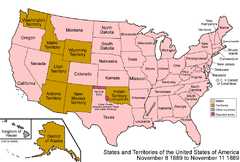

The following chronology traces the territorial evolution of the U.S. State of Montana .
The following chronology traces the territorial evolution of the U.S. State of Montana .

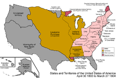
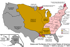
The District of Louisiana, or Louisiana District, was an official and temporary United States government designation for the portion of the Louisiana Purchase that had not been organized into the Territory of Orleans or "Orleans Territory". The district officially existed from March 10, 1804, until July 4, 1805, when it was organized as the Louisiana Territory.

The Territory of Missouri was an organized incorporated territory of the United States that existed from June 4, 1812, until August 10, 1821. In 1819, the Territory of Arkansas was created from a portion of its southern area. In 1821, a southeastern portion of the territory was admitted to the Union as the State of Missouri, and the rest became unorganized territory for several years.

The territory of the United States and its overseas possessions has evolved over time, from the colonial era to the present day. It includes formally organized territories, proposed and failed states, unrecognized breakaway states, international and interstate purchases, cessions, and land grants, and historical military departments and administrative districts. The last section lists informal regions from American vernacular geography known by popular nicknames and linked by geographical, cultural, or economic similarities, some of which are still in use today.

The following outline is provided as an overview of and topical guide to the U.S. state of Iowa.

The following outline is provided as an overview of and topical guide to the U.S. state of Montana:

The following outline is provided as an overview of and topical guide to the U.S. state of Kansas:

The following outline is provided as an overview of and topical guide to the U.S. state of Minnesota:
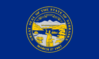
The following outline is provided as an overview of and topical guide to the U.S. state of Nebraska:
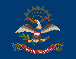
The following outline is provided as an overview of and topical guide to the U.S. state of North Dakota:

The following outline is provided as an overview of and topical guide to the U.S. state of Oklahoma:

The following outline is provided as an overview of and topical guide to South Dakota:

The following outline is provided as an overview of and topical guide to the U.S. state of Wyoming:
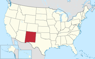
The area currently occupied by the U.S. State of New Mexico has undergone numerous changes in occupancy and territorial claims and designations. This geographic chronology traces the territorial evolution of New Mexico.

The following outline traces the territorial evolution of the U.S. State of Wyoming.
The following chronology traces the territorial evolution of the U.S. State of Idaho.
The following outline traces the territorial evolution of the U.S. state of Oregon.
The following outline traces the territorial evolution of the U.S. State of Nevada.
The following outline traces the territorial evolution of the U.S. State of North Dakota.
The following outline traces the territorial evolution of the U.S. State of South Dakota.
| By country | |
|---|---|
| By former country | |
| By subdivision |
|
| By region |
|
| By country, people, region or period | |
| By international organisation | |