The evolution of tectonophysics is closely linked to the history of the continental drift and plate tectonicshypotheses. The continental drift/ Airy-Heiskanen isostasy hypothesis had many flaws and scarce data. The fixist/ Pratt-Hayford isostasy, the contracting Earth and the expanding Earth concepts had many flaws as well.
The idea of continents with a permanent location, the geosyncline theory, the Pratt-Hayford isostasy, the extrapolation of the age of the Earth by Lord Kelvin as a black body cooling down, the contracting Earth, the Earth as a solid and crystalline body, is one school of thought. A lithosphere creeping over the asthenosphere is a logical consequence of an Earth with internal heat by radioactivity decay, the Airy-Heiskanen isostasy, thrust faults and Niskanen's mantle viscosity determinations.
Wunderlich, H.G. (March 1962). "50 Jahre Kontinentalverschiebungstheorie – von Wegener bis Runcorn" [50 Years Continental Drift Hypothesis – Wegener to Runcorn]. Geologische Rundschau. 52 (1): 504–513. Bibcode:1962GeoRu..52..504W. doi:10.1007/BF01840095. S2CID128754334.
The uncertainty of the distance between Europe and North America is too great to confirm the continental drift hypothesis. It states wrongly that the lock-and-key form of South America and Africa is less good if the continental shelf is taken into account. Note: the truth is that neither A. Wegener nor C. Schuchert used the east coastline of South America and west coastline of Africa, really; these coastlines don't fit (Bullard 1975).
Plate tectonics
The "Bullard's Fit" of the Iapetus Ocean suture zone.Approximate location of Mesoproterozoic (older than 1.3Ga) cratons in South America and Africa. The São Luís and the Luis Alves cratonic fragments are shown (Brazil), but the Arequipa–Antofalla craton, the Saharan Metacraton and some minor African cratons are not. Other versions describe the Guiana Shield separated from the Amazonian shield by a depression.
P.M.S. Blackett; E.C. Bullard; S.K. Runcorn, eds. (1965). "A Symposium on Continental Drift, 28th October, 1965". Philosophical Transactions of the Royal Society A. 258 (1088): i–x, 1–323, A1 –A6.(Bullard, Everett & Smith 1965), (Wilson 1965b), (Heezen & Tharp 1965).
Wells, finds on growth rings of Devonian corals the maximum Earth expansion during this time to be less than 0.6mm/year (Wells 1963), (Marvin 1966, p.60). Heezen, abandons the expanding Earth theory as it requires a radial expansion of 4–8mm/year for the Atlantic Ocean alone (Heezen 1966).
Nowadays, the fit between Africa and South America is based on paleomagnetism, slightly different from the older "Bullard's Fit" (based on least-square fitting of 500fathom (c.900m) contours across the Atlantic). (Bullard, Everett & Smith 1965), (Torsvik et al. 2001)
February 1966, Vine visits the Lamont group (Walt Pitman and Neil Opdyke) and tells them that their 'discovered' Emperor reversal was already named as Jaramillo reversal. And shows the reversal on the Walt Pitman's graphik (cm/ vertical), surprising Pitman, Opdyke and even himself (Ninkovich et al. 1966), (Vine 1966). Many anti-drifters changed their mind after the publication of these magnetometer readings of sediment core (Eltanin-19), geomagnetic reversals (Le Grand 1990).
The Vine–Matthews–Morley hypothesis is the first scientific test to confirm the seafloor spreading concept. Earth Sciences paradigm shift, from fix continents to plate tectonics (Wilson 1968):
Magnetometer readings of sediment cores, geomagnetic reversals: ratio of cm (vertical).
Magnetic profiles of seafloor, geomagnetic reversals: ratio of km (horizontal).
Radiometric analysis of lava flows, geomagnetic reversals: ratio of Ma (time). (Frankel 1987, p.235)
Conference in New York in November 1966, sponsored by NASA ((Phinney 1968) cited in (Bullard 1975)).
Even Maurice Ewing (Lamont–Doherty Earth Observatory) came to accept seafloor spreading by April 1967 and cited (along with his brother John Ewing) the case for Vine-Matthews-Morley Hypothesis as "strong support for the hypothesis of spreading."(Frankel 1987, p.230)
In 1967, W. Jason Morgan proposed that the Earth's surface consists of 12 rigid plates that move relative to each other (Morgan 1968). Two months later, in 1968, Xavier Le Pichon published a complete model based on 6 major plates with their relative motions (Le Pichon (1968), received 2 January 1968). The Englishmen Dan McKenzie and Robert Parker published the quantitative principles for plate tectonics (Euler's rotation theorem: Individual aseismic areas move as rigid plates on the surface of a sphere, quote: "a block on a sphere can be moved to any other conceivable orientation by a single rotation about a properly chosen axis.") (McKenzie & Parker 1967).
Note I: although Morgan (1968) (received 30 August 1967, revised 30 November 1967 and published 15 March 1968) was published later than McKenzie & Parker (1967) (published 30 December 1967), priority belongs to Morgan. It is based on a presentation at the American Geophysical Union's 1967 meeting (title: Rises, Trenches, Great Faults, and Crustal Blocks).
Note II: W. Jason Morgan shared with Fred Vine an office in the Princeton University for two years, and a scientific paper from H. W. Menard drifted his attention to plate tectonics. It was probably the long faults on Menard (1967) (cited in Morgan 1968) and the Euler's rotation theorem that gave him the idea.[5][6]
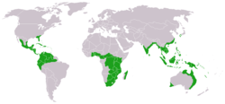
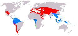
Euler rotational pole.Spreading at a mid-ocean ridge (the image has a flaw though, the seafloor gets thicker with age).Approximate world distribution of living CycadalesA distribution map of Gnetophyta colour-coded by genus: Green – Welwitschia Blue – Gnetum Red – Ephedra Purple – Gnetum and Ephedra range overlap
Wilson cycle: slab pull/ subduction opens a space on western South America and the sliding seafloor away from the Mid-Atlantic Ridge on eastern South America occupies the new available space.
Overview: viscous resistance, slab thickness, slab bending, trench migration and seismic coupling, slab width, slab edges and mantle return flow:
Vening Meinesz (together with J.H.F. Umbgrove, B.G. Escher and Ph.H. Kuenen) had more evidence that the established paradigm and the reality do not match. But as all geophysicists he could not really believe in crust motions in such a large scale and he knew Wegener's Continental drift hypothesis fate too. Hess (1962) accumulated even more evidence, but he prudently introduced them as geopoetry, quote: "Little of Umbgrove (1947) brilliant summary remains pertinent when confronted by the relatively small but crucial amount of information collected in the intervening years. Like Umbgrove, I shall consider this paper an essay in geopoetry."
The IAV/ IAVEI board (i.e., B.G. Escher and A. Rittmann) probably never dumped the idea that the South Atlantic is under extension.
And the anti-drifters were in a way right as well. Although convection would mix up the mantle and make it homogeneous. The seafloor cycle with subduction and upwelling is something between conduction and convection, it allows for its inhomogeneity in a quasi-steady state. The mantle and the continents are in a way passive, the heat sink of the earth is the seafloor. So that the heat generated in the earth gets neutralised.
Wegener's continental drift hypotheses is a logical consequence of: the theory of thrusting (alpine geology), the isostasy, the continents forms resulting from the supercontinent Gondwana break up, the past and present-day life forms on both sides of the Gondwana continent margins, and the Permo-Carboniferous moraine deposits in South Gondwana.
Graphics
Plate tectonics map, Digital Tectonic Activity MapGlobal plate tectonic movement
↑Bill Bonini; Laurie Wanat, eds. (Fall 2003). "Jason Morgan Retires"(PDF). The Smilodon: The Princeton Geosciences Newsletter. 44 (2). Fortuitously, he was assigned as well an office that he shared for two years with Fred Vine,... This insight was fundamental to the revolutionary theory then developing, and sharing that office with Fred Vine drew Morgan into the subject — as he puts it — "with a bang." A paper written by H.W. Menard caused him to begin musing on his own about great faults and fracture zones, and how they might relate to theorems on the geometry of spheres Passages about W. Jason Morgan from McPhee, John (1998) Annals of the Former World, New York: Farrar, Straus, Giroux.
Heezen, B. C; Tharp, M (1965). "Tectonic Fabric of the Atlantic and Indian Oceans and Continental Drift". Philosophical Transactions of the Royal Society A: Mathematical, Physical and Engineering Sciences. 258 (1088): 90–106. Bibcode:1965RSPTA.258...90H. doi:10.1098/rsta.1965.0024. S2CID121476006.
Carey, S. W. (1958). "The tectonic approach to continental drift". In Carey, S. W. (ed.). Continental Drift—A symposium, held in March 1956. Hobart: Univ. of Tasmania. pp.177–363. Expanding Earth from pp. 311–349.
Coats, Robert R. (1962). "Magma type and crustal structure in the Aleutian arc". The Crust of the Pacific Basin. American Geophysical Union Monograph. Vol.6. pp.92–109.
Dana, James Dwight (1863). Manual of Geology: Treating of the Principles of the Science with Special Reference to American Geological History. Bliss. p.805.
Flint, R. F. (1947). Glacial Geology and the Pleistocene Epoch. New York: John Wiley and Sons. p.589. ISBN978-1-4437-2173-8.{{cite book}}: ISBN / Date incompatibility (help)
Frankel, H. (1987). "The Continental Drift Debate". In H.T. Engelhardt Jr; A.L. Caplan (eds.). Scientific Controversies: Case Solutions in the resolution and closure of disputes in science and technology. Cambridge University Press. ISBN978-0-521-27560-6.
W.A.J.M. van Waterschoot van der Gracht; Bailey Willis; Rollin T. Chamberlin; John Joly; G.A.F. Molengraaff; J.W. Gregory; Alfred Wegener; Charles Schuchert; Chester R. Longwell; Frank Bursley Taylor; William Bowie; David White; Joseph T. Singewald, Jr.; Edward W. Berry (1928). W.A.J.M. van Waterschoot van der Gracht (ed.). Theory of Continental Drift: a symposium on the origin and movement of land masses both intercontinental and intracontinental as proposed by Alfred Wegener, A Symposium of the American Association of Petroleum Geologists (AAPG, 1926). Tulsa, OK. p.240.{{cite book}}: CS1 maint: location missing publisher (link)
Le Grand, H. E. (1990). "Is one picture worth a thousand experiments?". In Le Grand, H. E. (ed.). Experimental Inquiries: Historical, Philosophical and Social Studies of Experimentation in Science. Dordrecht: Kluwer. pp.241–270.
Hess, H. H. (November 1962). "History of Ocean Basins"(PDF). In A. E. J. Engel; Harold L. James; B. F. Leonard (eds.). Petrologic studies: a volume to honor of A. F. Buddington. Boulder, CO: Geological Society of America. pp.599–620.
Jeffreys, H. (1924). The Earth – its Origin, History and Physical Constitution (1ed.). Cambridge University Press. p.429.
Jeffreys, H. (1952). The Earth – its Origin, History and Physical Constitution (3ed.). Cambridge University Press. p.574. ISBN978-0-521-20648-8.{{cite book}}: ISBN / Date incompatibility (help)
Kay, Marshall, ed. (1969). North Atlantic: geology and continental drift, a symposium. Tulsa, OK: American Association of Petroleum Geologists (AAPG).
Keary, P; Vine, F. J. (1990). Global Tectonics. Oxford: Blackwell Scientific Publications. pp.302.
Kious, W. Jacquelyne; Tilling, Robert I. (February 2001) [1996]. "Historical perspective". This Dynamic Earth: the Story of Plate Tectonics (Onlineed.). U.S. Geological Survey. ISBN978-0-16-048220-5. Retrieved 29 January 2008. Abraham Ortelius in his work Thesaurus Geographicus... suggested that the Americas were 'torn away from Europe and Africa... by earthquakes and floods... The vestiges of the rupture reveal themselves, if someone brings forward a map of the world and considers carefully the coasts of the three [continents].'
Lilienthal, T. (1756). Die Gute Sache der Göttlichen Offenbarung. Königsberg: Hartung. This is also likely owing to the fact that the coasts of certain lands, situated opposite each other though separated by sea, have a corresponding shape, so that they would be congruent with one another were they to stand side by side; for example, the southern part of America and Africa. For this reason one supposes that perhaps both of these continents were previously attached to each other, either directly, or through the sunken island of Atlantis;...
Lyell, Charles (1875). Principles of Geology (12thed.).
Naomi Oreskes; Homer Le Grand, eds. (December 2001). Plate Tectonics: An Insider's History of the Modern Theory of the Earth. Westview Press. p.448. ISBN978-0-8133-3981-8.
Ortelius, Abraham (1596). Thesaurus Geographicus (3ed.). Antwerp: Plantin. The vestiges of the rupture reveal themselves, if someone brings forward a map of the world and considers carefully the coasts of the three [continents (Europe, Africa and Americas)]
Suess, E. (1875). Die Entstehung der Alpen[The Origin of the Alps]. W. Braumüller. A mass movement, more or less horizontal and progressive, should be the cause underlying the formation of our mountain systems.
Suess, Eduard (19 August 1885). Das Antlitz der Erde[The Face of the Earth]. Translated by Sollas, H.B.C. Vienna: F. Tempsky.
Sullivan, Walter (1991). Continents in Motion: The New Earth Debate (1ed.). American Inst. of Physics. p.425. ISBN978-0-88318-703-6.
du Toit, Alexander (1937). Our wandering continents: an hypothesis of continental drifting. Edinburgh: Oliver and Boyd. ISBN978-0-8371-5982-9.{{cite book}}: ISBN / Date incompatibility (help)
Umbgrove, J.H.F. (1947). The Pulse of the Earth (2ed.). The Hague, NL: Martinus Nyhoff. p.359.
Wallace, Alfred Russel (2007). Darwinism: An Exposition of the Theory of Natural Selection With Some of Its Applications. Cosimo, Inc. p.516. ISBN978-1-60206-453-9.
Wegener, A. (1966) [1929]. The Origin of Continents and Oceans. Courier Dover Publications. ISBN978-0-486-61708-4.
Windley, B.F. (1996). The Evolving Continents (3ed.). John Wiley & Sons. ISBN978-0-471-91739-7.
Ziegler, P.A. (1990). Geological Atlas of Western and Central Europe (2ed.). Bath: Shell Internationale Petroleum Maatschappij BV, Geological Society Publishing House. p.239. ISBN978-90-6644-125-5.
Cited articles
Ampferer, O. (1921). "Bemerkung zu der Arbeit von R. Schwinner "Vulkanismus und Gebirgsbildung"". Verh. Geol. Staatsanst. Vienna: 101–124.
Ampferer, O. (1920). "Geometrische Erwägungen über den Bau der Alpen". Mitt. Geol. Ges. Wien. 12. Vienna: 135–174.
Argand, E. (1916). "Sur l'arc des Alps Occidentales". Eclogae Geologicae Helveticae. 14. Lausanne: 145–192.
Argand, E. (1924). "La Tectonique de l'Asie". Extrait du Compte-rendu du XIIIe Congrès Géologique International 1922 (13th International Geological Congress) (in French). 1 (5). Liège: 171–372.
Fukao, Y; Obayashi, M; Inoue, H; Nenbai, M (1992). "Subducting slabs stagnant in the mantle transition zone". Journal of Geophysical Research. 97 (B4): 4809–22. Bibcode:1992JGR....97.4809F. doi:10.1029/91JB02749.
Hager, Bradford H.; O'Connell, Richard J. (1981). "A Simple Global Model of Plate Dynamics and Mantle Convection". Journal of Geophysical Research. 86 (B6): 4843–4867. Bibcode:1981JGR....86.4843H. doi:10.1029/JB086iB06p04843.
Heezen, B. C.; Tharp, M. (1961). Physiographic diagram of the South Atlantic, the Caribbean, the Scotia Sea, and the eastern margin of the South Pacific Ocean. Boulder, CO: The Geological Society of America.
Heezen, B. C.; Tharp, M. (1964). Physiographic diagram of the Indian Ocean, the Red Sea, the South China Sea, the Sulu Sea, and the Celebes Sea. Boulder, CO: The Geological Society of America.
Heezen, B. C; Tharp, M (1966). "A discussion concerning the floor of the northwest Indian Ocean – Physiography of the Indian Ocean". Philosophical Transactions of the Royal Society A: Mathematical, Physical and Engineering Sciences. 259 (1099): 137–149. doi:10.1098/rsta.1966.0003. S2CID202574464.
Heezen, B. C. (October 1966). Lecture at the conference 'What's New on Earth'. New Brunswick, NJ: Rutgers University.
Hess, H.H. (1960a). "Nature of great oceanic ridges". Preprints of the 1st International Oceanographic Congress (New York, August 31-September 12, 1959). Washington: American Association for the Advancement of Science. (A). pp.33–34.
Hess, H.H. (1960b). Evolution of ocean basins: Report to Office of Naval Research. Contract No. 1858(10), NR 081-067 (Report). p.38.
Holmes, Arthur (1929c). "Radioactivity and Earth movements". Geological Society of Glasgow Transactions. XVIII: 573–580.
Hurley, P.M.; Melcher, G.C.; Rand, J.R.; Fairbairn, H.W.; Pinson, W.H. (1966). "Rb-Sr whole rock analyses in Northern Brazil correlated with ages in West Africa". Geol. Soc. Am. Progr., Ann. Meetings San Francisco (1966). pp.100–101 (abstract).
Köppen, W. (1921a). "Polwanderungen, Verschiebungen der Kontinente und Klimageschichte". Dr. A. Petermanns Mitteilungen. 67: 1–8, 57–63.
Köppen, W. (1921b). "Ursachen und Wirkungen der Kontinentalverschiebungen und Polwanderungen". Dr. A. Petermanns Mitteilungen. 67: 145–149, 191–194.
Köppen, W. (1925). "Muß man neben der Kontinentalverschiebung noch eine Polwanderung in der Erdgeschichte annehmen?". Dr. A. Petermanns Mitteilungen. 71: 160–162.
Ninkovich, Dragoslav; Opdyke, Neil; Heezen, Bruce C.; Forster, John H. (November 1966). "Paleomagnetic stratigraphy, rates of deposition and tephrachronology in North Pacific deep-sea sediments". Earth and Planetary Science Letters. 1 (6): 476–492. Bibcode:1966E&PSL...1..476N. doi:10.1016/0012-821X(66)90052-5.
Rittmann, Alfred (1939). "Bemerkungen zur 'Atlantis-Tagung' in Frankfurt im Januar 1939" [Comments about the 'Atlantis Conference', Frankfurt, January 1939]. Geologische Rundschau. 30 (3): 284. Bibcode:1939GeoRu..30..284R. doi:10.1007/BF01804845. S2CID129572224.
Rittmann, Alfred (1951). "Orogénèse et volcanisme". Archives des Sciences (4–5). Géneve: 273–314.
Rodney H. Grapes (2012). Barry J. Cooper (ed.). "Wegener and continental drift re-examined"(PDF). INHIGEO Newsletter. No.44. pp.75–77. ISSN1028-1533. Retrieved 27 February 2022. Review of Allan Krill, Fixists vs. Mobilists in the Geology Contest of the Century, 1844–1969.
Silver, P.G.; Carlson, R.W.; Olson, P. (1988). "Deep slabs, geochemical heterogeneity, and the large-scale structure of mantle convection: Investigation of an enduring paradox". Annual Review of Earth and Planetary Sciences. 16: 477–541. Bibcode:1988AREPS..16..477S. doi:10.1146/annurev.ea.16.050188.002401.
Staub, R. (1924). "Der Bau der Alpen". Beitr. Z. Geolog. Karte der Schweiz, N. F. 52. Bern: 272.
Vening Meinesz, F. A. (1952a). "The Formation of the Continents by Convection". Kon. Ned. Akad. Weten. 55 (527).
Vening Meinesz, F. A. (1952b). "The Origin of Continents and Oceans". Geologie en Mijnbouw. New Series. 14: 373–384.
Vening Meinesz, F. A. (1955). "Plastic Buckling of the Earth's Crust: the Origin of Geosynclines". Crust of the earth: A symposium. Geological Society of America.
Vening Meinesz, F. A. (1959). "The results of the development of the Earth's topography in spherical harmonics up to the 31st order; provisional conclusions". Koninkl. Ned. Akad. Van Wetenschappen Amsterdam. Proc. Ser. B., Phys. Sciences. 62: 115–136.
Wegener, Alfred (1912a). "Die Herausbildung der Grossformen der Erdrinde (Kontinente und Ozeane), auf geophysikalischer Grundlage". Petermanns Geographische Mitteilungen. 63: 185–195, 253–6, 305–9. Diese (gemeint sind "relative geringfuegige Niveaudifferenzen der grossen ozeanischen Becken untereinander") scheinen es auch nahezulegen, die mittelatlantische Bodenschwelle als diejenige Zone zu betrachten, in welche bei der noch immer fortschreitenden Erweiterung des atlantischen Ozeans der Boden desselben fortwaehrend aufreisst und frischem, relativ fluessigen und hochtemperiertem Sima aus der Tiefe Platz macht [This (meaning the "relatively minor differences in level of the large oceanic basin with each other") seem to suggest also to consider the Mid-Atlantic Rift as the zone in which the expansion of the Atlantic Ocean is still ongoing, and its seafloor tears open constantly to make space to fresh, relatively fluid and tempered Sima]
Wegener, K. (1925). "Die Kontinentalschollen". Dr. A. Petermanns Mitteilungen. 71: 51–53.
Wegener, K. (1941). "Geophysik und Geographie". Dr. A. Petermanns Mitteilungen. 87: 98–100.
Wegener, K. (1942). "Die Theorie Alfred Wegeners über die Entstehung der Kontinente und Ozeane". Dr. A. Petermanns Mitteilungen. 88: 178–182. He gives reasons for the paleo connection of the Americas and Eurasia-Africa by naming paleontological similarities, parallelism of coastal forms and the recently researched submarine Atlantic mountain range as ideal seam of continental splits (p.181).
Wilson, J. Tuzo (July 1962). "Cabot Fault, an Appalachian Equivalent of San Andreas and Great Glen Faults and Some Implications for Continental Displacement". Nature. 195 (4837): 135–138. Bibcode:1962Natur.195..135W. doi:10.1038/195135a0. S2CID4289725.
Wessel, P.; Müller, R. D. (2007). "Plate Tectonics". In Anthony B. Watts (ed.). Treatise on Geophysics: Crust and Lithosphere Dynamics. Vol.6. Elsevier. pp.49–98.
This page is based on this Wikipedia article Text is available under the CC BY-SA 4.0 license; additional terms may apply. Images, videos and audio are available under their respective licenses.