Tobin, California

Last updated

Tobin
Plumas County California Incorporated and Unincorporated areas Tobin Highlighted.svg
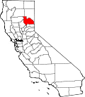
Location in Plumas County and the state of California
Usa edcp location map.svg
Red pog.svg
Tobin
Location in the United States
Coordinates: 39°55′14″N121°17′56″W / 39.92056°N 121.29889°W / 39.92056; -121.29889
Country Flag of the United States (23px).png  United States
State Flag of California.svg  California
County Plumas
Area
[1]
  Total5.029 sq mi (13.025 km2)
  Land5.029 sq mi (13.025 km2)
  Water0 sq mi (0 km2)  0%
Elevation
2,064 ft (629 m)
Population
 (2020) [2]
  Total19
  Density3.8/sq mi (1.5/km2)
Time zone UTC-8 (Pacific (PST))
  Summer (DST) UTC-7 (PDT)
ZIP code
95980
Area code 530
FIPS code 06-78792
GNIS feature ID1660008

Tobin is a census-designated place (CDP) in Plumas County, California, United States. The population was 12 at the 2010 census, up from 11 at the 2000 census.

Contents

Geography

Tobin is located at 39°55′14″N121°17′56″W / 39.92056°N 121.29889°W / 39.92056; -121.29889 (39.920539, -121.298918). [3]

According to the United States Census Bureau, the CDP has a total area of 5.0 square miles (13 km2), all land.

Climate


Climate data for Tobin
MonthJanFebMarAprMayJunJulAugSepOctNovDecYear
Mean daily maximum °F (°C)50.9
(10.5)
54.9
(12.7)
59.8
(15.4)
65.7
(18.7)
74.5
(23.6)
83.8
(28.8)
92.3
(33.5)
91.6
(33.1)
85.9
(29.9)
72.5
(22.5)
58.7
(14.8)
49.8
(9.9)
70.0
(21.1)
Mean daily minimum °F (°C)32.9
(0.5)
34.6
(1.4)
36.7
(2.6)
39.5
(4.2)
45.7
(7.6)
51.6
(10.9)
57.2
(14.0)
55.5
(13.1)
51.3
(10.7)
43.8
(6.6)
37.2
(2.9)
32.8
(0.4)
43.2
(6.2)
Average precipitation inches (mm)11.55
(293)
11.30
(287)
10.38
(264)
5.32
(135)
2.67
(68)
1.01
(26)
0.09
(2.3)
0.32
(8.1)
1.03
(26)
3.60
(91)
8.40
(213)
12.02
(305)
67.69
(1,718.4)
Average snowfall inches (cm)2.8
(7.1)
1.2
(3.0)
2.6
(6.6)
0.6
(1.5)
0.0
(0.0)
0.0
(0.0)
0.0
(0.0)
0.0
(0.0)
0.0
(0.0)
0.0
(0.0)
0.3
(0.76)
1.8
(4.6)
9.3
(23.56)
Source: NOAA [4]

Demographics

2010

At the 2010 census Tobin had a population of 12. The population density was 2.4 people per square mile (0.9/km2). The racial makeup of Tobin was 12 (100.0%) White. Hispanic or Latino of any race were 0 people (0.0%). [5]

The whole population lived in households, no one lived in non-institutionalized group quarters and no one was institutionalized.

There were 8 households, 0 (0%) had children under the age of 18 living in them, 3 (37.5%) were opposite-sex married couples living together, 0 (0%) had a female householder with no husband present, 0 (0%) had a male householder with no wife present. There were 0 (0%) unmarried opposite-sex partnerships, and 1 (12.5%) same-sex married couples or partnerships. 4 households (50.0%) were one person and 1 (12.5%) had someone living alone who was 65 or older. The average household size was 1.50. There were 3 families (37.5% of households); the average family size was 2.00.

The age distribution was 0 people (0%) under the age of 18, 1 people (8.3%) aged 18 to 24, 1 people (8.3%) aged 25 to 44, 9 people (75.0%) aged 45 to 64, and 1 people (8.3%) who were 65 or older. The median age was 52.8 years. For every 100 females, there were 71.4 males. For every 100 females age 18 and over, there were 71.4 males.

There were 17 housing units at an average density of 3.4 per square mile, of the occupied units 2 (25.0%) were owner-occupied and 6 (75.0%) were rented. The homeowner vacancy rate was 0%; the rental vacancy rate was 12.5%. 2 people (16.7% of the population) lived in owner-occupied housing units and 10 people (83.3%) lived in rental housing units.

2000

At the 2000 census there were 11 people, 8 households, and 1 family residing in the CDP. The population density was 2.2 people per square mile (0.8/km2). There were 21 housing units at an average density of 4.2 per square mile (1.6/km2). The racial makeup of the CDP was 72.73% White, 9.09% from other races, and 18.18% from two or more races. Hispanic or Latino of any race were 27.27%. [6]

There were 8 households, of which 12.5% had children under the age of 18 living with them, 12.5% were married couples living together, and 87.5% were non-families. 87.5% of households were one person and 25.0% were one person aged 65 or older. The average household size was 1.38 and the average family size was 4.00.

The age distribution was 18.2% under the age of 18, 18.2% from 25 to 44, 45.5% from 45 to 64, and 18.2% 65 or older. The median age was 50 years. For every 100 females, there were 266.7 males. For every 100 females age 18 and over, there were 350.0 males.

The median household income was $11,250 and the median family income was $11,250. Males had a median income of $ versus $ for females. The per capita income for the CDP was $2,584, one of the lowest of all statistically measured locations in the United States (although the small sample size means this status must be taken cautiously). Below the poverty line were 100.0% of people, 100.0% of families, 100.0% of those under 18 and 100.0% 65 or over.

Media

The primary local news source is the Feather River Bulletin, a newspaper published every Wednesday.

Politics

In the state legislature, Tobin is in the 1st Senate District , represented by Republican Brian Dahle, [7] and the 1st Assembly District , represented by Republican Megan Dahle. [8]

Federally, Tobin is in California's 1st congressional district , represented by Republican Doug LaMalfa. [9]

See also

Related Research Articles

<span class="mw-page-title-main">Trapper Creek, Alaska</span> Census-designated place in Alaska, United States

Trapper Creek is a census-designated place (CDP) in Matanuska-Susitna Borough, Alaska, United States. It is part of the Anchorage Metropolitan Area and is known as the southern gateway to Denali State Park. According to the 2020 census the population of Trapper Creek was 499.

Tolsona is a census-designated place (CDP) in Copper River Census Area, Alaska, United States. The population was 12 at the 2020 census, down from 30 in 2010.

Birch Creek is a census-designated place (CDP) in Yukon-Koyukuk Census Area, Alaska, United States. The population was 33 at the 2010 census, up from 28 in 2000.

<span class="mw-page-title-main">Prattville, California</span> Census-designated place in California, United States

Prattville is a census-designated place (CDP) in Plumas County, California, United States. The population was 24 at the 2020 census, down from 33 at the 2000 census.

<span class="mw-page-title-main">Taft Mosswood, California</span> Census-designated place in California, United States

Taft Mosswood is a census-designated place (CDP) in San Joaquin County, California, United States. The population was 1,530 at the 2010 census, up from 1,388 at the 2000 census. It comprises an unincorporated "island" within the City of Stockton.

<span class="mw-page-title-main">Fruitdale, San Jose</span> Place in California, United States

Fruitdale is a district of San Jose, California, though some portions are still unincorporated as a census-designated place. The population of the CDP was 935 at the 2010 census.

<span class="mw-page-title-main">Carrick, California</span> Census-designated place in California

Carrick is a census-designated place (CDP) in Siskiyou County, California, United States. Its population is 143 as of the 2020 census, up from 131 from the 2010 census. Carrick is located just outside the town of Weed, uses Weed in its mailing addresses and is generally viewed by locals as a neighborhood of Weed, though located outside of the city proper. On September 15, 2014, Carrick was under mandatory evacuation order due to a forest fire.

<span class="mw-page-title-main">Greenview, California</span> Census-designated place in California

Greenview is a census-designated place (CDP) in Siskiyou County, California, United States. Its population is 208 as of the 2020 census, up from 201 from the 2010 census.

<span class="mw-page-title-main">Manatee Road, Florida</span> Census-designated place in Florida, United States

Manatee Road is a census-designated place (CDP) in Levy County, Florida, United States. The population was 2,484 at the 2020 census, up from 2,244 at the 2010 census. At the 2000 census, the CDP was misspelled as "Manattee Road". It is part of the Gainesville, Florida Metropolitan Statistical Area.

<span class="mw-page-title-main">Lacoochee, Florida</span> CDP in Florida, United States

Lacoochee is a census-designated place (CDP) in Pasco County, Florida, United States. The population was 1,345 at the 2000 census.

<span class="mw-page-title-main">Haiku-Pauwela, Hawaii</span> Census-designated place in Hawaii, United States

Haiku-Pauwela is a census-designated place (CDP) in Maui County, Hawaii, United States, consisting of the village of Haiku, Hawaii and the hamlet of Pauwela. Haiku itself is an unincorporated community. The population was 8,595 at the 2020 census.

<span class="mw-page-title-main">Cañada de los Alamos, New Mexico</span> CDP in New Mexico, United States

Cañada de los Alamos is a census-designated place (CDP) in Santa Fe County, New Mexico, United States. It is part of the Santa Fe, New Mexico Metropolitan Statistical Area. The population was 434 at the 2010 census.

Iron Post is a census-designated place (CDP) in Mayes County, Oklahoma, United States. The population was 117 at the 2000 census, but had declined to 92 in 2010, a loss of more than 21 percent.

Sour John is a census-designated place (CDP) in Muskogee County, Oklahoma, United States. The population was 61 at the 2000 census.

<span class="mw-page-title-main">Homeacre-Lyndora, Pennsylvania</span> Census-designated place in Pennsylvania, United States

Homeacre-Lyndora is a census-designated place (CDP) in Butler County, Pennsylvania, United States. The population was 6,906 at the 2010 census.

<span class="mw-page-title-main">Colonial Park, Pennsylvania</span> Census-designated place in Pennsylvania, United States

Colonial Park is an unincorporated community and census-designated place (CDP) in Lower Paxton Township, Pennsylvania, United States. The population was 13,229 at the 2010 census. It is part of the Harrisburg–Carlisle Metropolitan Statistical Area. It uses the Harrisburg ZIP code of 17109 and hosts a great deal of the area's retail activity, including the Colonial Park Mall.

<span class="mw-page-title-main">Reese Center, Texas</span> Former CDP in Texas, United States

Reese Center is an unincorporated community and former census-designated place (CDP) in Lubbock County, Texas, United States. The population was 42 at the 2000 census. Its population was not recorded separately for the 2010 census. It is part of the Lubbock Metropolitan Statistical Area.

<span class="mw-page-title-main">Lake Bosworth, Washington</span> CDP in Washington, United States

Lake Bosworth is a census-designated place (CDP) in Snohomish County, Washington, United States. The population was 868 at the 2020 census, up from 667 at the 2010 census.

<span class="mw-page-title-main">Calpet, Wyoming</span> Unincorporated community in Wyoming, United States

Calpet is an unincorporated community in Sublette County, Wyoming, United States. The population was 7 at the 2000 census, when it was a census-designated place (CDP).

<span class="mw-page-title-main">Table Rock, Wyoming</span> Town in Wyoming, United States

Table Rock is a ghost town in Sweetwater County, Wyoming, United States. It was part of a census-designated place at the 2000 census, with a population of 82, but the 2010 census reported a population of 0.

References

  1. U.S. Census Archived 2012-01-25 at the Wayback Machine
  2. "US Census Bureau". www.census.gov. Retrieved April 13, 2024.
  3. "US Gazetteer files: 2010, 2000, and 1990". United States Census Bureau. February 12, 2011. Retrieved April 23, 2011.
  4. "NOWData - NOAA Online Weather Data". National Oceanic and Atmospheric Administration . Retrieved June 14, 2022.
  5. "2010 Census Interactive Population Search: CA - Tobin CDP". U.S. Census Bureau. Archived from the original on July 15, 2014. Retrieved July 12, 2014.
  6. "U.S. Census website". United States Census Bureau . Retrieved January 31, 2008.
  7. "Senators". State of California. Retrieved March 10, 2013.
  8. "Members Assembly". State of California. Retrieved March 2, 2013.
  9. "California's 1st Congressional District - Representatives & District Map". Civic Impulse, LLC. Retrieved March 3, 2013.